Part 3: Packrafting the Jökulsárlón Lagoon
…continued from Part 2: The Ring Road, Rafting the East Glacier River
Day 5: The East Fjords
The northeast country was the most diverse terrain I had ever seen. I cleared a ridge in the morning, revealing the vast, open lava fields of the Skútustaðahreppur region. A huge plain of lava rocks and ash spread out across the land. It was everything Iceland is – picturesque, dark, otherworldly, like nothing like I had known. I grew up in a country with millions of acres of deciduous forests, foliage, deer, black bears, and catfish. But here, the calderas, hot springs, snowfields, and glaciers continuously shape the face of the land. It had the openness of Alaska and the emptiness of a lunar landscape. This country was a geologist’s paradise.
There was one particularly rough mountain pass that I cleared at midday to reach the coast. It was graded at 12% downhill on gravel, with switchbacks. The fact that I was still new to driving a manual transmission didn’t exactly help. I swore a lot as I turned at each switchback in a low gear, worried that the van would tumble off the road and roll down the mountainside. But I made it and the road leveled off as I approached the East Fjords, easily one of the most beautiful regions in the entire country.


I drove until mid-afternoon and stopped at the coastal town of Hofn. Natalie reported her status on Facebook. She saw the auroras a few nights ago. I was jealous, even though I had no reason to be.
I left the campground to get a drink at a nearby restaurant. When I looked at their expensive menu, I almost walked out. This restaurant had burgers for $40, a BLT for $40, and entrees going at $60 – prices which unfortunately aren’t that uncommon in Iceland, thanks to their huge tourism industry. But then I saw something better for less: Icelandic pancakes for $12. Now we’re talking.
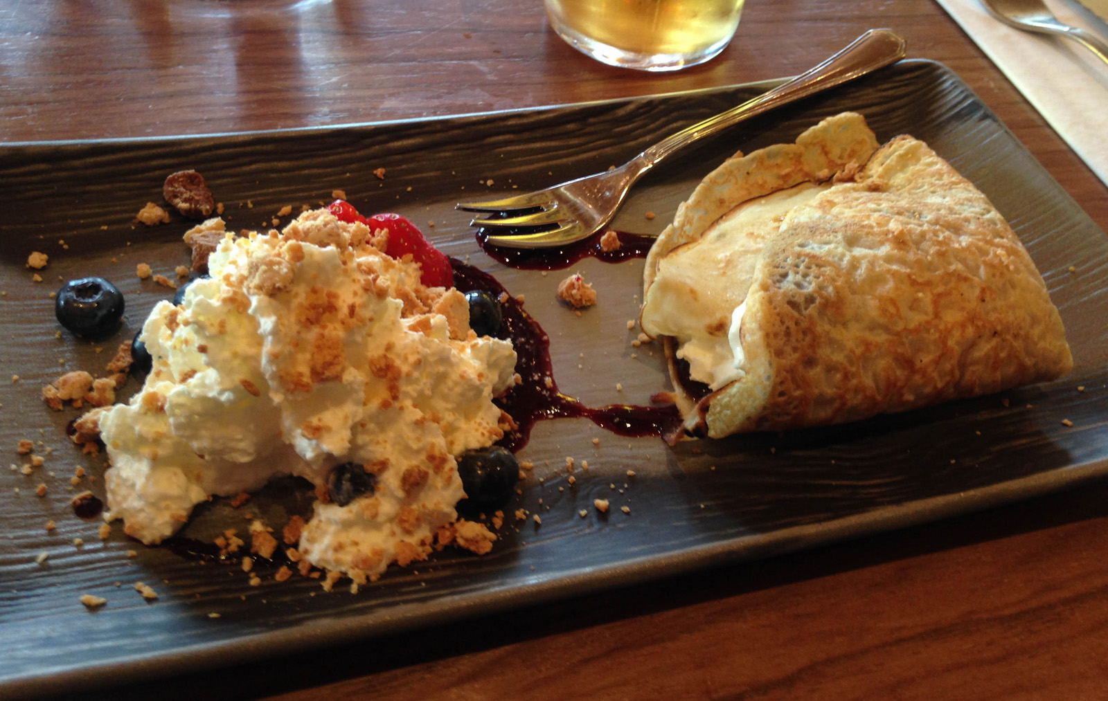
They brought me a hot pancake with whipped cream, blueberries, syrup, and lots of decadence. I would do it again in a second.
Day 6: Packrafting the Jökulsárlón Lagoon
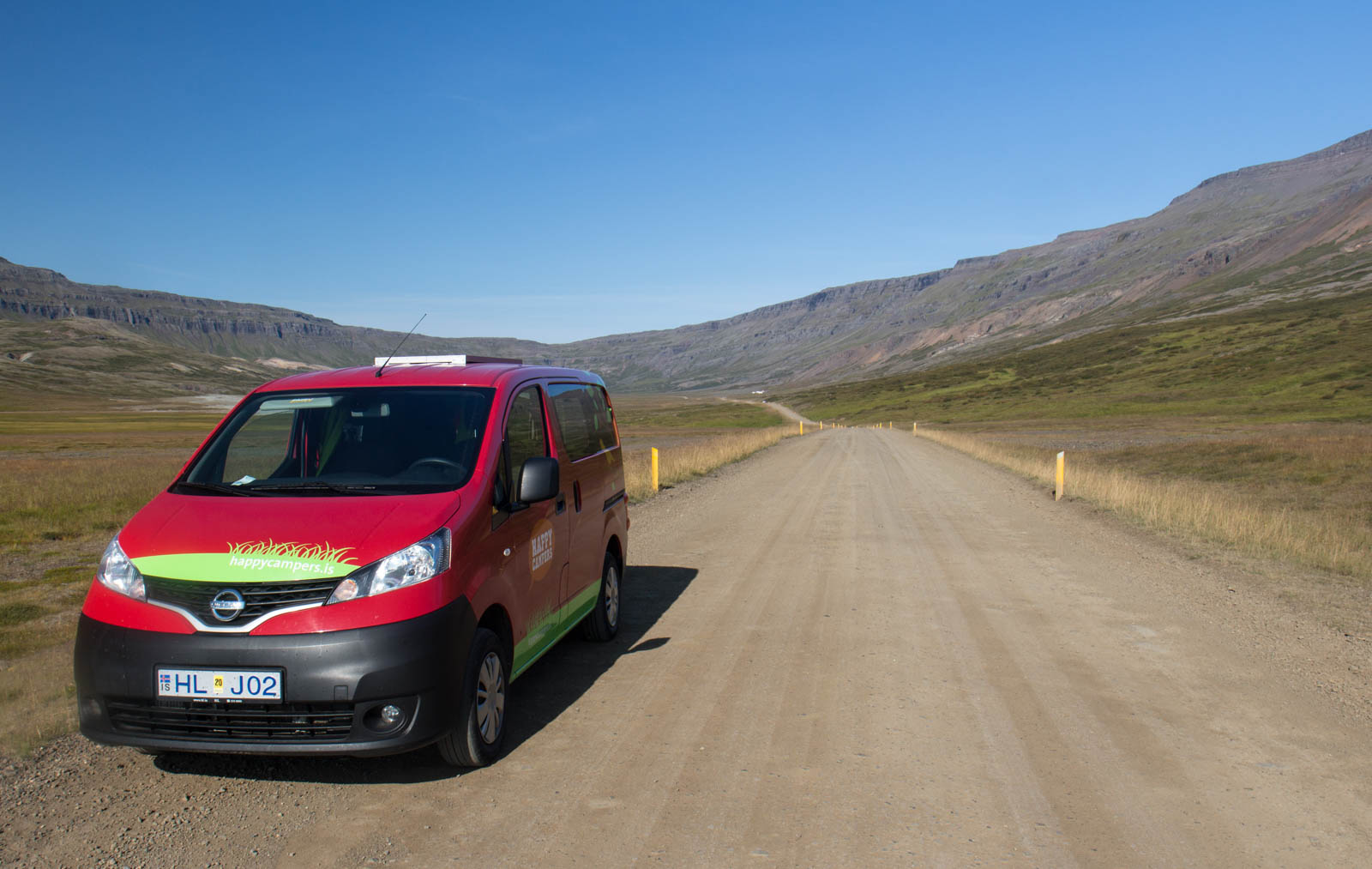
I figured out that I could stream music from my camper van’s wifi. When I plugged my phone into the dashboard USB, it played the audio through the van’s speaker system. Hell yeah? I wish I figured this out earlier. I loaded up an ambient Spotify playlist and drove the southeast coast to the likes of Hammock, Brian Eno, Caspian, Julianna Barwick, and others who would complement the open road. To me, epic landscapes like these always seems to bring out more depth and nuance in my music. And perhaps the music itself amplifies my sense of adventure as I wander into new lands. I didn’t know it at the time, but as the soundscapes were building and I approached the lagoon, this would be the most exhausting day yet.
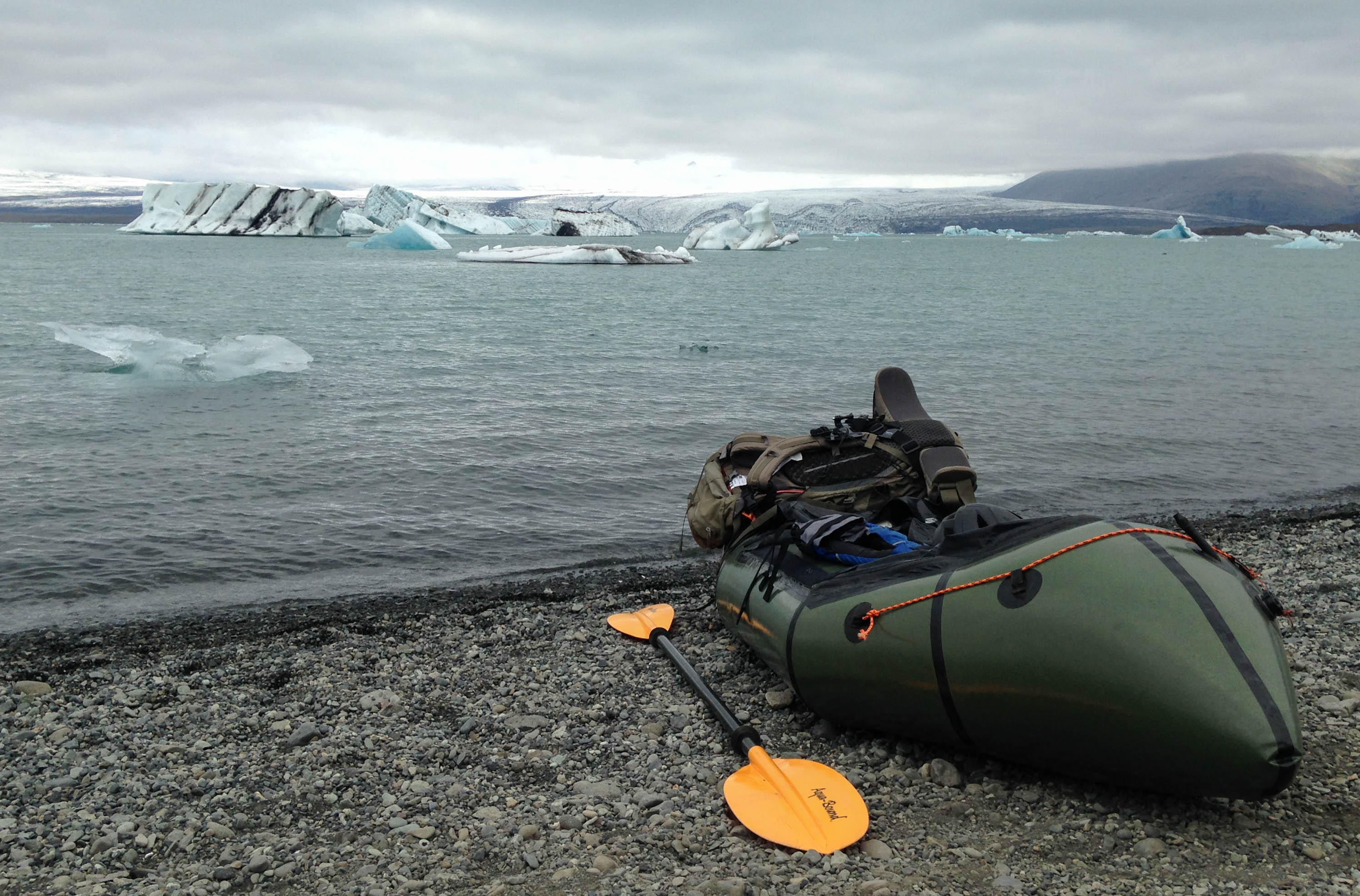
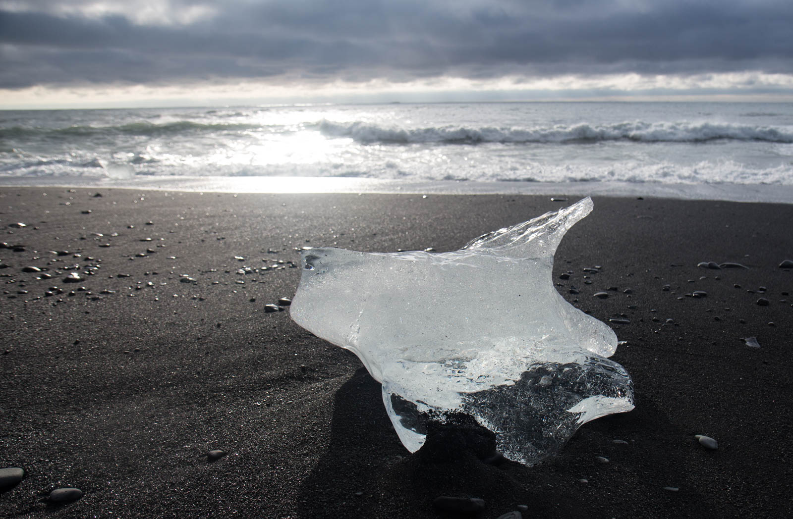
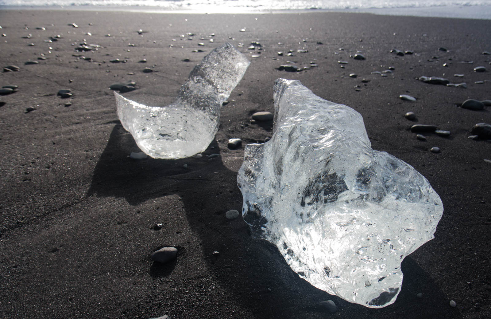
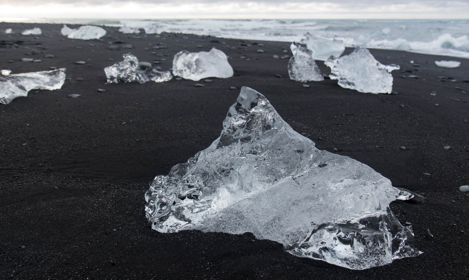
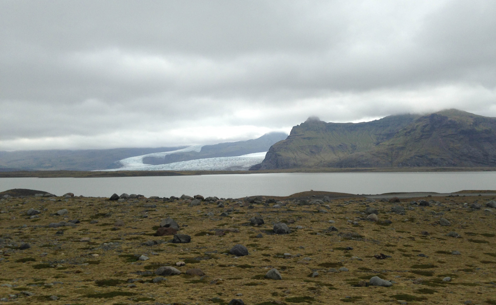
I parked at the main lot of the Jökulsárlón Lagoon, a huge glacial lake on the southeast coast. It was one of three lakes that I planned to traverse that day in my packraft. But first, I wanted to see Diamond Beach. The glacier above the lagoon frequently calves, sending huge icebergs across the lake that eventually reach the mouth of a small river close to the road. They break up and wash downstream and into the ocean. The tide then washes them back onto the black sand beach, creating ice diamonds.


I went back to the van, got my gear, and hiked along the east side of the lagoon to find a good launch point relatively clear of the bigger icebergs. The rangers warned me that they could flip anytime, causing a bad accident. I paddled into the lake, far enough from what could have been a dangerous calving.
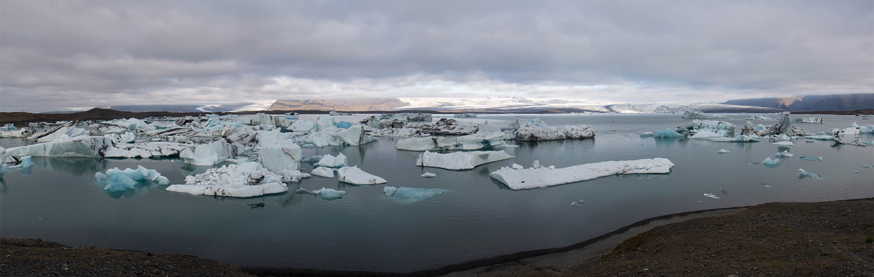
The Breiðamerkurjökull Glacier to the north was massive. On a map it is about 8 miles wide. There was no way I could fit it into a camera. I paddled across the lake for an hour with that huge glacier to my right and countless icebergs to my left. I got to the other side of the lake, packed up my raft, and started walking the marked trail between there and the lakes to the west.
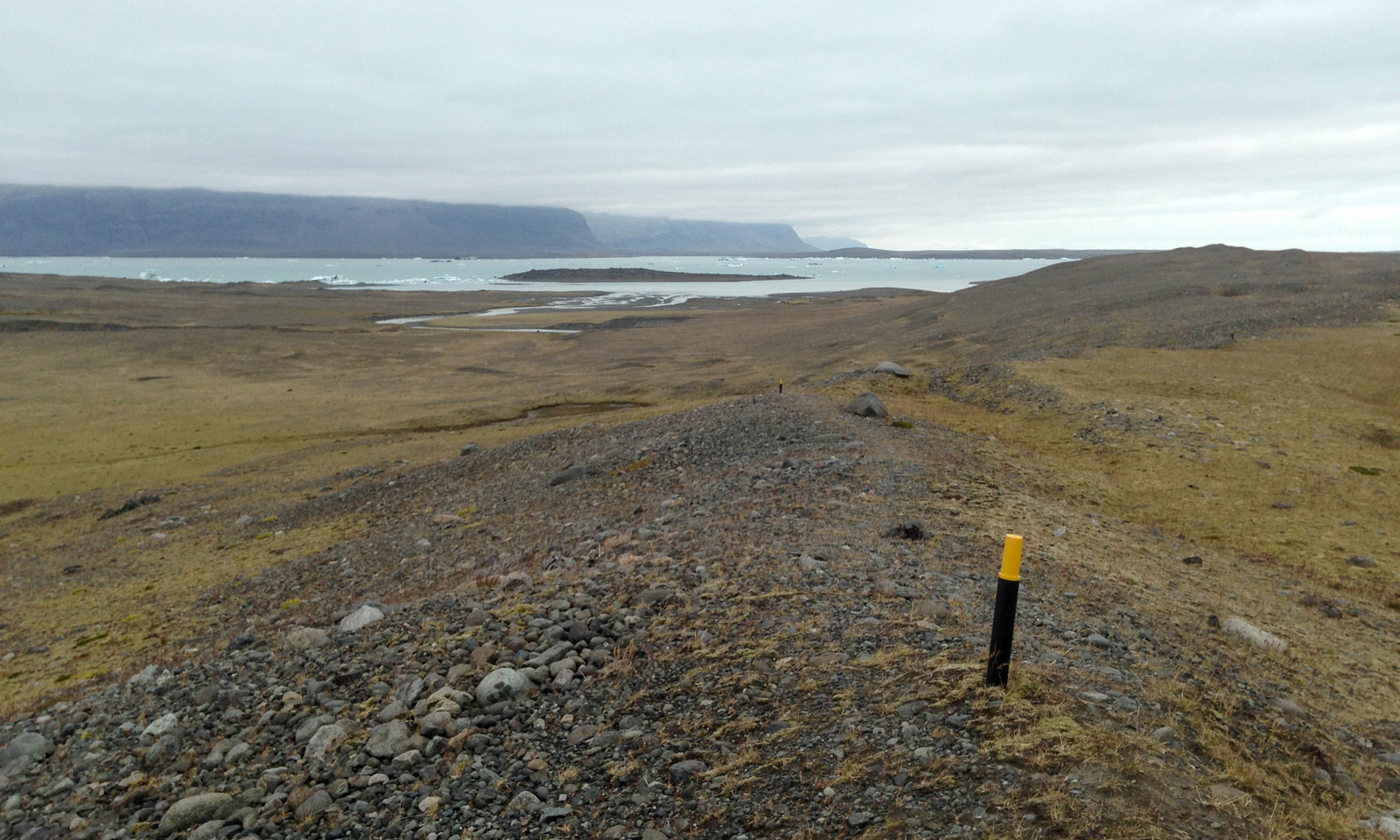
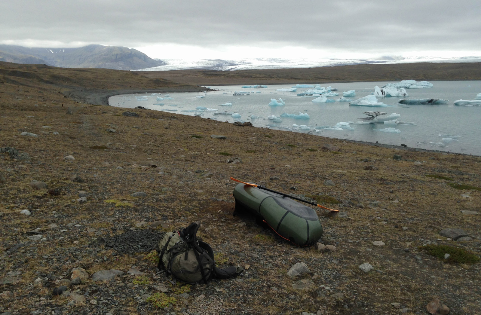
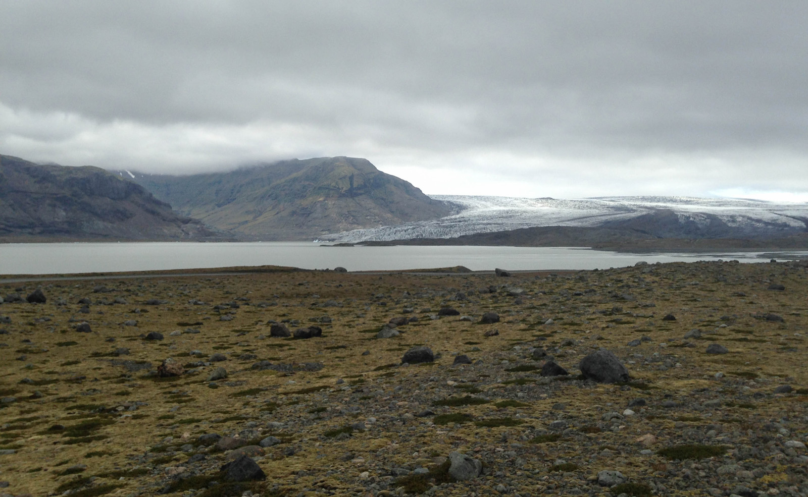
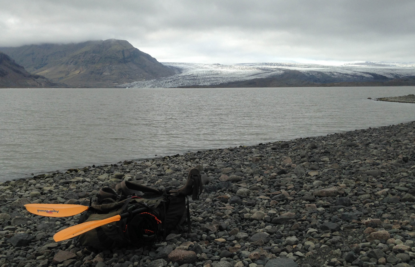
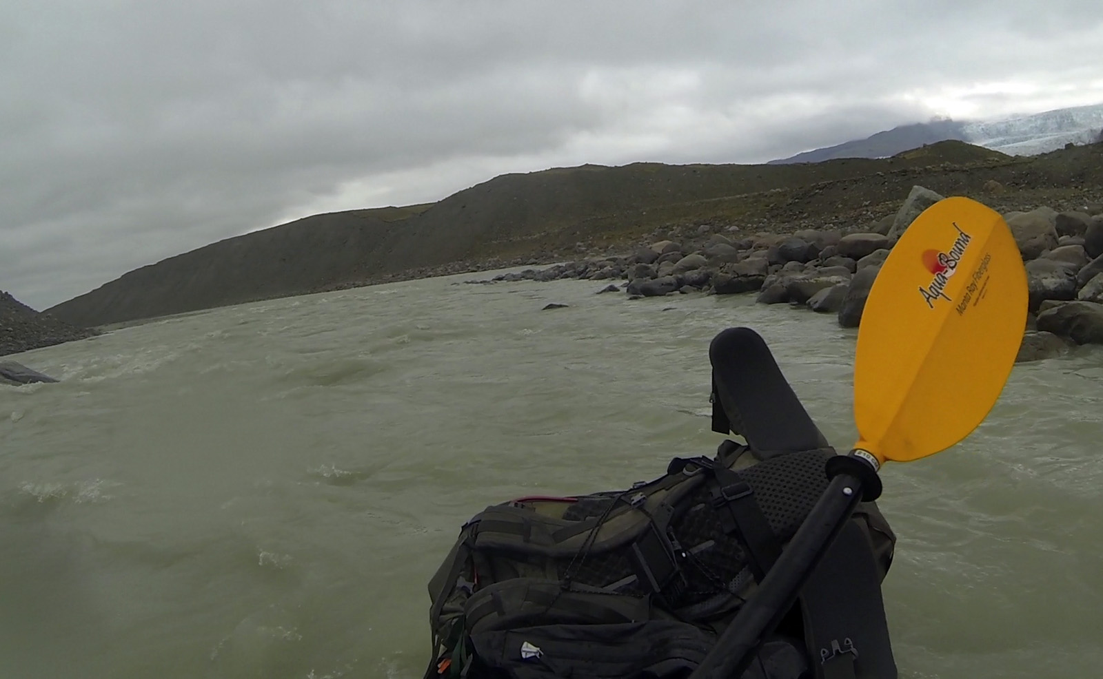
The trail went over five miles of moraine, but felt like longer. Soon, I was on the higher hills, looking down at the braided streams of glacial meltwater that fed the lake below. The path was defined by trail markers that went on for two good hours before reaching the west end of Breiðárlón Lagoon. I planned to paddle it for a mile to the mouth of a small mile long river on the south end, float the river to Fjallsárlón, and hike back to the road from there. I easily paddled across the lake, luckily without any wind to complicate my route. In a packraft, the wind can take you in any direction it wants, and probably not where you want to go.
I reached the mouth of the river and scouted the rapids at the top. It didn’t look like this on the satellite. I expected to see an easy, floatable river between here and the lake downstream. But this river was fast with a lot of Class II. Well, I’m nothing if not adaptable.
I navigated mostly on center lines through the top rapids. I approached the third rapid about a half mile downstream and positioned for the middle to avoid some holes on the right. I thought I was cruising. Then out of nowhere, I approached a river-wide pourover ledge of four feet. Fuck, I should have scouted it. The swell went over and piled into a big hydraulic. I charged at it, hoping to bust through. No luck! It pulled me back in the hole and I flipped.
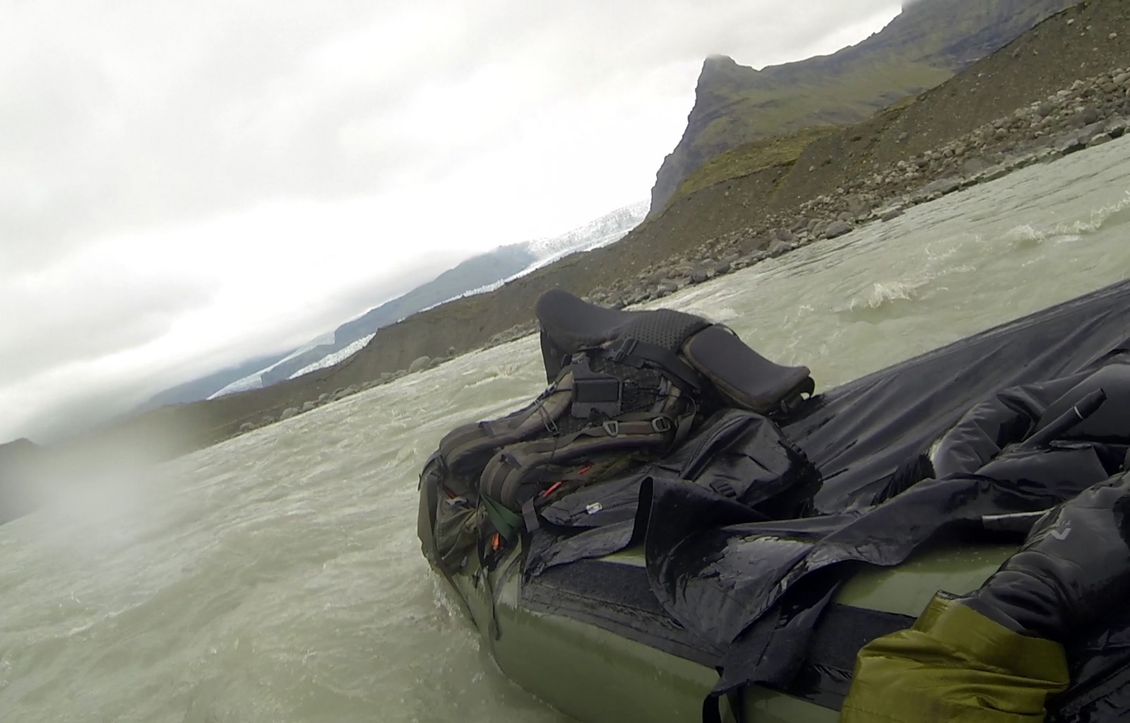
Luckily, there was no retention. I washed out of the rapid and went straight into another Class II. Shit, where’s my paddle?!! I spotted it 10 feet away to the left. It was partially submerged with one oar bobbing out of the water. That’s a first. I kicked for it and got it easily. Still pretty unnerving. I waited out another rapid, hoping for an easier break to self-rescue, and got back in just before another rapid was on. As it mellowed out, I scrambled into position and eddied out to the left to get my bearings. I got to the shore and stepped onto firm gravel. That could have gone better.
I love to run big rivers, but wipeouts like that one always freak me out. I wasn’t planning on running swiftwater at all that day. In this case, what looked like an easy float from the satellite was far from it. That said, it can be done if you mind the ledge in the middle to scout and/or portage. I didn’t do either, but I’m sure it has a runnable line.
The satellite said that there were two more rapids before it turned to the right and opened into the lake. I scouted them both and planned on a center line. Pretty much everything on that river was a center line except for that fucking ledge.
I was discouraged, but I kept going. I easily cleared the last few rapids on the river, and went around one last bend. The calming water carried me into the lake in full view of the Vatnajökull Glacier. She smiled back at me as I floated peacefully into quiet water.
I shored in, packed up, hiked back to the road, and eventually got picked up by a traveling German tourist.
This story continues in The Golden Circle.