Pictured Rocks National Lakeshore
…continued from Sleeping Bear Dunes
The Upper Peninsula of Michigan is a beautiful area for many reasons, notably for the pristine shoreline of Pictured Rocks, a national lakeshore extending for 42 miles along the coast of Lake Superior. I spent half the day driving up there from Sleeping Bear to spend a couple of days camping and exploring the park. I had enough time that afternoon to hike the Chapel Loop, a 10 mile route outlining the most dramatic section of lakeside cliffs.
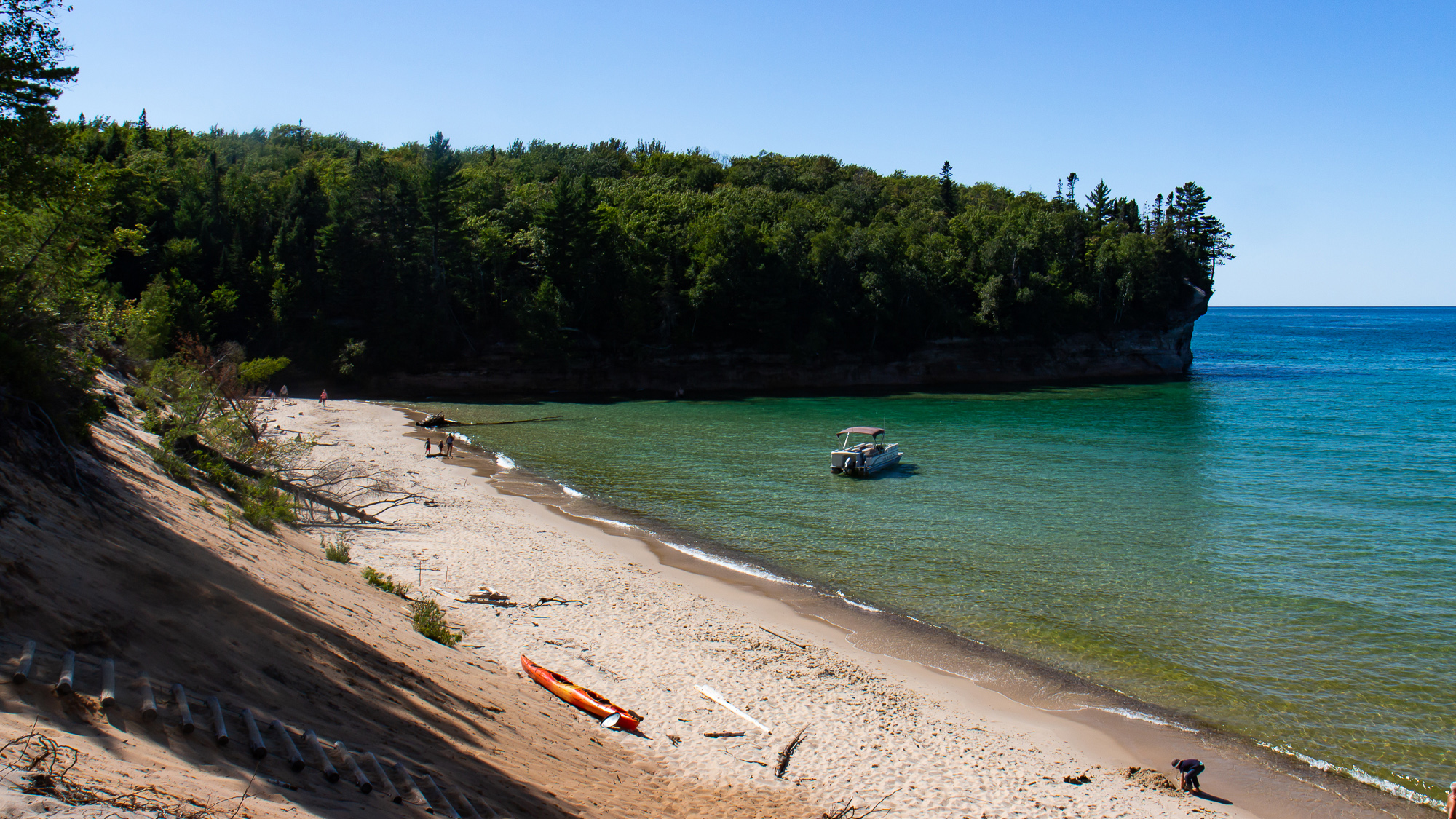
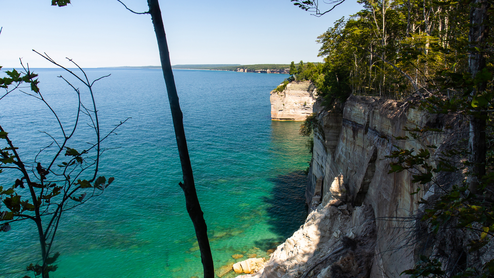
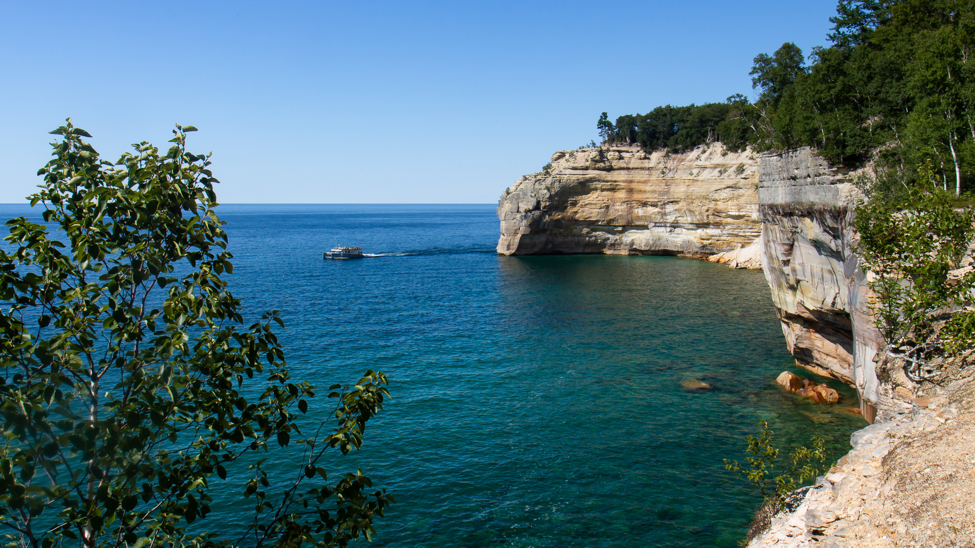
I parked at the trailhead and hiked through the forest for an hour, often passing by other hikers before reaching Chapel Beach and the sound of crashing water. Turning west, the trail went along numerous overlooks for five miles. I often stopped to photograph the dramatic cliffsides as tour boats passed below. Eventually I reached Mosquito Beach on the far end of the circuit and turned south on a two mile uphill hike to my car.
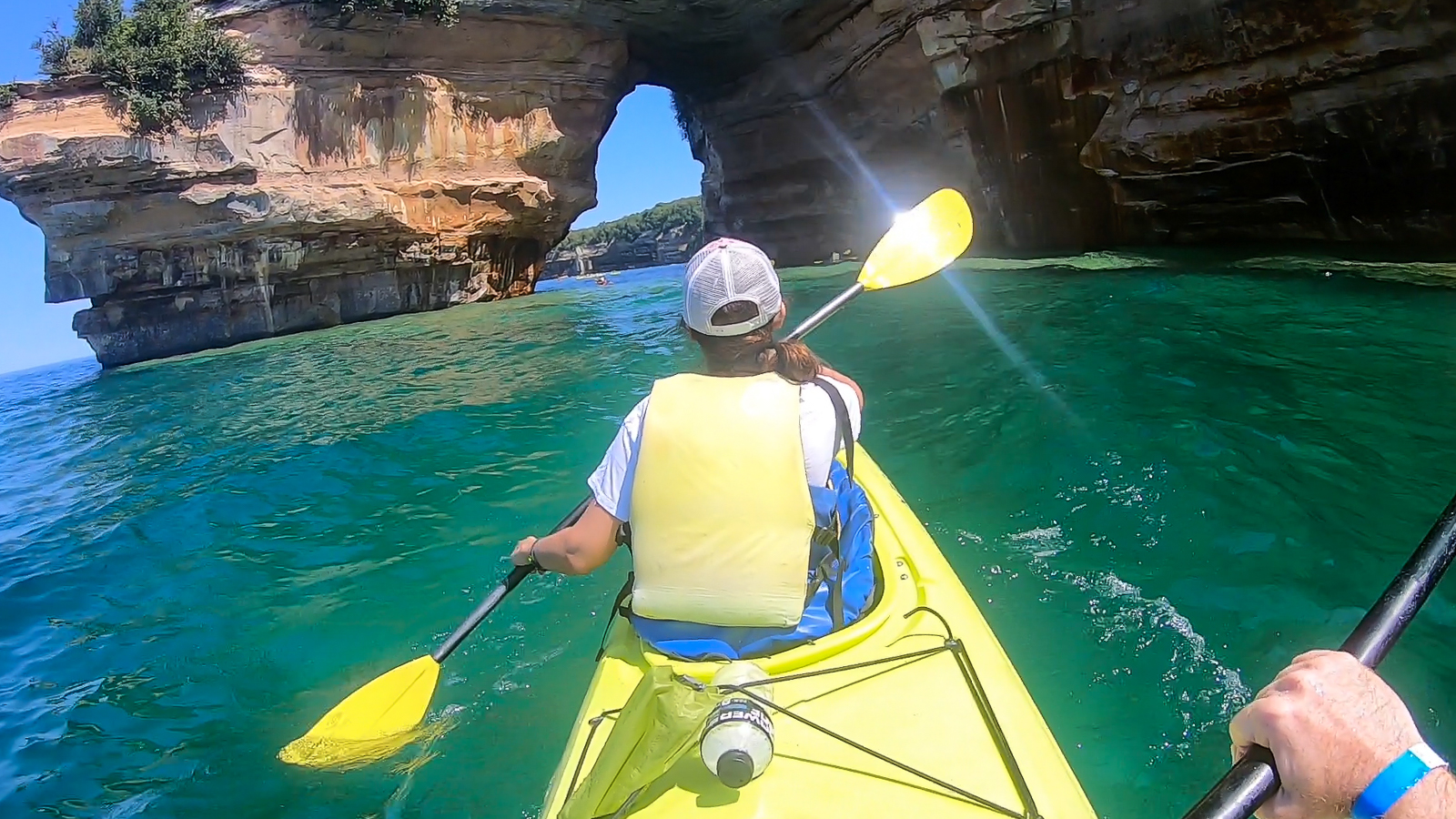
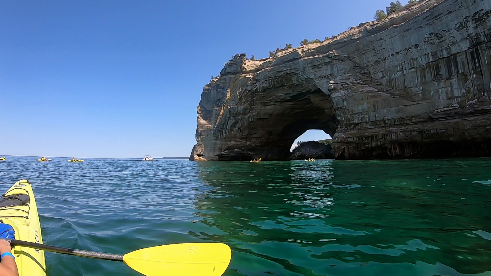
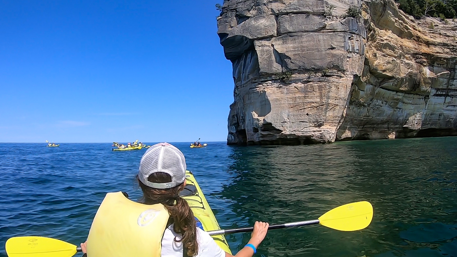
It was a great trail, but as I already learned elsewhere, a scenic shoreline can only be fully appreciated from the water. So on the next day I took an all day kayaking trip with Paddling Michigan, starting in Miners Beach just six miles west of the Mosquito trailhead. We paddled east along the steadily rising cliffside, where already the cliffs were layered in different colorful minerals. Sections of them included a layer of gravel left behind by glaciers of another age, grinding and burying moraine into the ancient bedrock.
The water was a translucent jade color illuminated in a bright sun as it slowly shifted about in the calm morning. We passed over a shipwreck, which I couldn’t see very well from the boat. But I did get some video footage of the wooden planks of the ship under the flickering sunbeams. There were other wrecks in the area as well, due to Lake Superior’s potentially treacherous weather patterns. I wasn’t at all surprised to find out that this area has its share of dive sites.
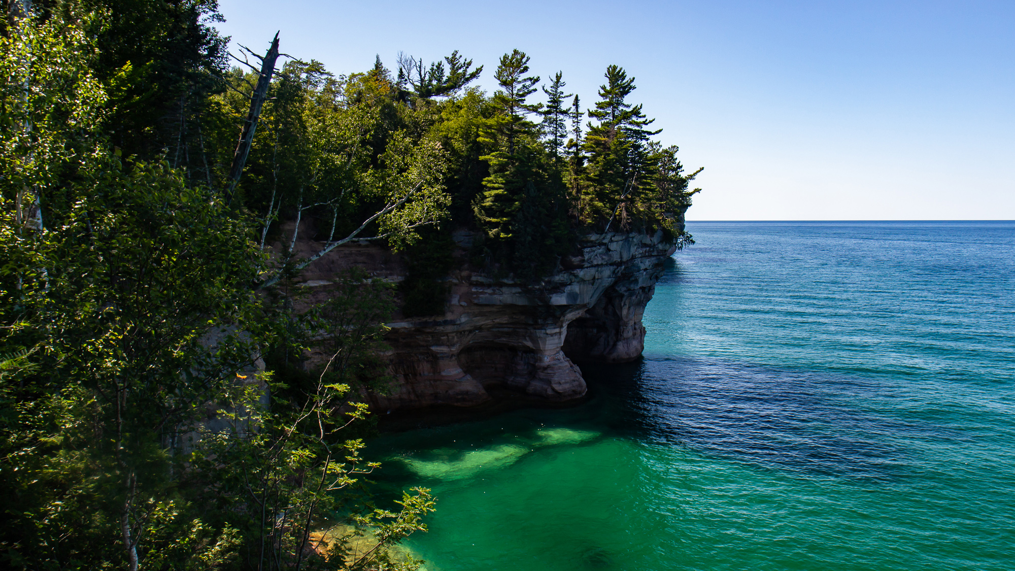
We stopped for lunch on the shore for an hour and then continued on past Mosquito Beach. Here, the cliff points were the most dramatic, rising up to 200 feet above the water. We paddled underneath arches, into cliffside mini-caves, and one small tunnel that waves had carved into the rock wall. I understood why more daring people have taken bigger expeditions into places like Alaska’s Inside Passage, where they can explore its coves, islands, and beaches day in and out. The sport of sea kayaking offers an epic, yet peaceful opportunity to any adventurer looking to find their coastal frontier.

Passing Grand Portal point, we made a straight mile to Chapel Beach, where several people made a 60 foot leap off of a nearby jump rock. The rest of us shored our kayaks as they were already getting loaded onto a shuttle boat. Then we made a three mile hike on the Chapel Trail back to the parking lot.
Great as it was, I barely saw a quarter of the Pictured Rocks shoreline. I have no idea when, but a 42 mile backpacking hike from end to end would be a great way to follow up on this tour.
The scenery looks amazing.. I hope I could kayak soon…
Thanks, it’s definitely worth checking out!
Nice write-up. You could take your packraft when you go back….
https://wheremandoesnotremain.com/2018/05/10/yo-yo-and-fear-through-pictured-rocks/
Thanks. Yeah, I thought about it but wasn’t sure if the wind would pick up. It can do that on big lakes..