Adventures with Kit
Adventures with Kit
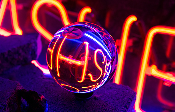
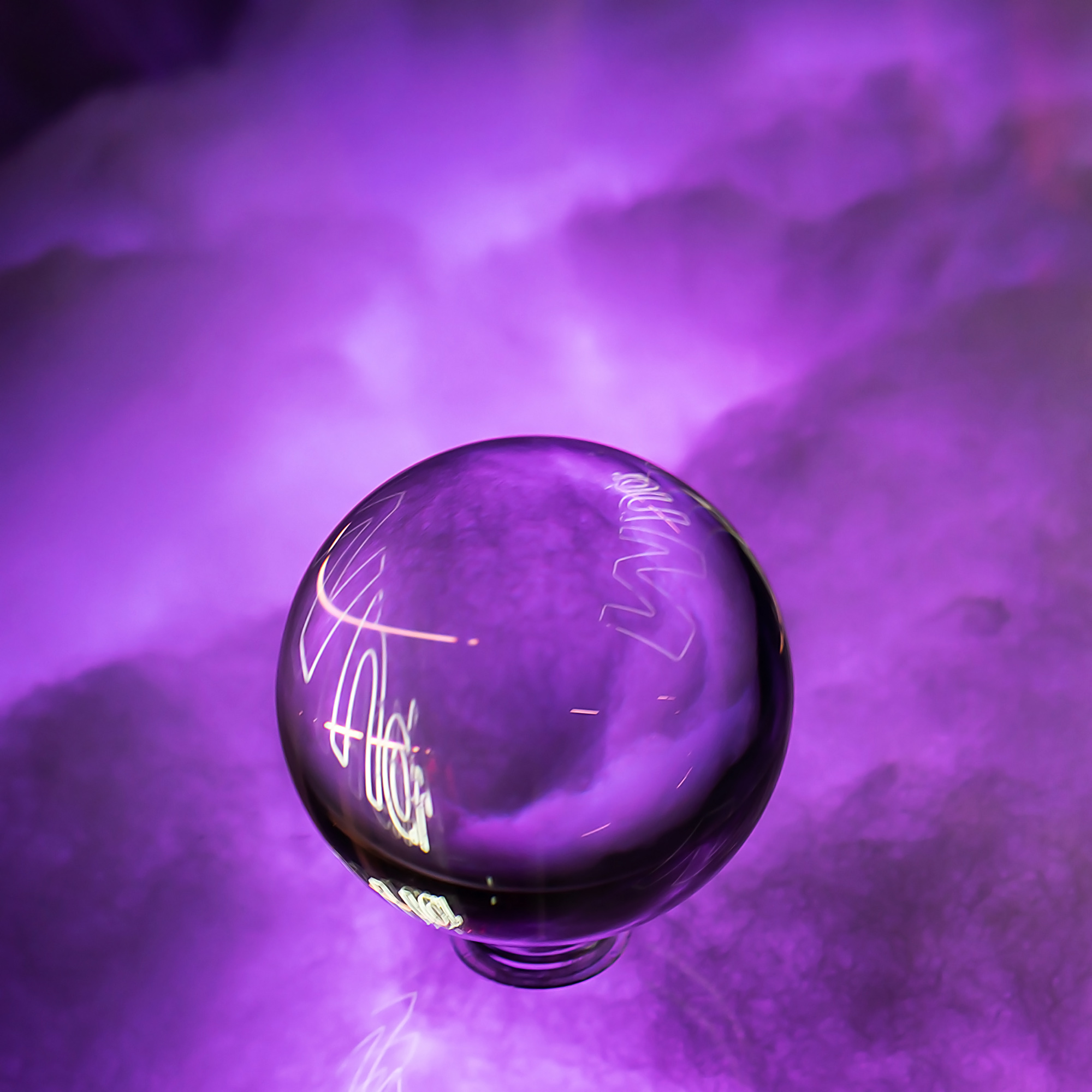
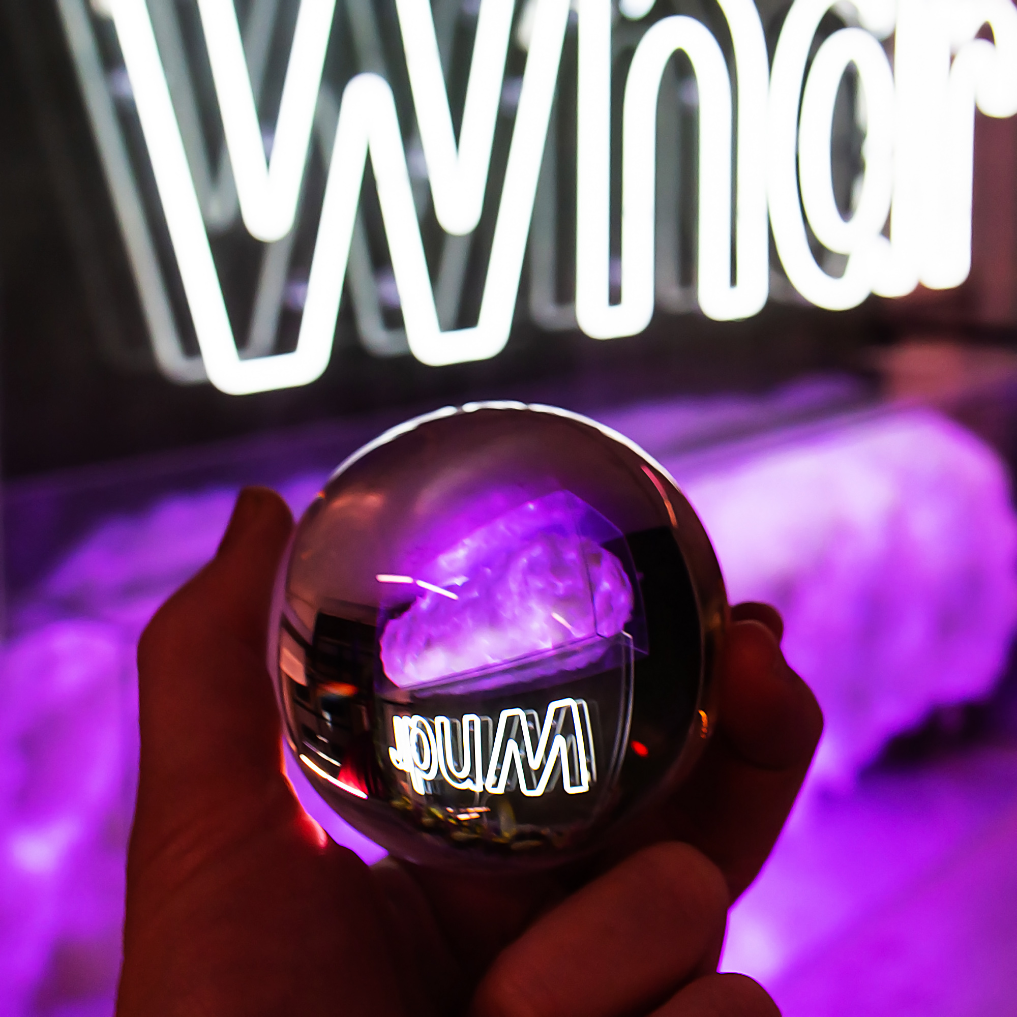
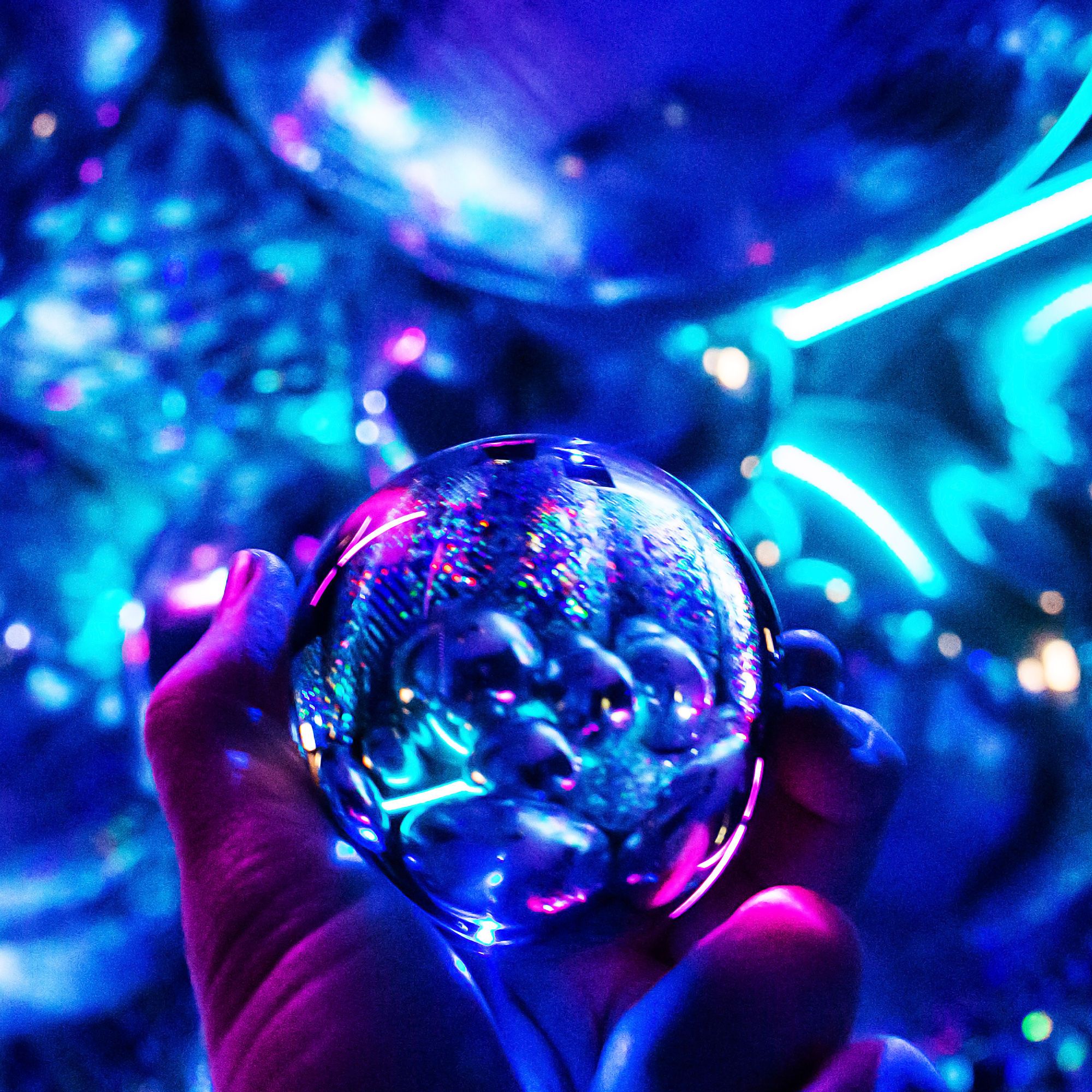
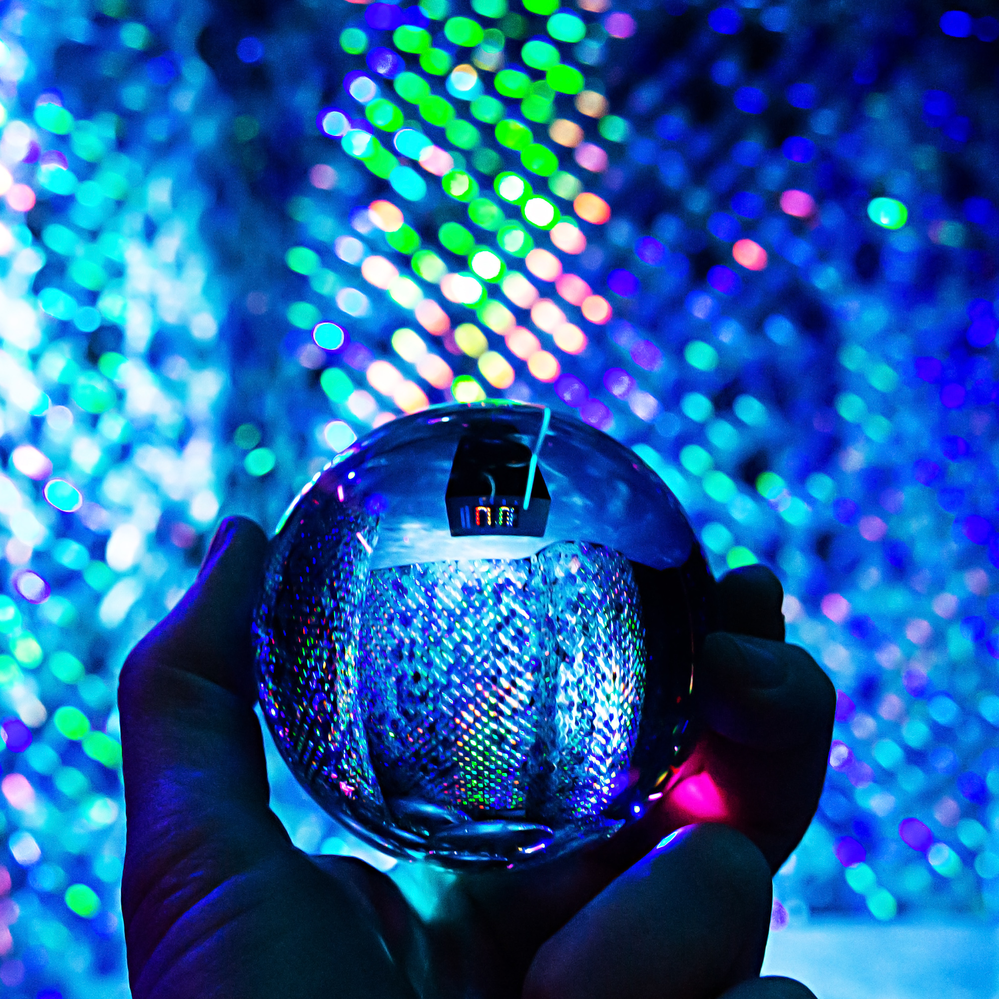
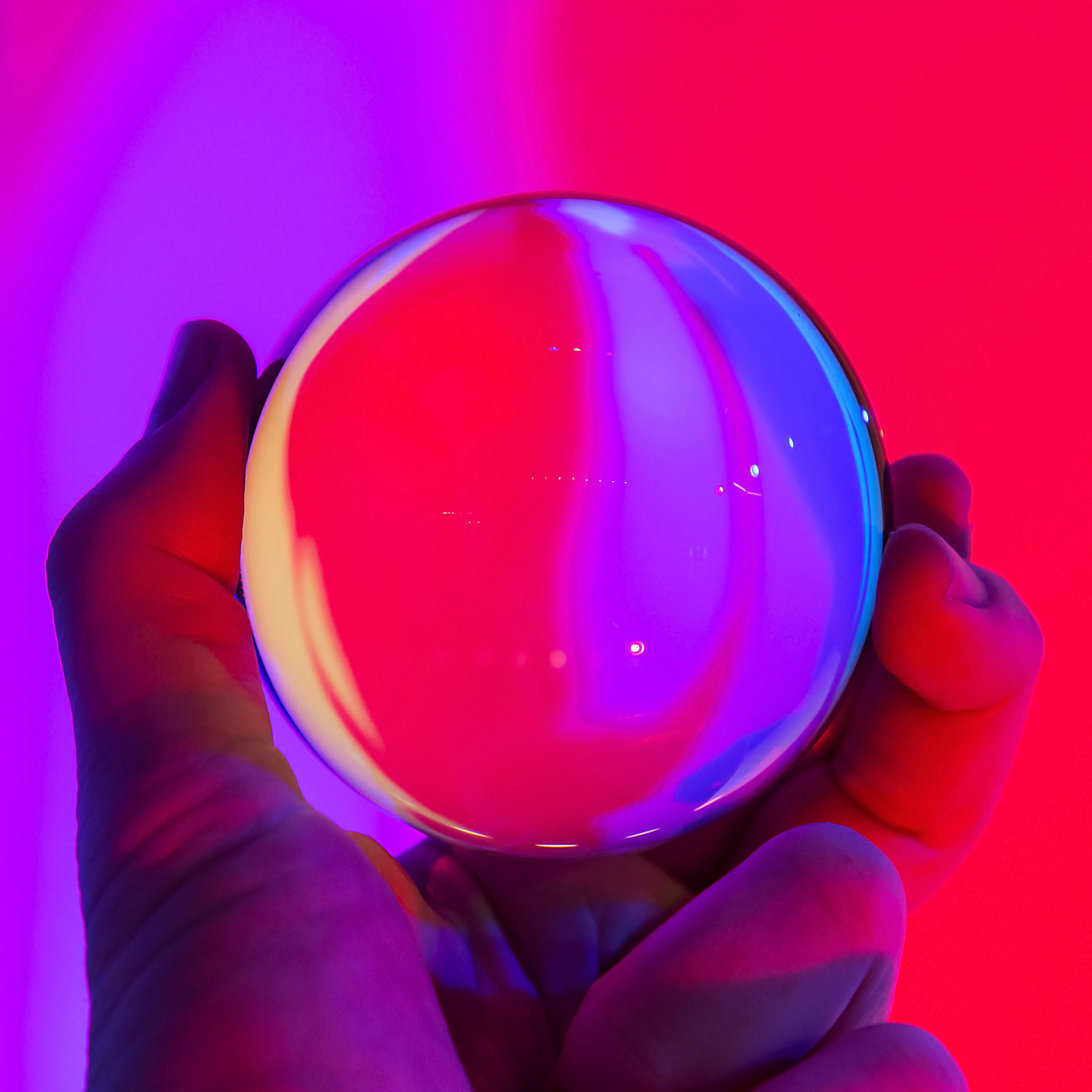
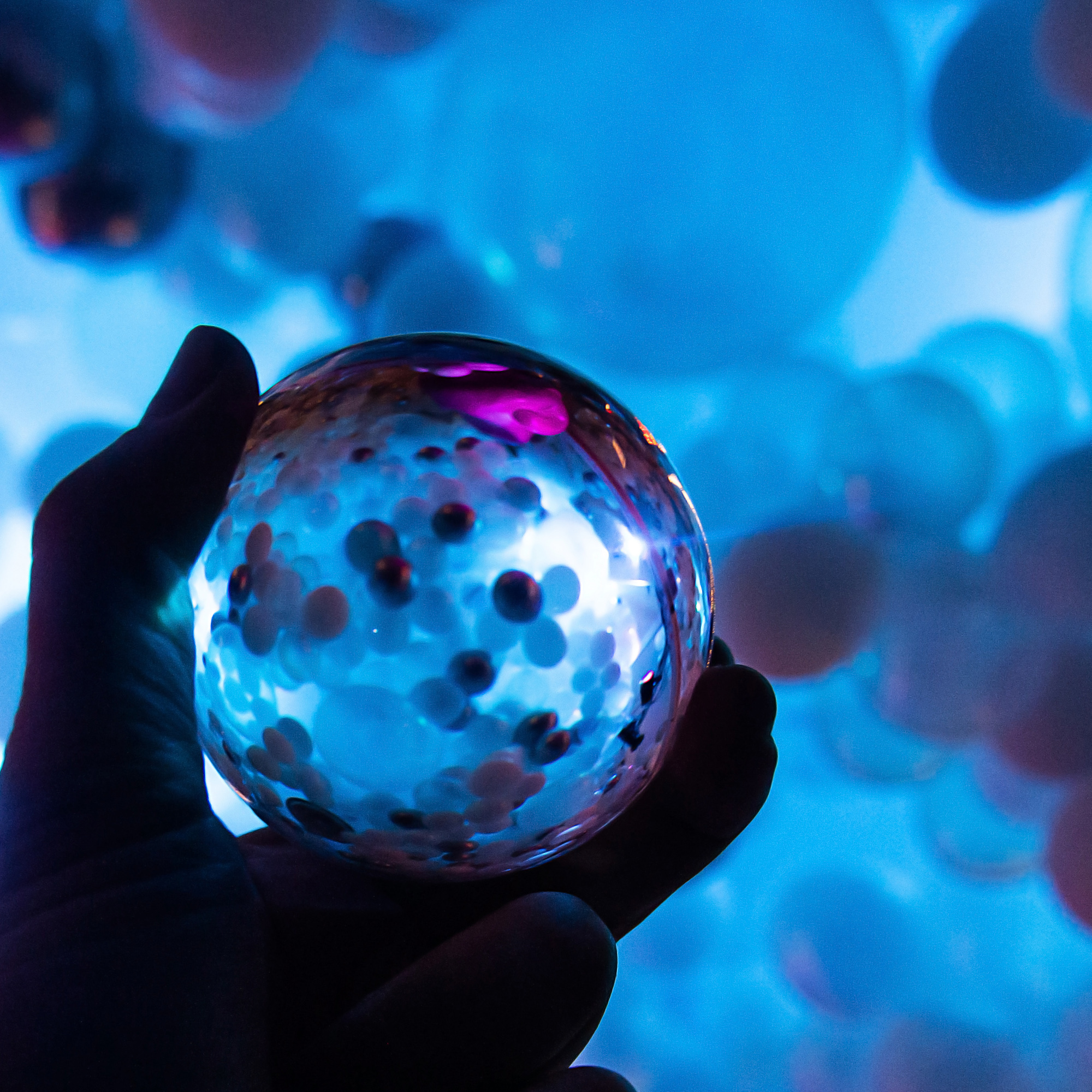
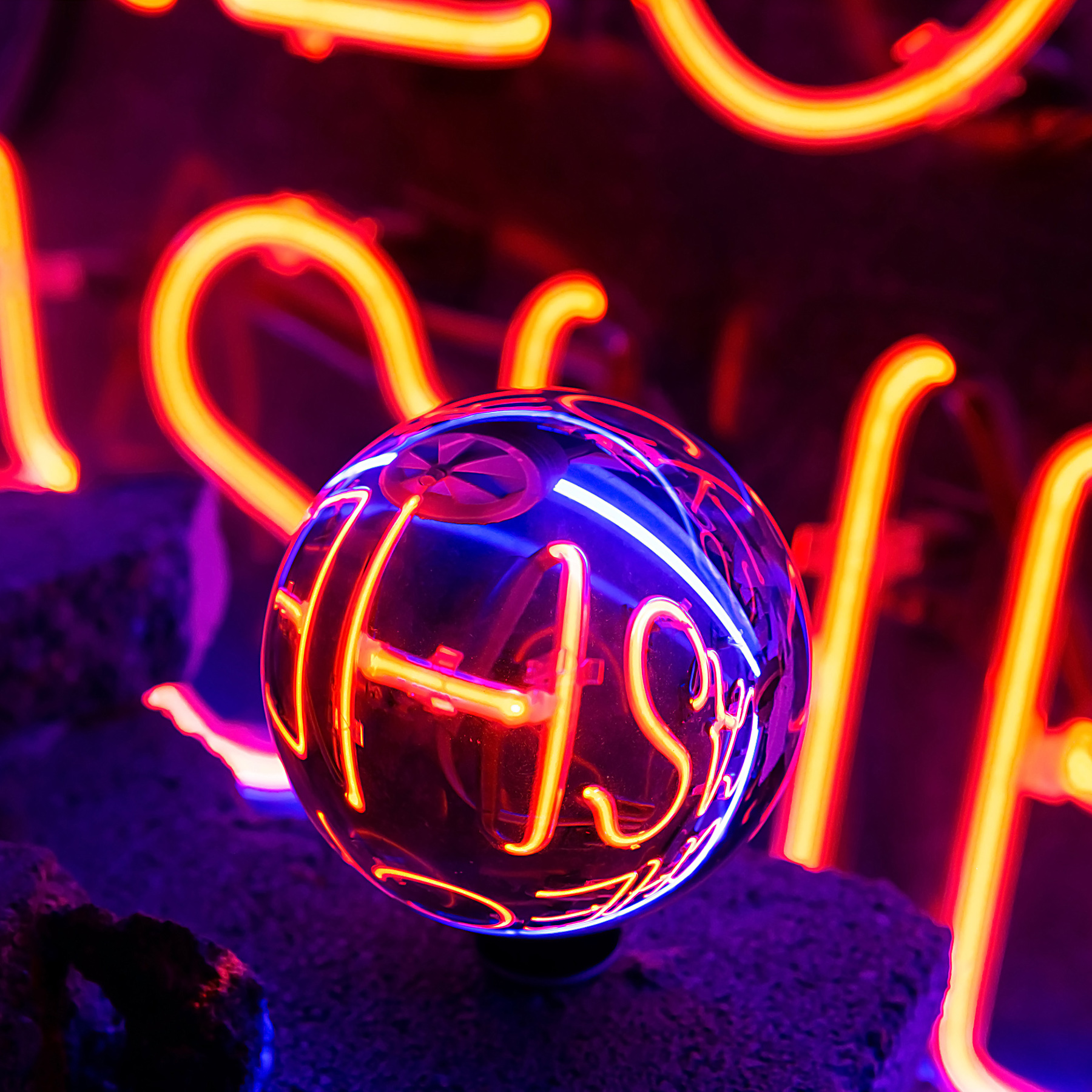
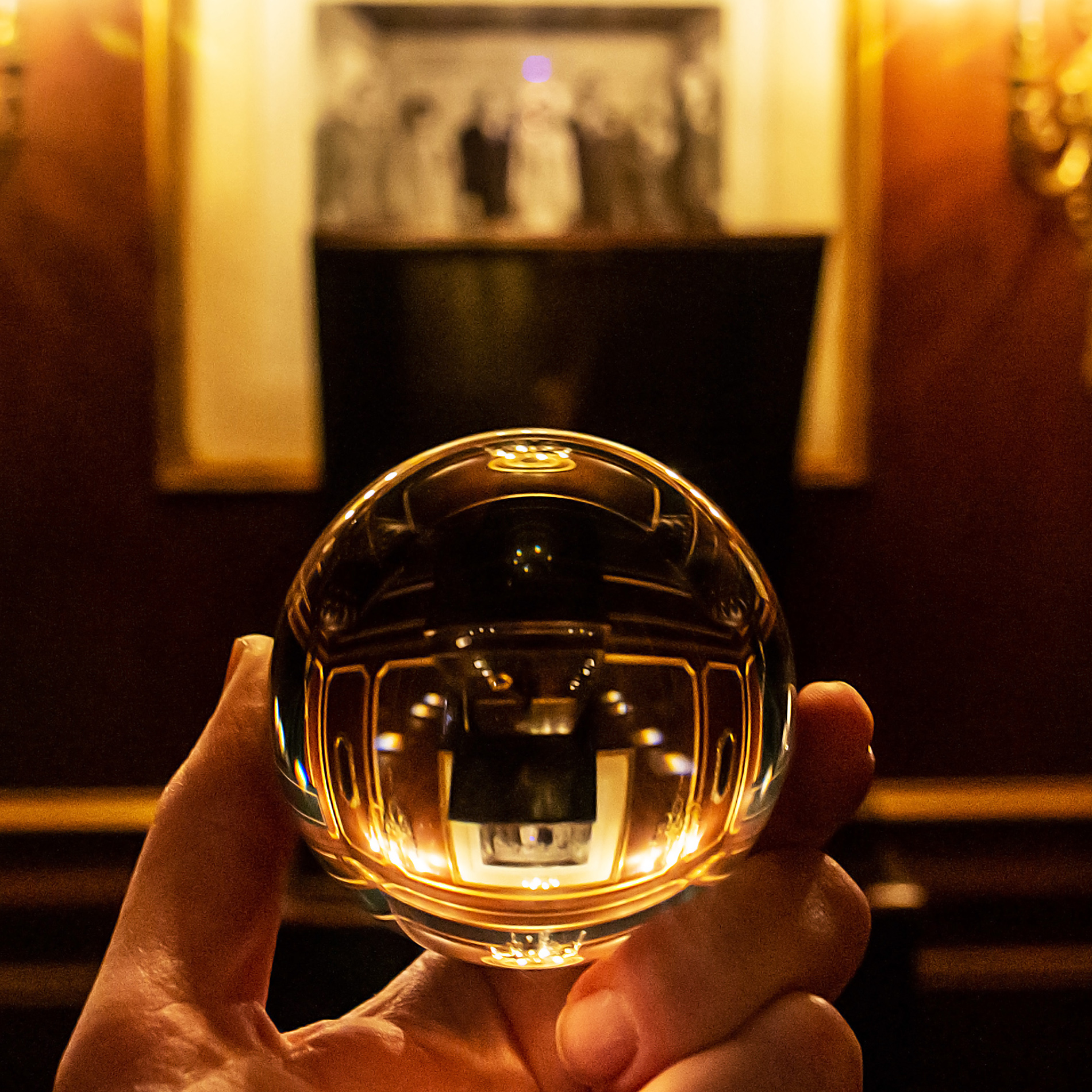
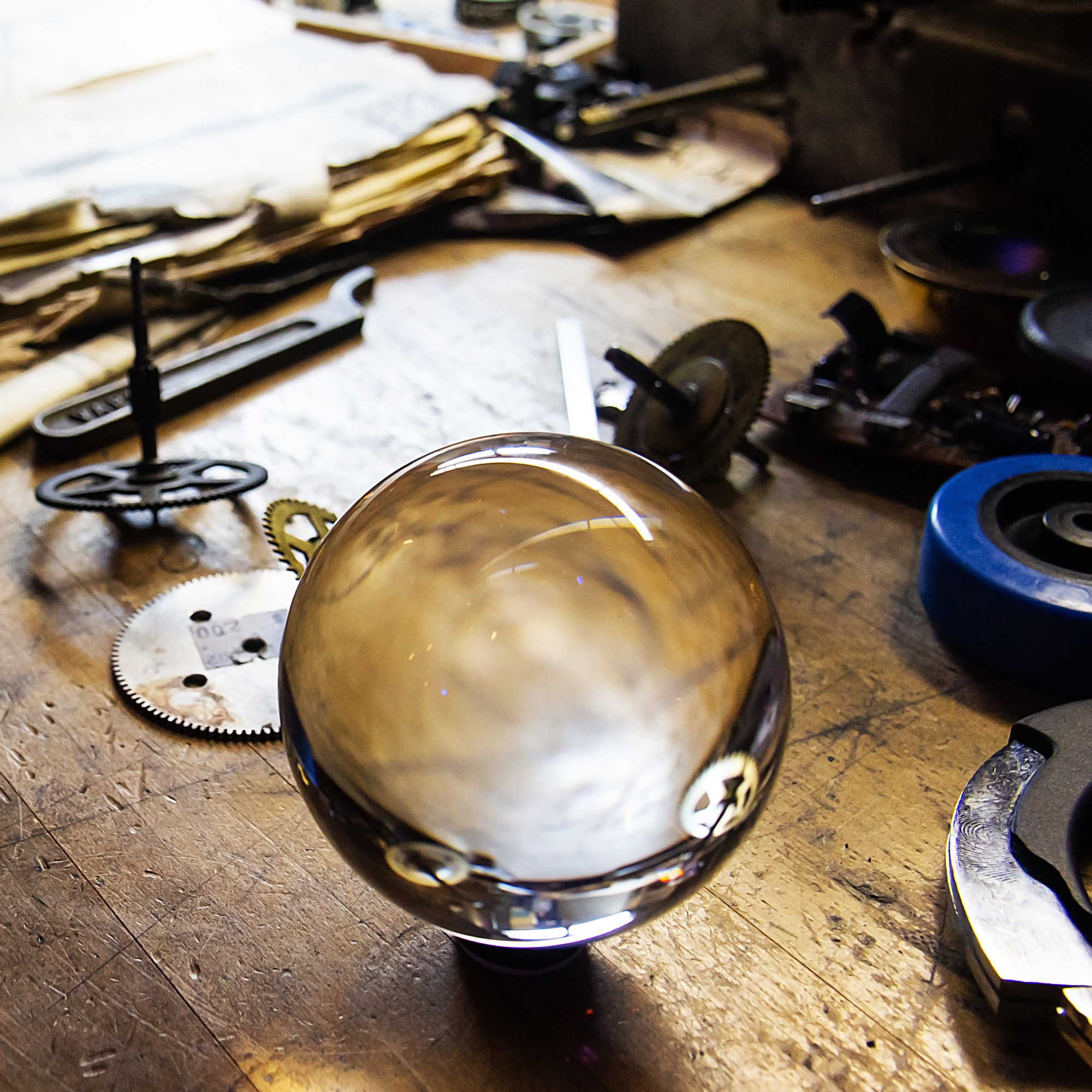
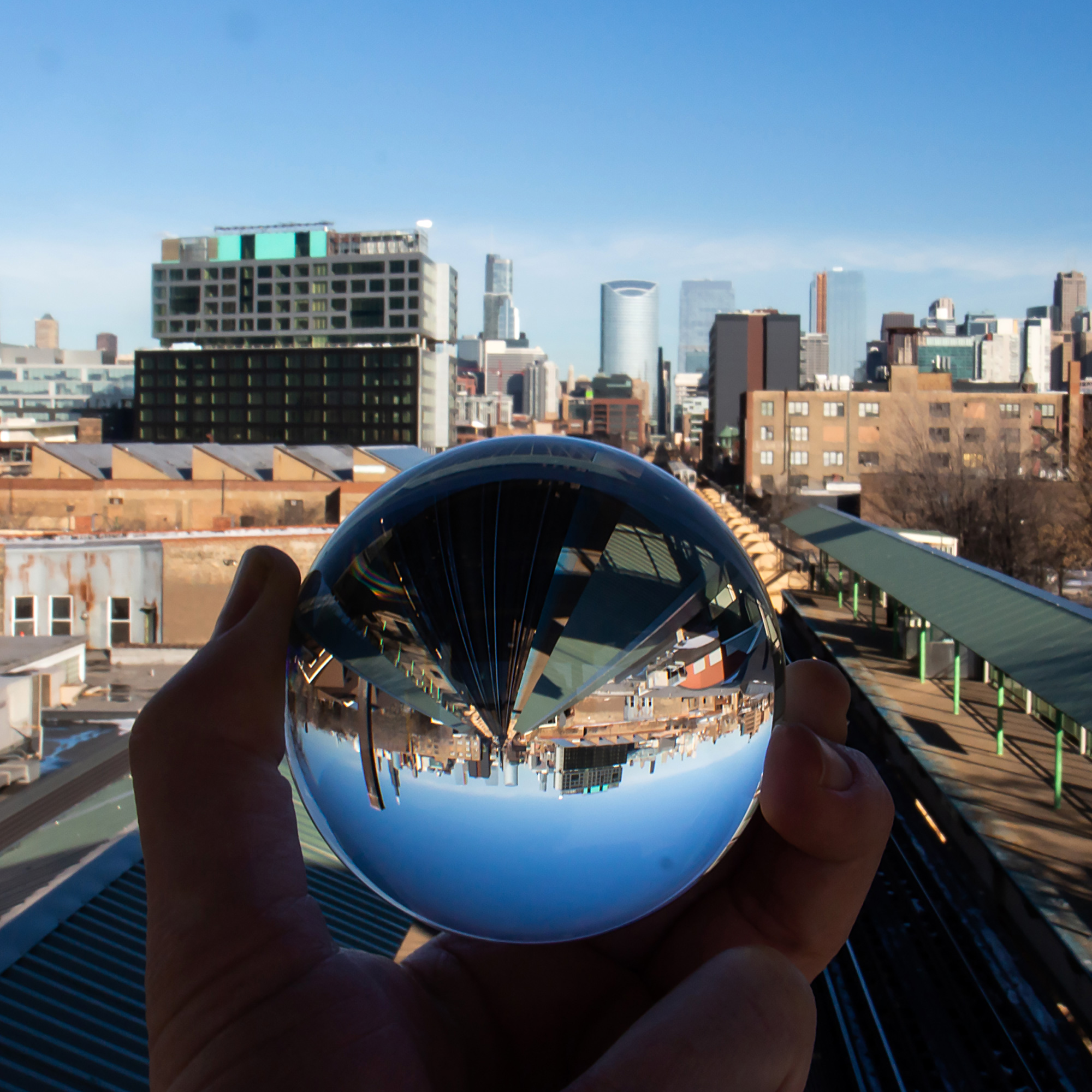
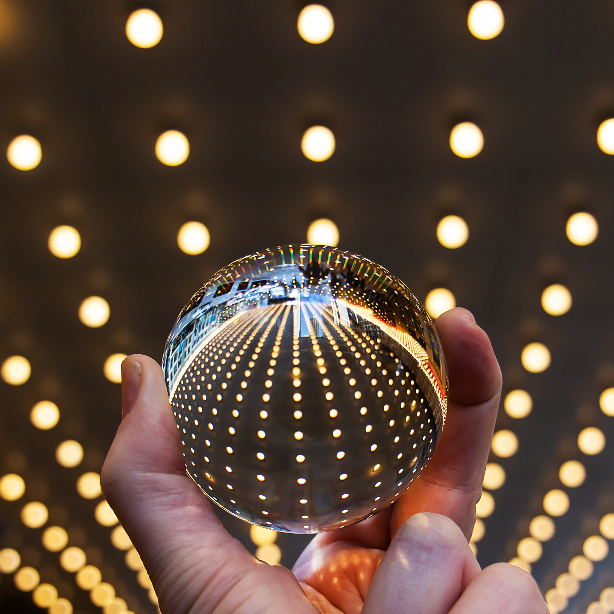
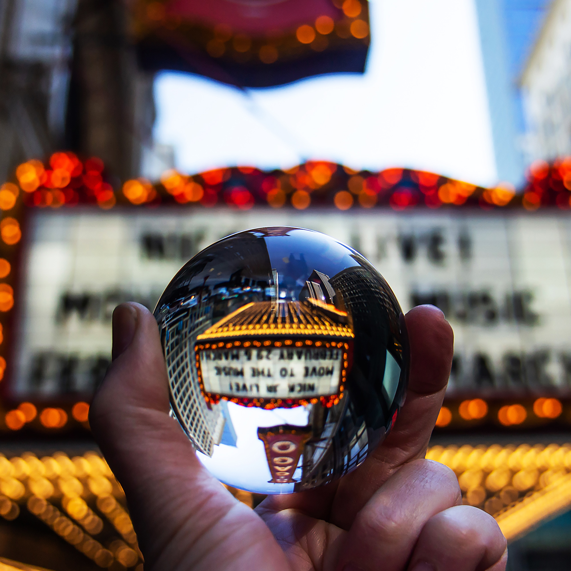
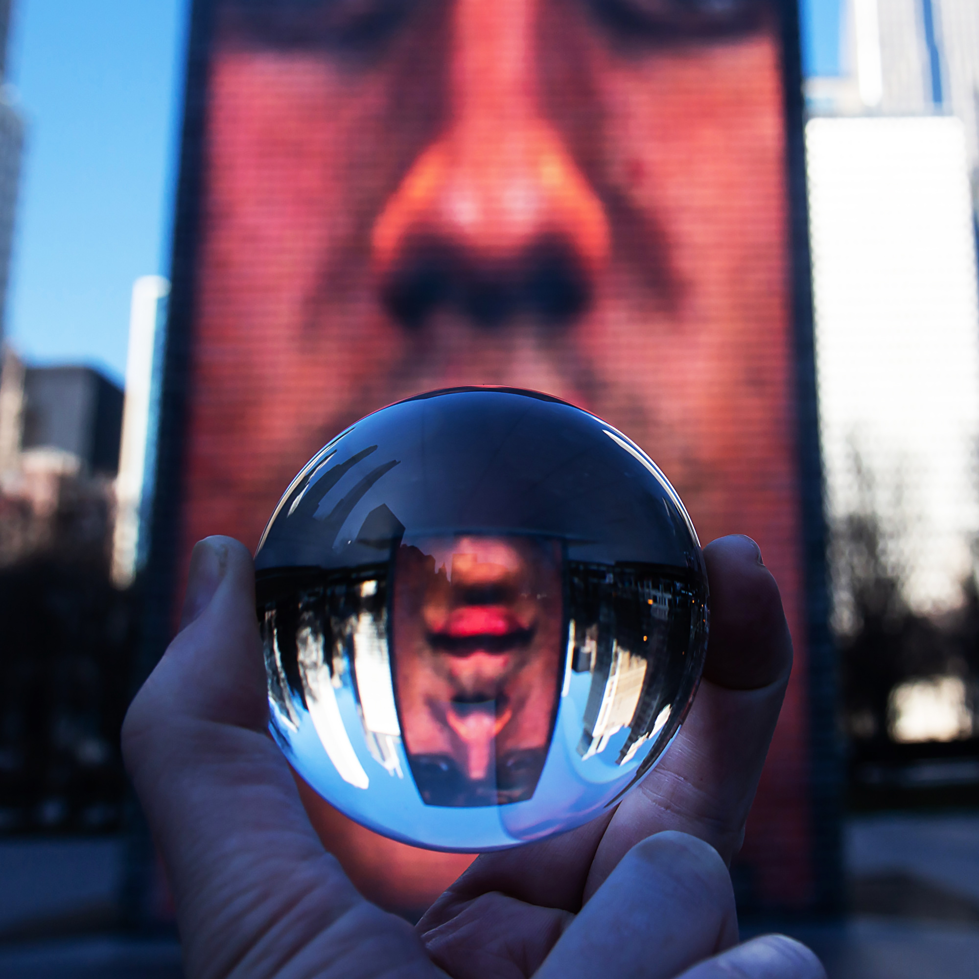
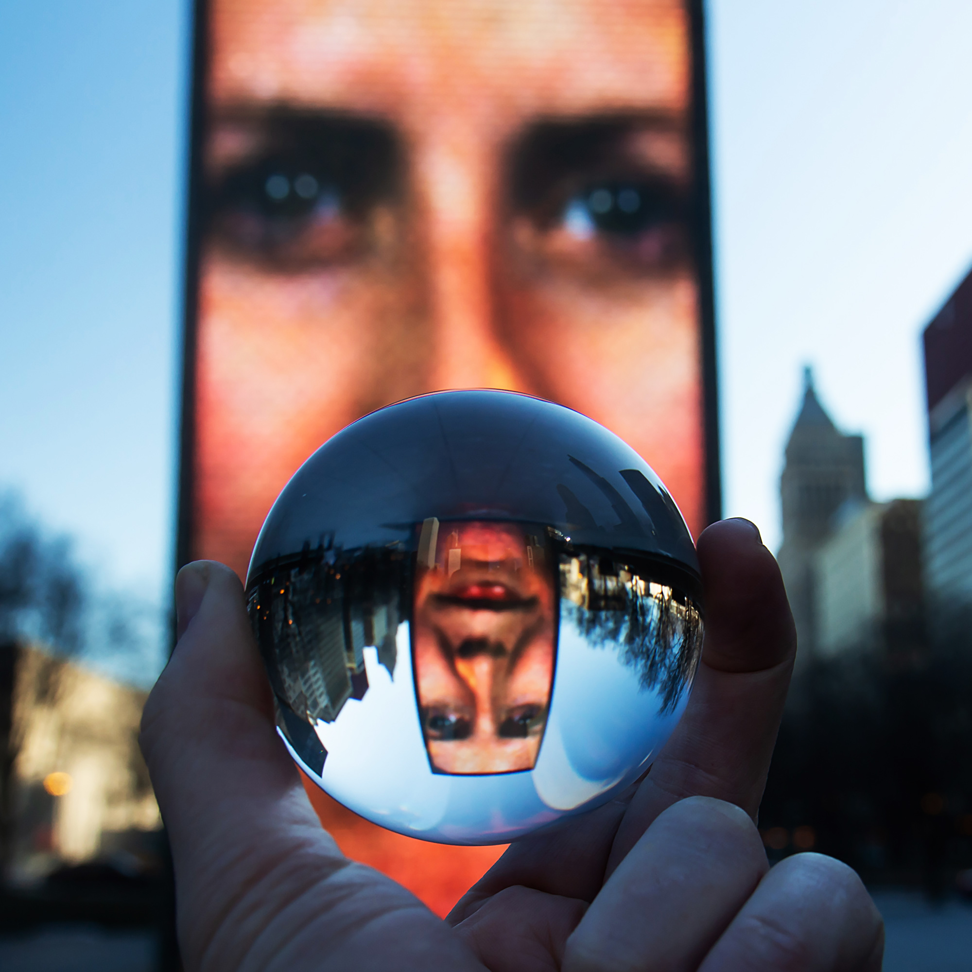
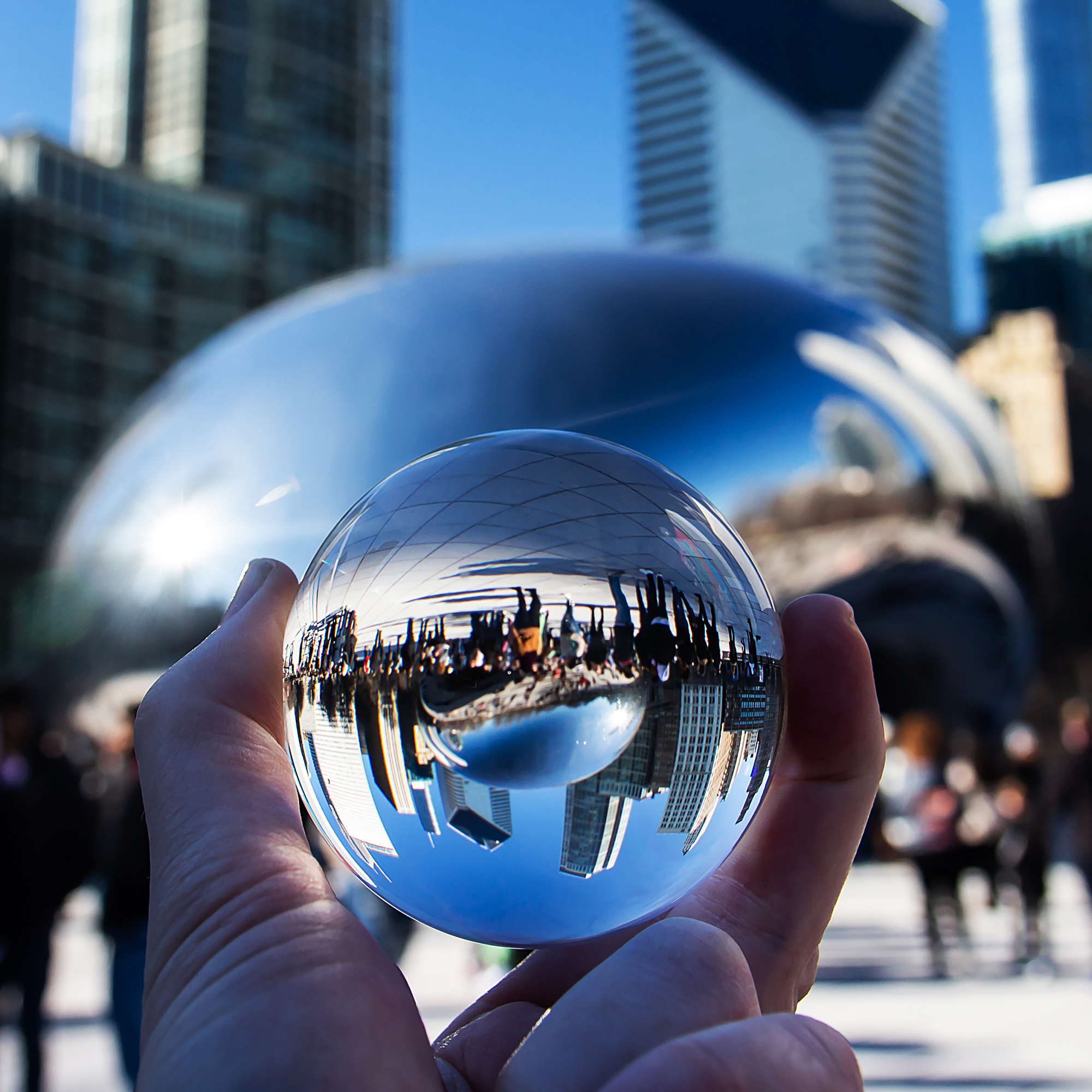
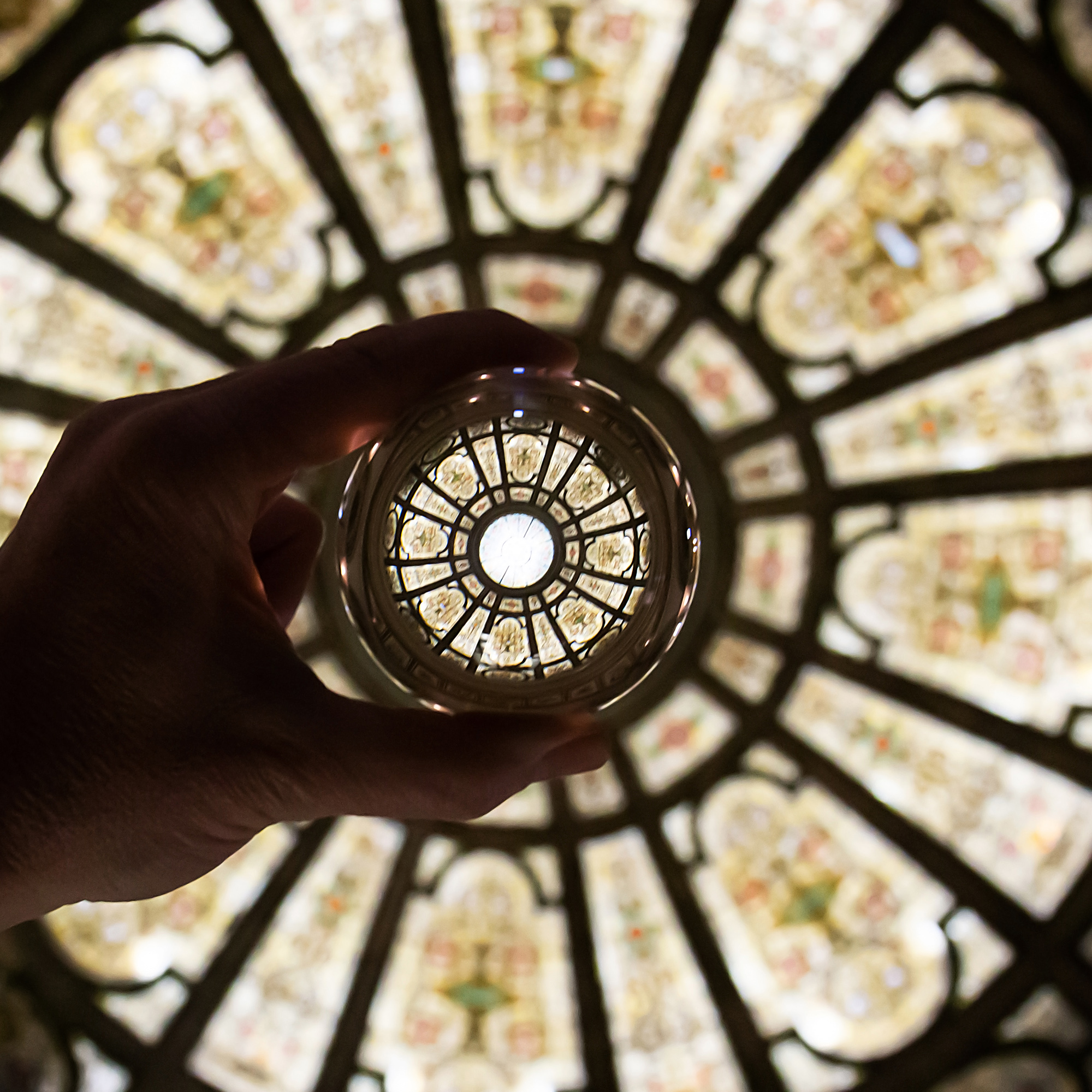
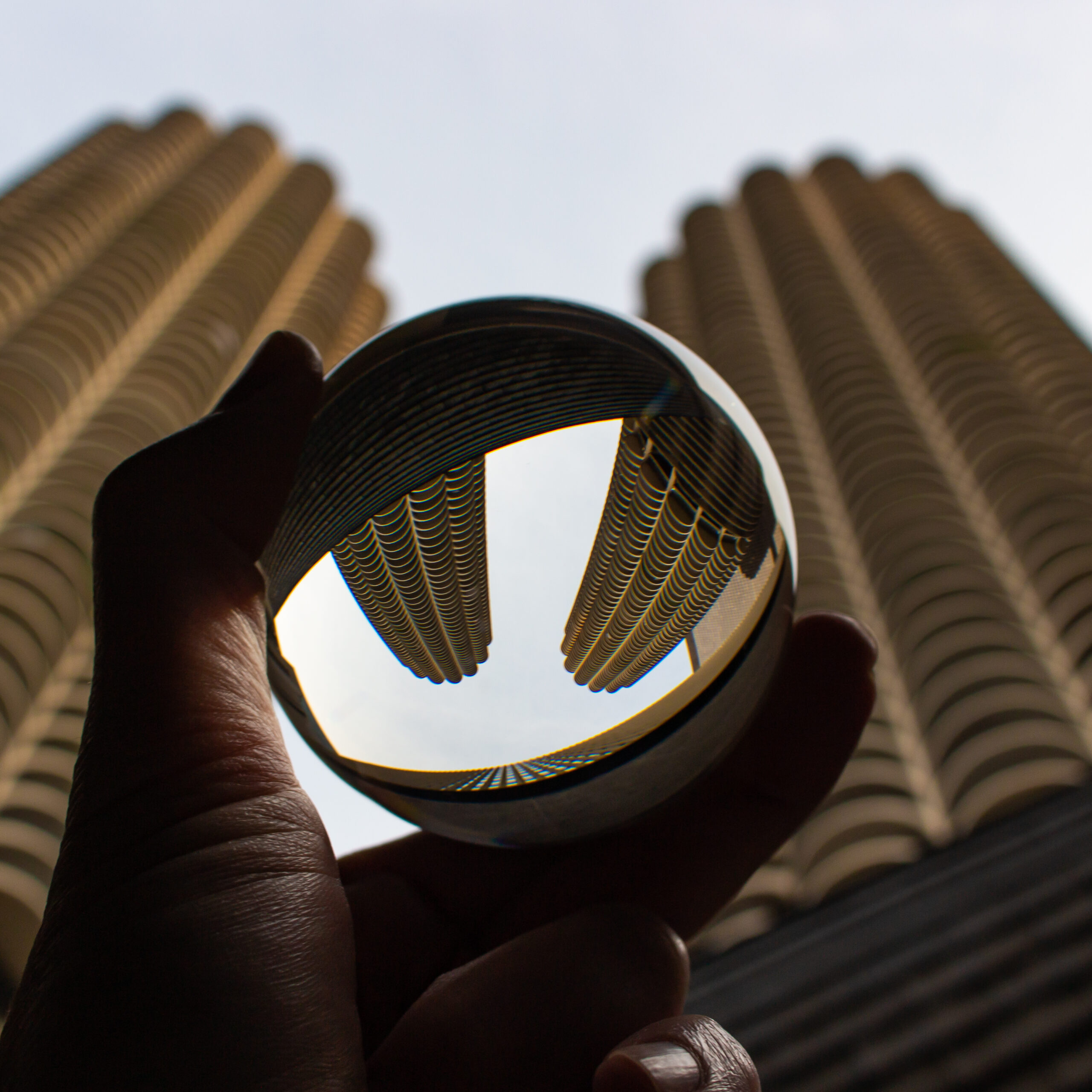
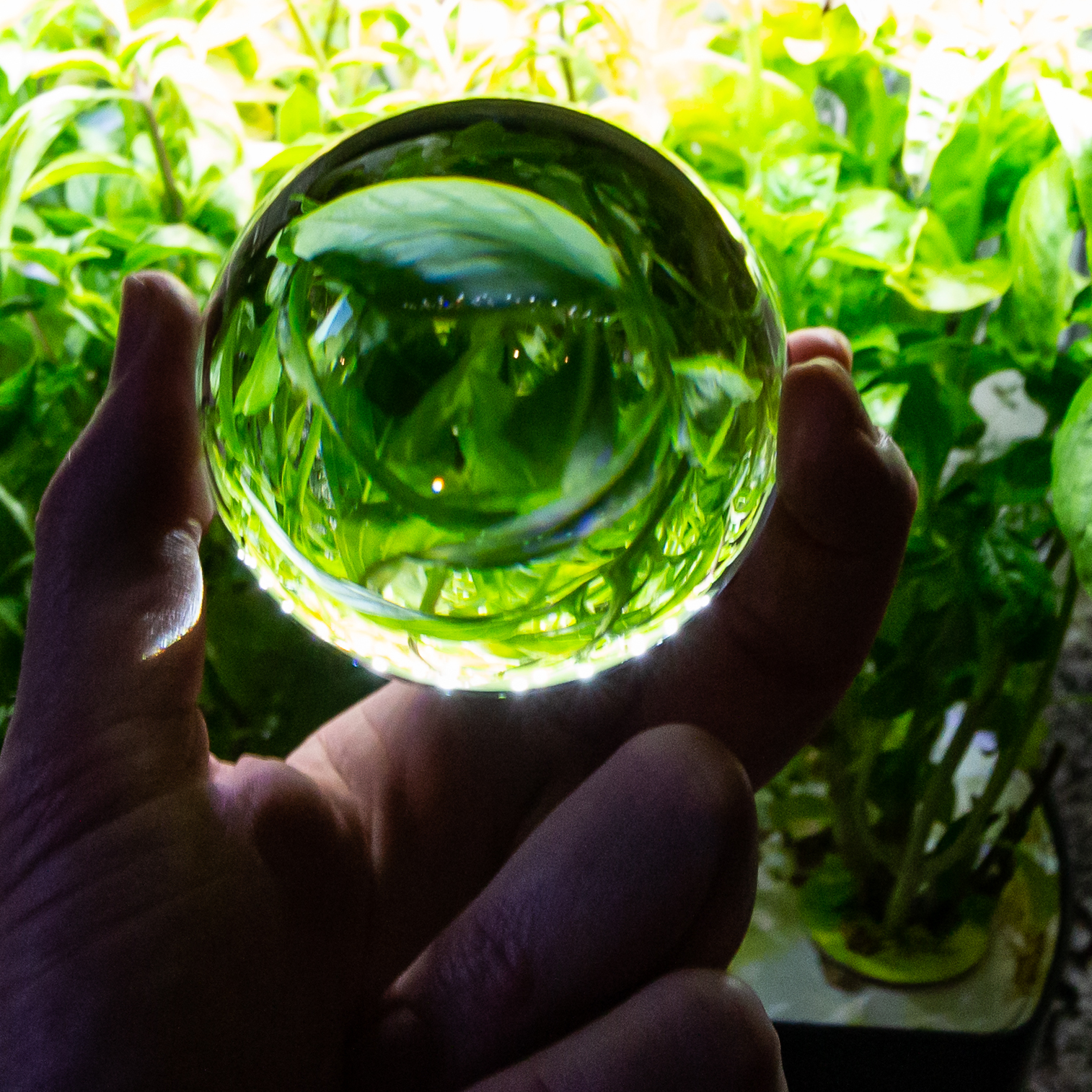
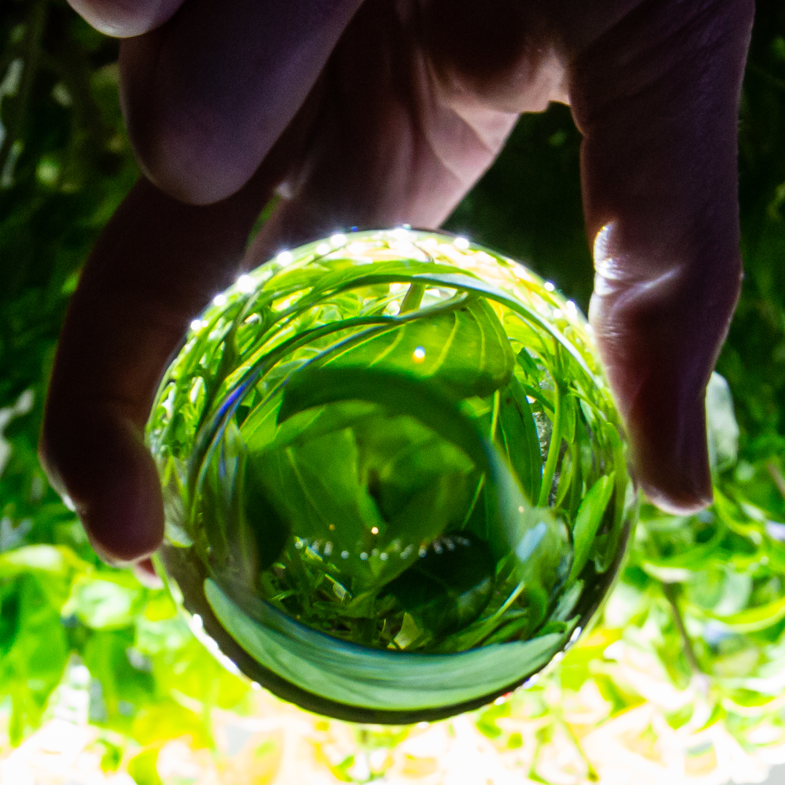
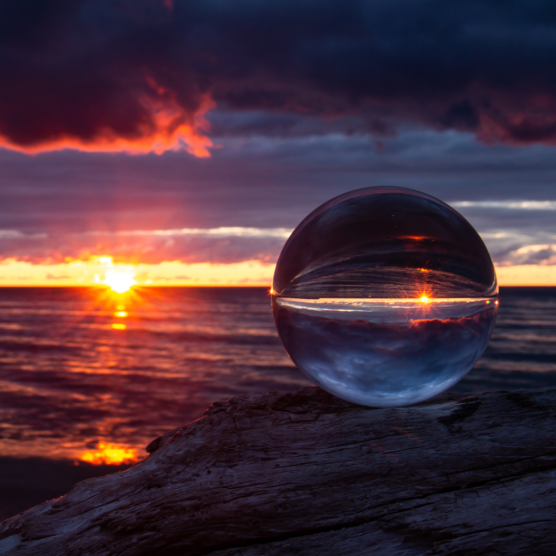
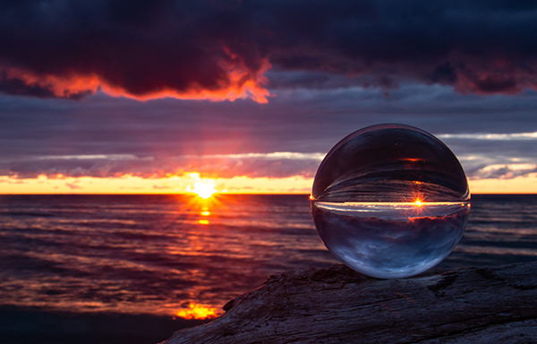
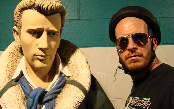
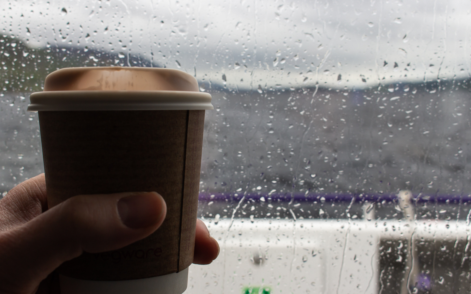
Meet Kit, my Lensball.
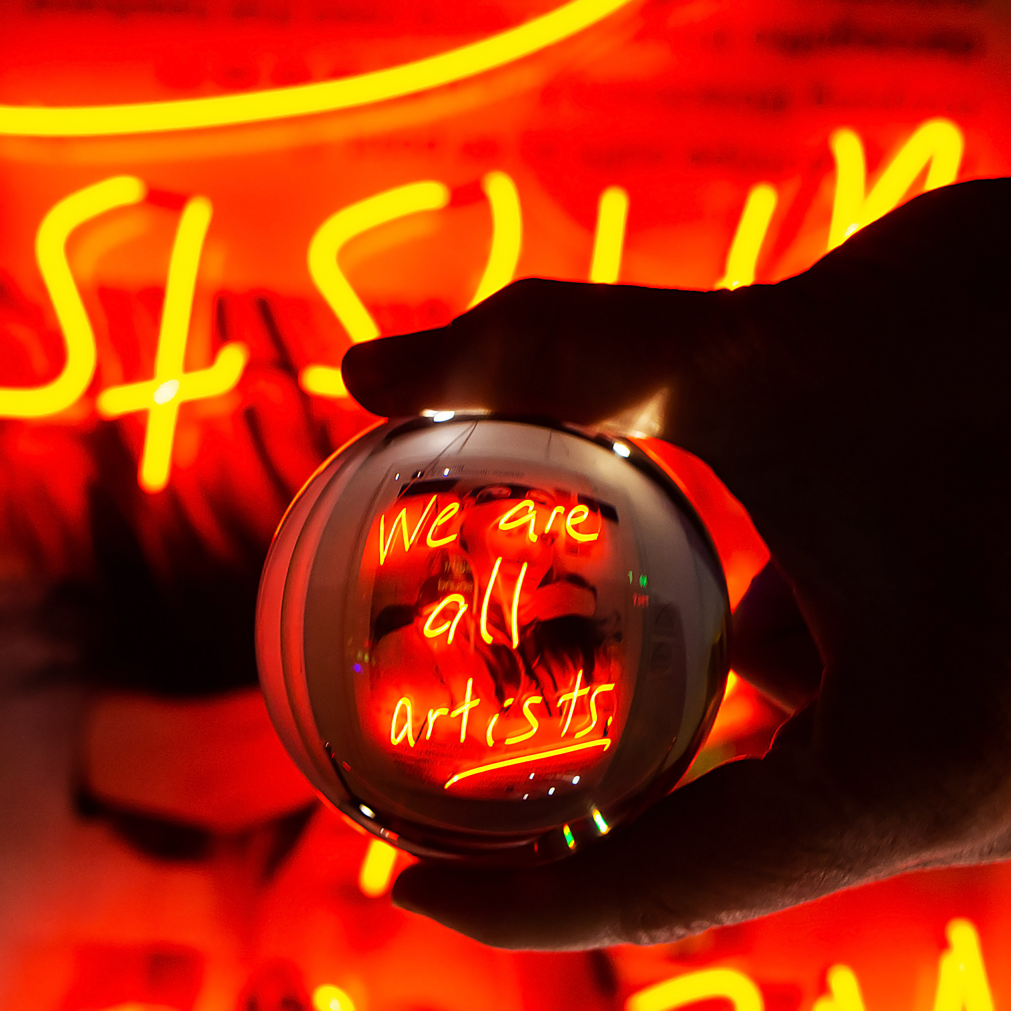
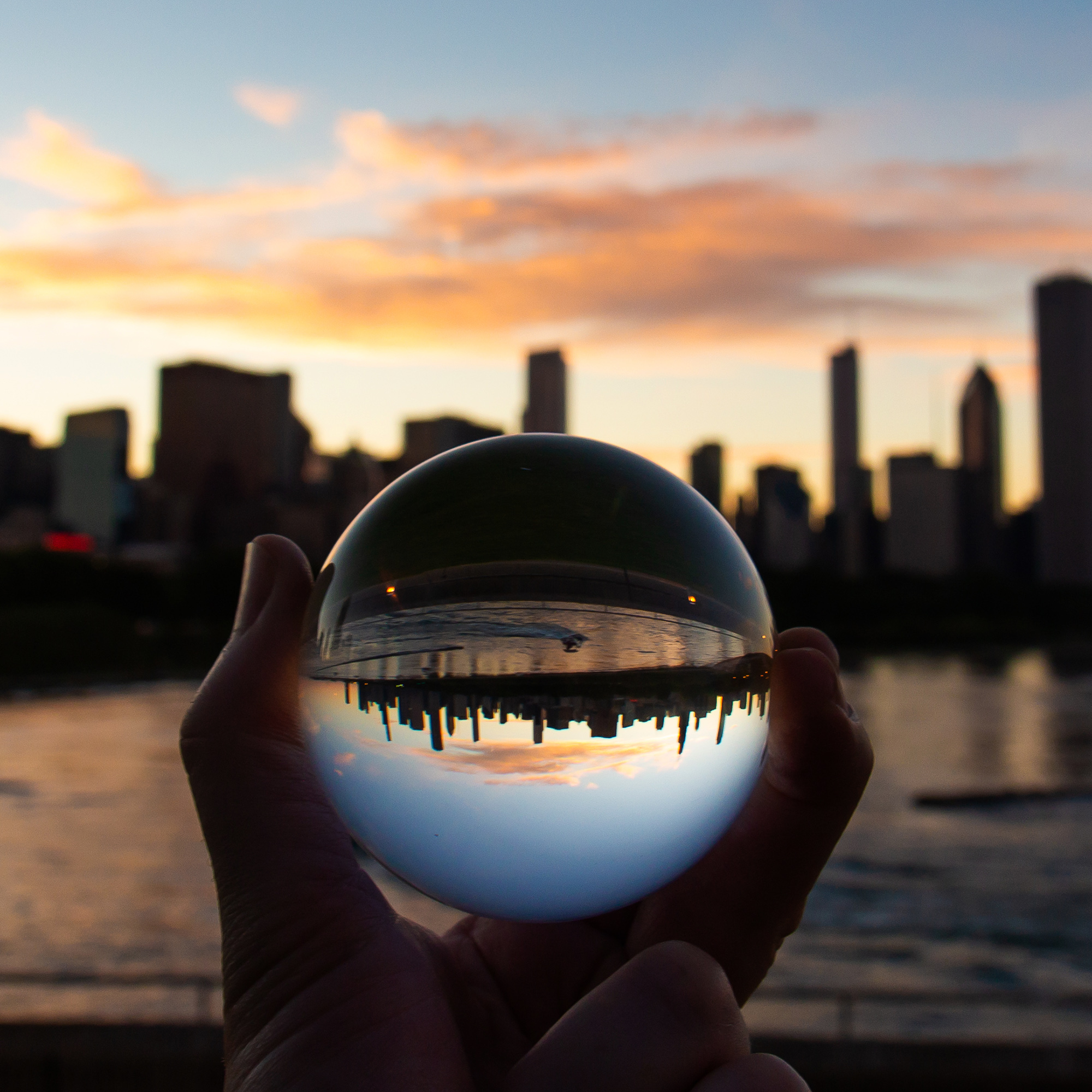
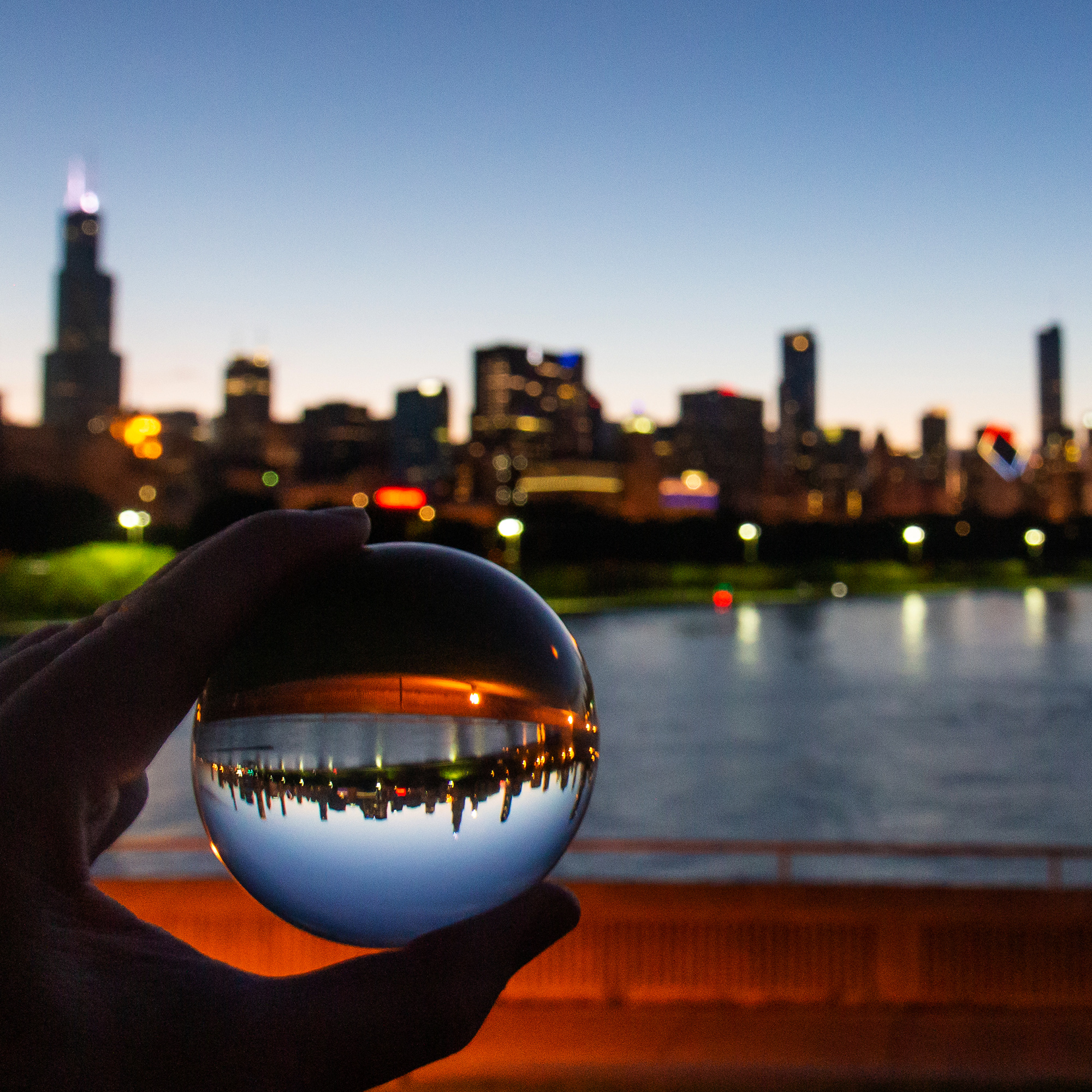
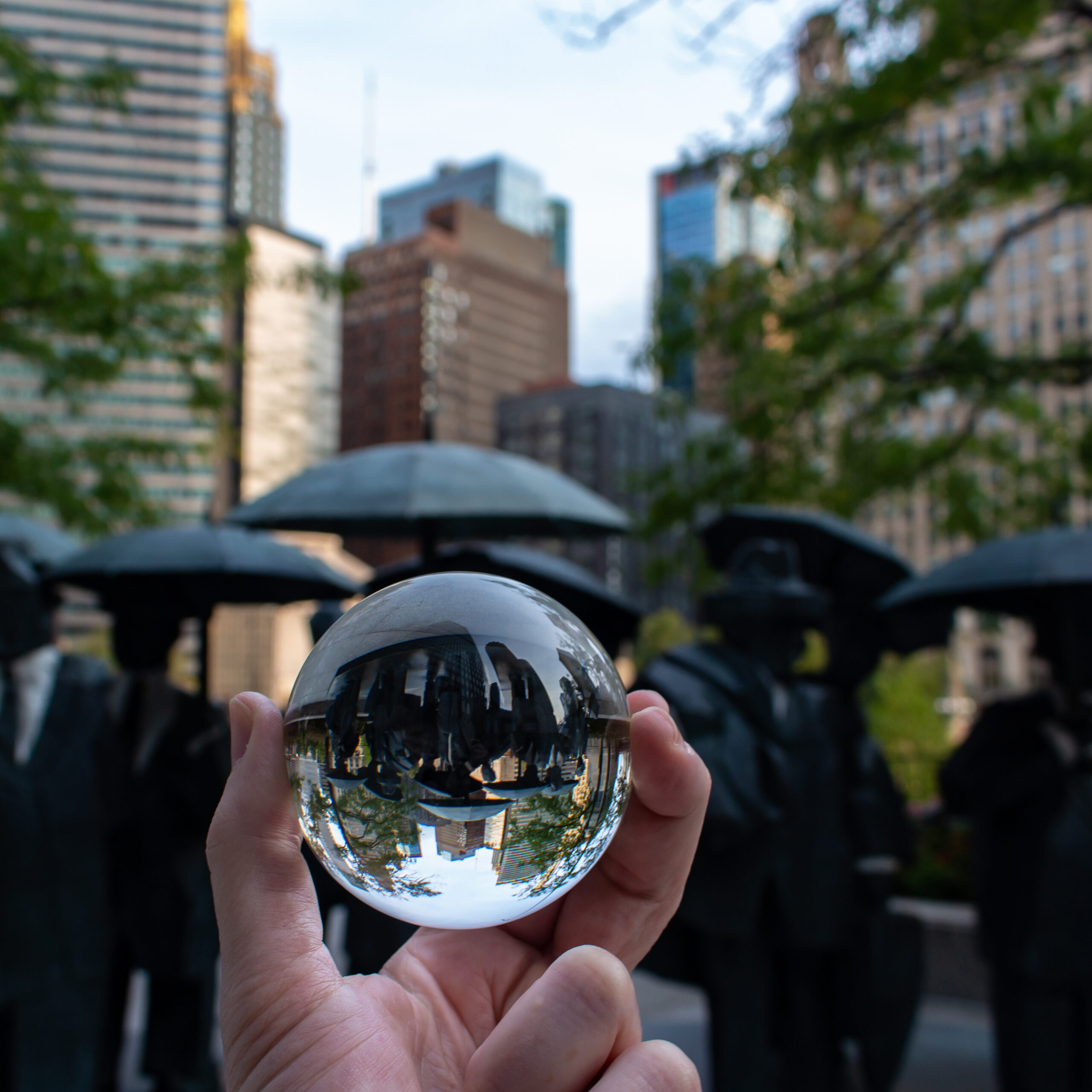
This glass ball is something of a travel companion that I started using a couple years ago. It can be very powerful as a foreground subject, capturing and rafracting the surrounding light in many different situations. In my case, I tend to gravitate towards ambient light, often times in front of neon signs or a city skyline when I use it in pictures. The possibilities are endless so long as there is a background to set the stage for light to travel – from source to glass, from glass to sensor. From sensor to disk, and from disk to Instagram. Because this ball is all about the Instagram. It’s all for the likes.
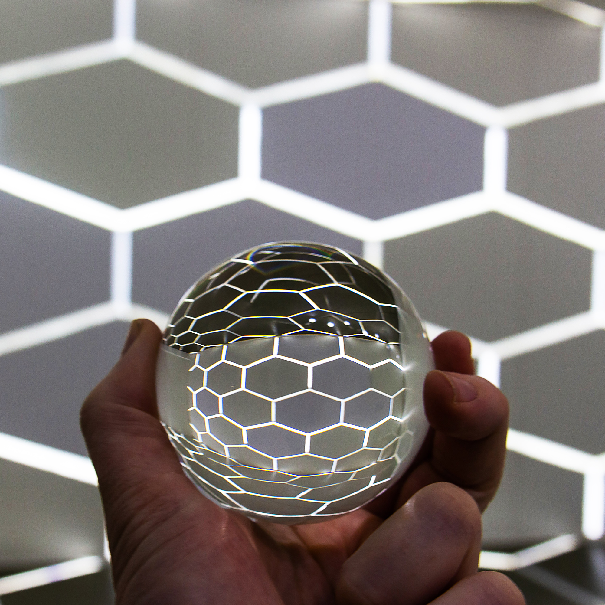
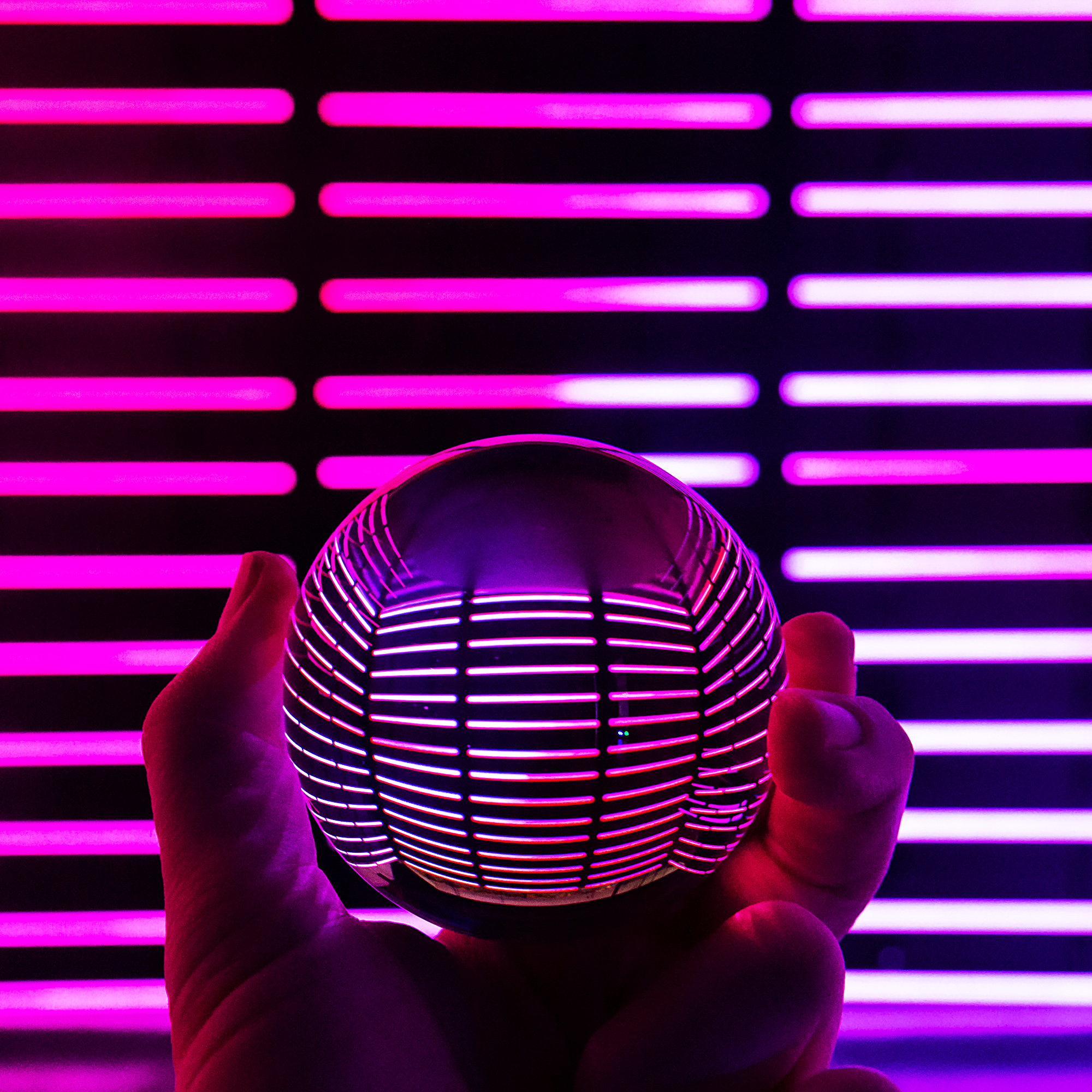
We had some interactive art installations earlier this year, Wndr Museum and Hebru Brantley’s Nevermore Park, that both offered a wide array of photo ops for a ball such as she. On other occasions I went around Chicago and shot the Lensball in front of sculptures or downtown architecture. And other times I just found something random to use, like the hydroponic basil jungle that is my roommate’s Aerogarden.
When this is all over and we can travel safely again, I imagine Kit will be ready for the city lights of Vegas.


Pictured Rocks National Lakeshore
Pictured Rocks National Lakeshore
…continued from Sleeping Bear Dunes
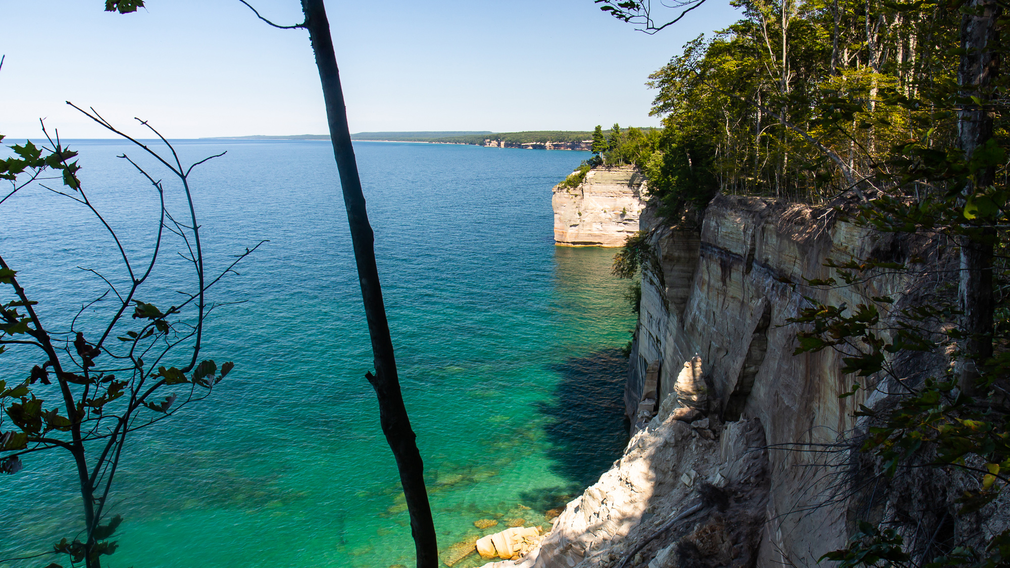
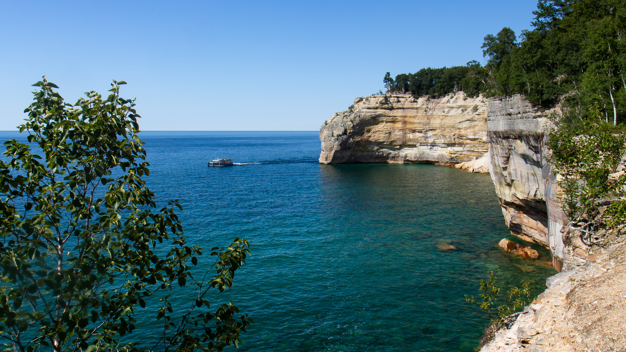
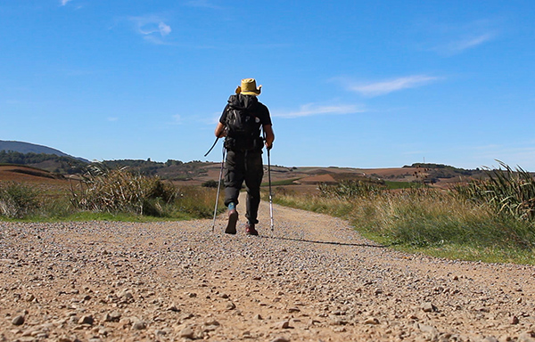
The Upper Peninsula of Michigan is a beautiful area for many reasons, notably for the pristine shoreline of Pictured Rocks, a national lakeshore extending for 42 miles along the coast of Lake Superior. I spent half the day driving up there from Sleeping Bear to spend a couple of days camping and exploring the park. I had enough time that afternoon to hike the Chapel Loop, a 10 mile route outlining the most dramatic section of lakeside cliffs.
I parked at the trailhead and hiked through the forest for an hour, often passing by other hikers before reaching Chapel Beach and the sound of crashing water. Turning west, the trail went along numerous overlooks for five miles. I often stopped to photograph the dramatic cliffsides as tour boats passed below. Eventually I reached Mosquito Beach on the far end of the circuit and turned south on a two mile uphill hike to my car.
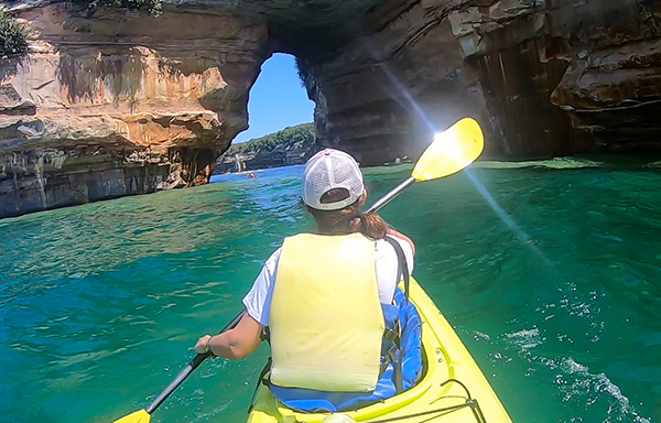
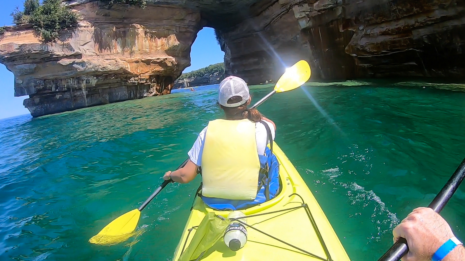
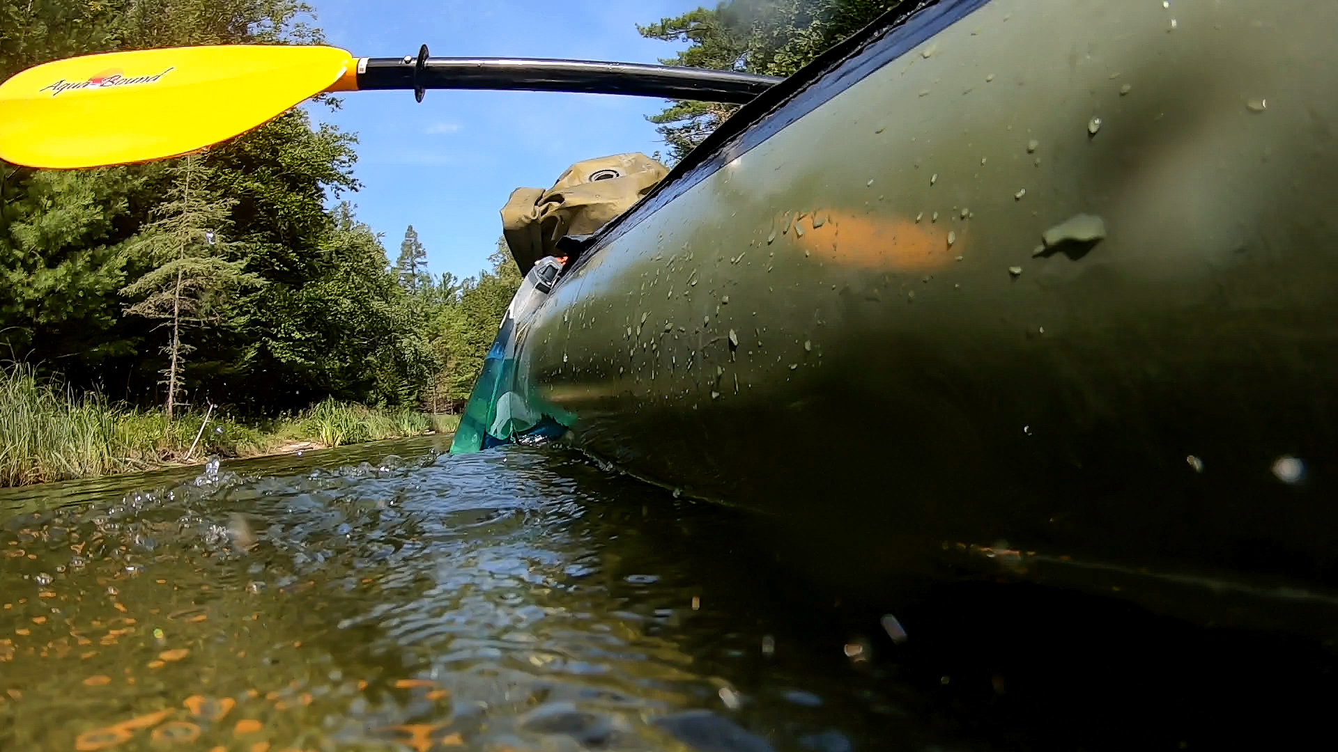
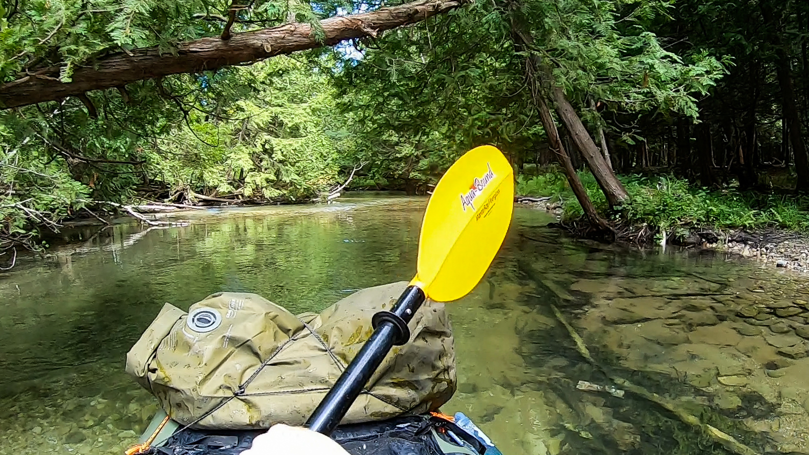
It was a great trail, but as I already learned elsewhere, a scenic shoreline can only be fully appreciated from the water. So on the next day I took an all day kayaking trip with Paddling Michigan, starting in Miners Beach just six miles west of the Mosquito trailhead. We paddled east along the steadily rising cliffside, where already the cliffs were layered in different colorful minerals. Sections of them included a layer of gravel left behind by glaciers of another age, grinding and burying moraine into the ancient bedrock.
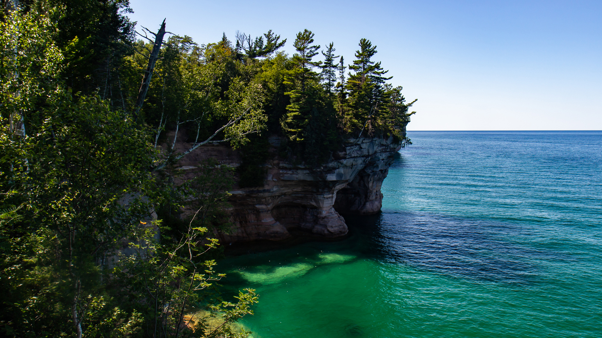
The water was a translucent jade color illuminated in a bright sun as it slowly shifted about in the calm morning. We passed over a shipwreck, which I couldn’t see very well from the boat. But I did get some video footage of the wooden planks of the ship under the flickering sunbeams. There were other wrecks in the area as well, due to Lake Superior’s potentially treacherous weather patterns. I wasn’t at all surprised to find out that this area has its share of dive sites.
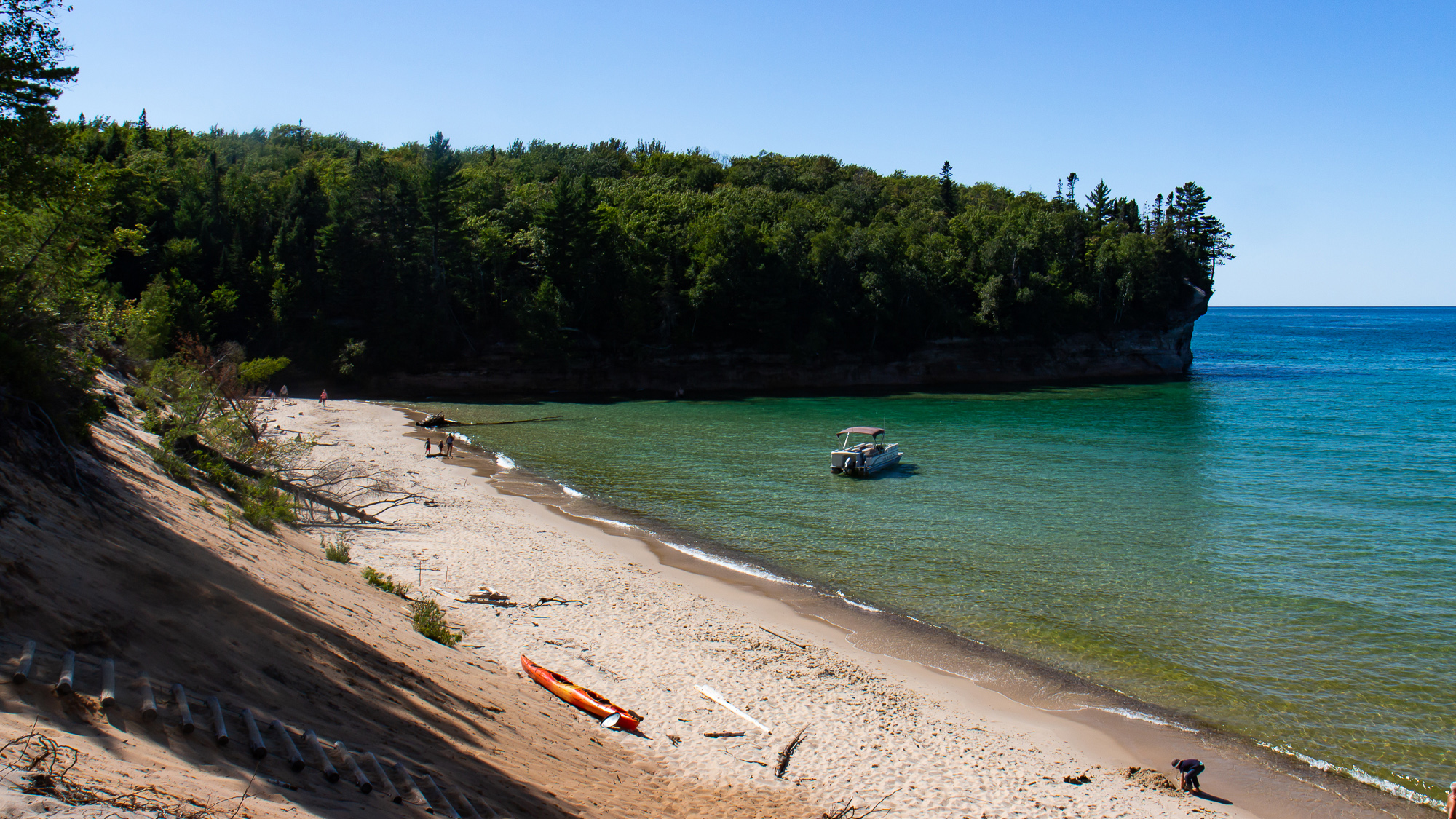
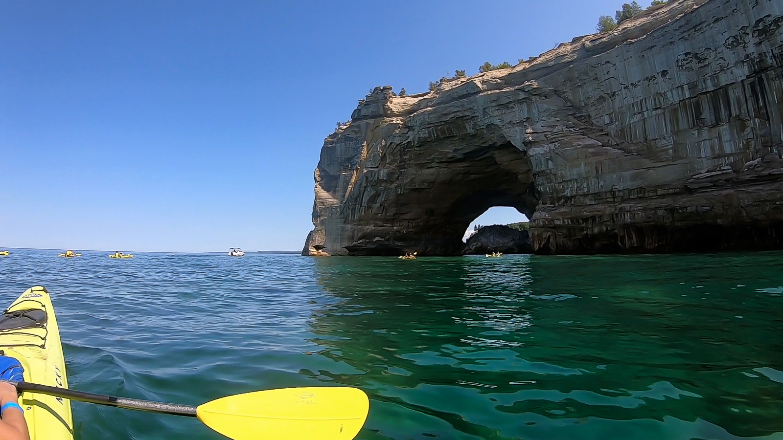
We stopped for lunch on the shore for an hour and then continued on past Mosquito Beach. Here, the cliff points were the most dramatic, rising up to 200 feet above the water. We paddled underneath arches, into cliffside mini-caves, and one small tunnel that waves had carved into the rock wall. I understood why more daring people have taken bigger expeditions into places like Alaska’s Inside Passage, where they can explore its coves, islands, and beaches day in and out. The sport of sea kayaking offers an epic, yet peaceful opportunity to any adventurer looking to find their coastal frontier.
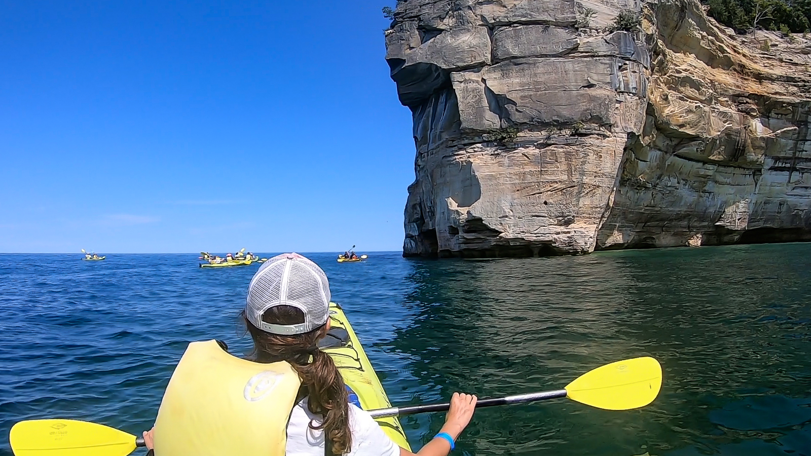

Passing Grand Portal point, we made a straight mile to Chapel Beach, where several people made a 60 foot leap off of a nearby jump rock. The rest of us shored our kayaks as they were already getting loaded onto a shuttle boat. Then we made a three mile hike on the Chapel Trail back to the parking lot.
Great as it was, I barely saw a quarter of the Pictured Rocks shoreline. I have no idea when, but a 42 mile backpacking hike from end to end would be a great way to follow up on this tour.
Sleeping Bear Dunes
Sleeping Bear Dunes
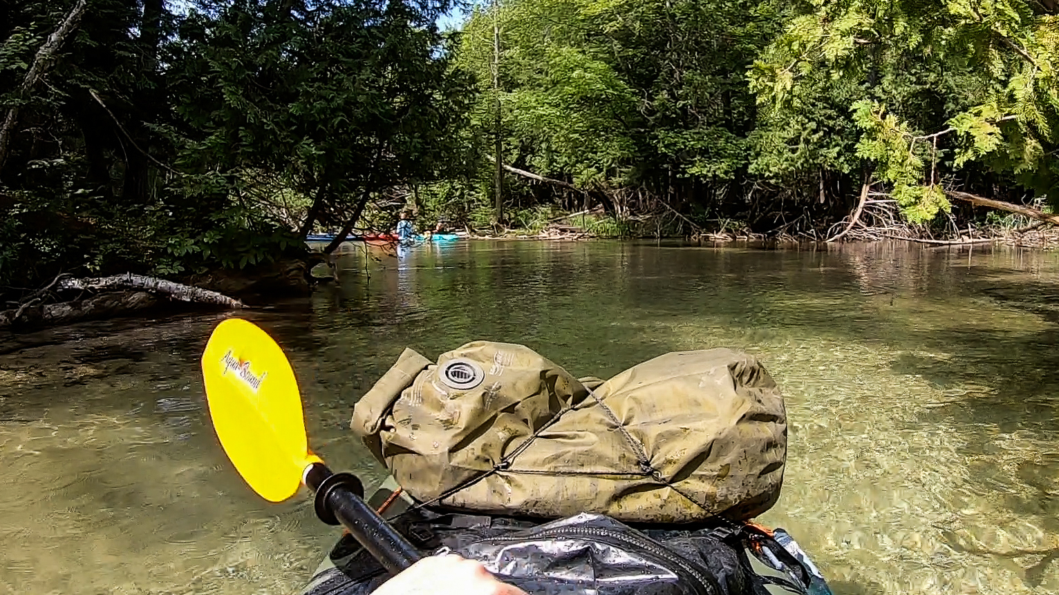
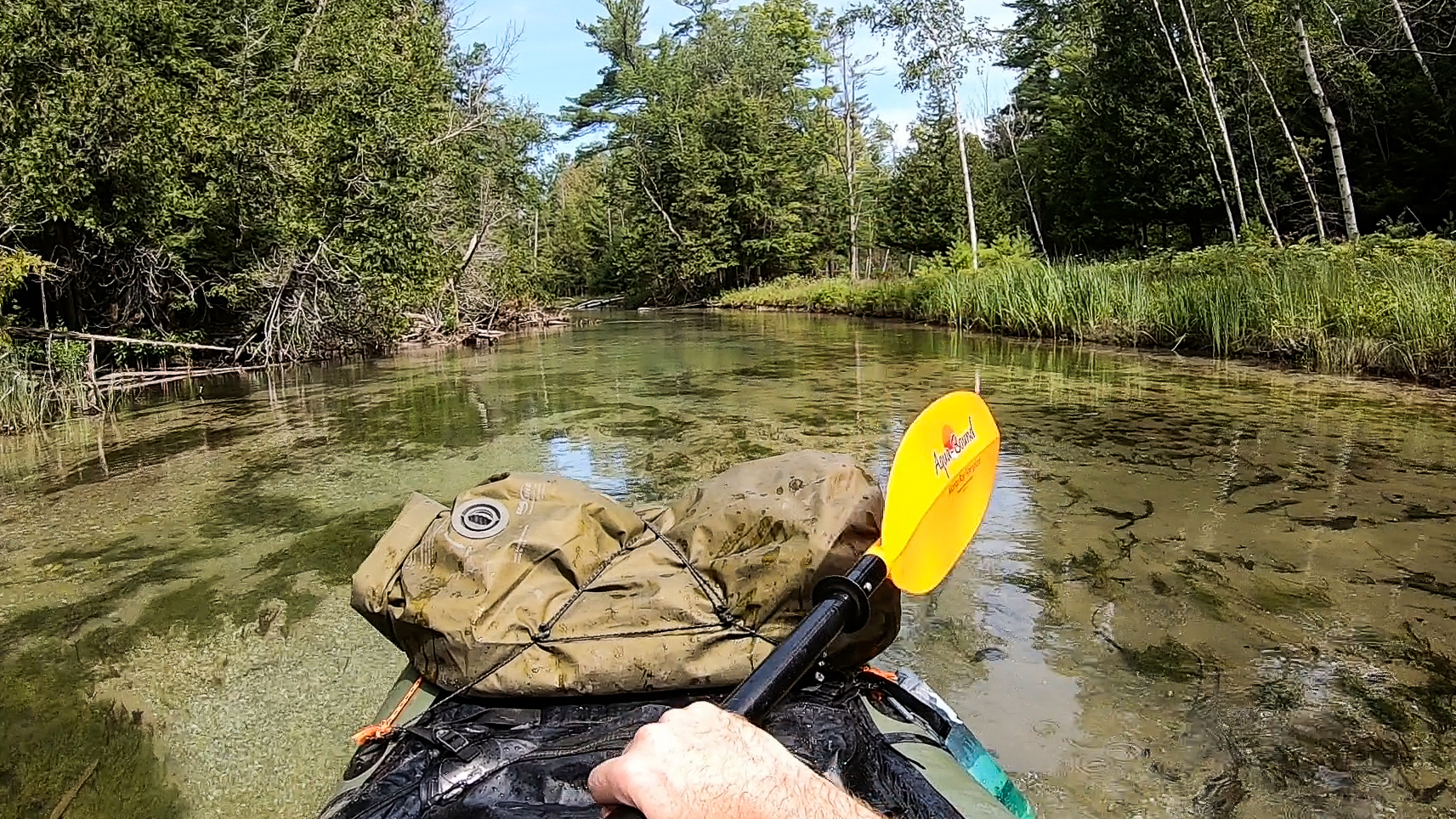
If there was ever a Class 0, it would be the Crystal River in northern Michigan. True to its name, this flatwater river is like a sheet of glass no more than a foot above the sandy riverbed, meandering its way through a dense wood of evergreen to the lakeside vacation town of Glen Arbor. Every summer weekend, an outfitter in the town shuttles people to a boat launch a few miles up the road. I try to avoid spending money just to paddle, and hiked up there on my own.
I set up my raft and got in, and immediately enjoyed the calm and steady current as it made its way through the woods. Many places were a foot deep or less, but usually just deep enough not to scrape my raft on the bottom as I dug my paddle into the sand and grit. I passed several families and on more than one occasion saw kids paddling by themselves out ahead. The truth is that you would have to actually try to screw up on this river.
After about two hours I got to the takeout, packed up, and got a fish and chips dinner at a restaurant close by – the benefits of paddling next to a tourist town.


My plan was to packraft for three days on this vacation – first on the Crystal River, then for two days on the Boardman, a bigger Class II river south of Traverse City. For the past 16 years, the Boardman has undergone a major dam removal project, so far removing three of its four decommissioned dams from the river. I had the idea to spend two days paddling through it with my packraft to see the grassy fields left behind from what were once artificial lakes, and to document the recovering ecosystems. So on the second day, I parked at a river takeout south of the city and hiked the River Road upstream.
Eventually the road crossed over the river and I got a good look at what I was actually dealing with. It rained a lot in the last night, and that river was high. And fast. That along with the fact that camping in the rain already had me in a bad mood, gave me an uneasy feeling about going any further. If I were to go around a bend at that speed and run into a strainer, I don’t know if I would be ready for it. Further on were Class II rapids that I knew nothing about, and also likely higher and faster from the rainstorm. I didn’t want to run it today and end up in the paper tomorrow. So I turned back.
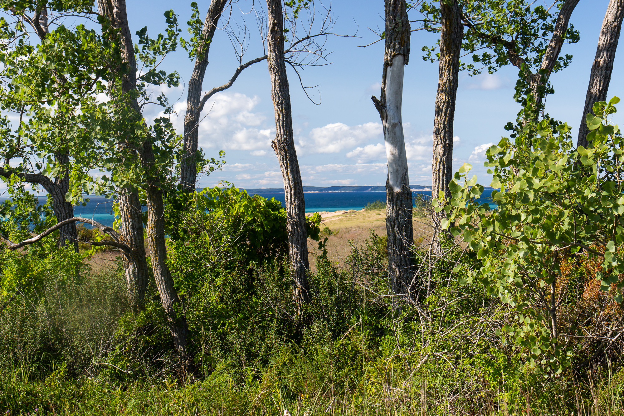
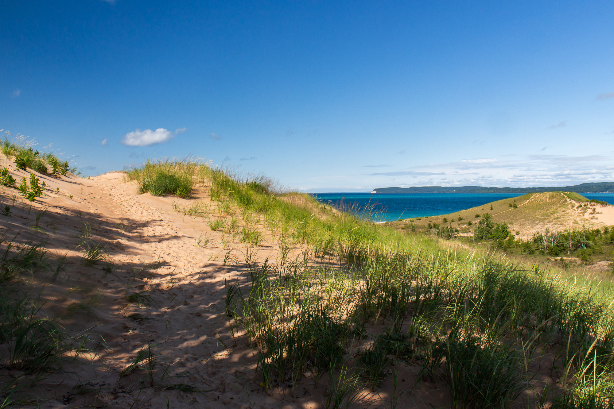
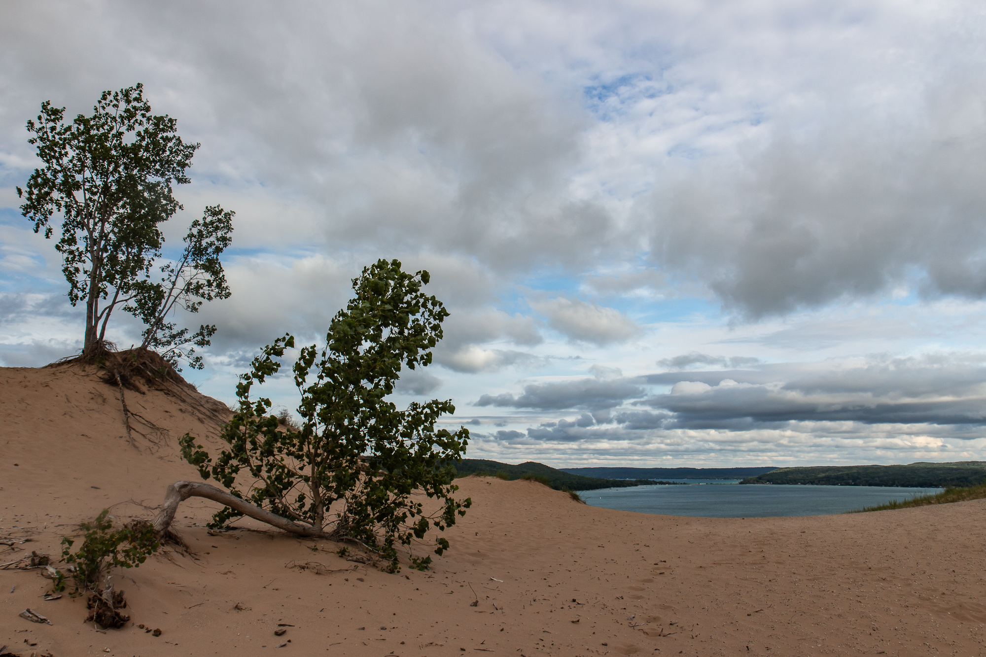
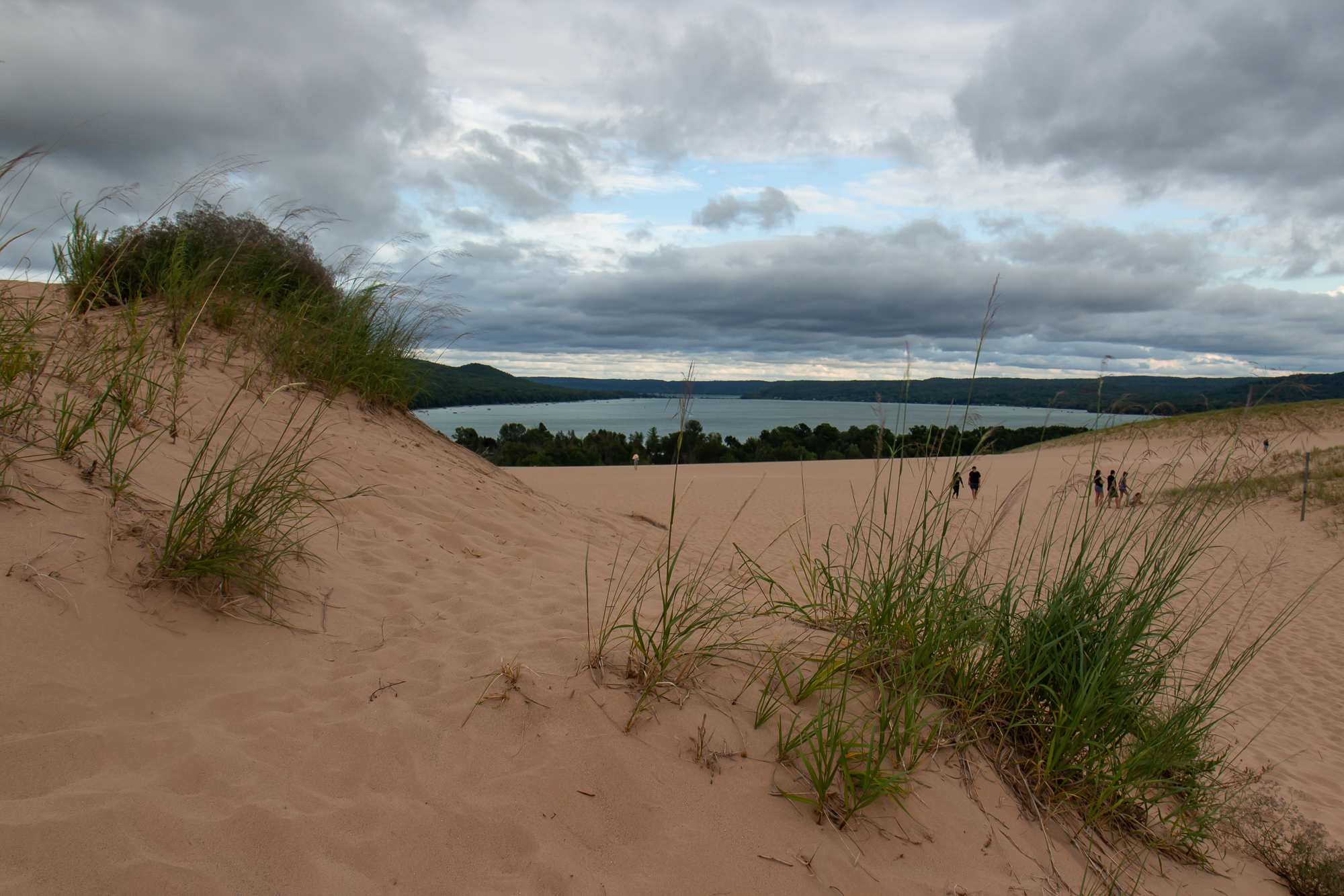
Determined to make something of the day, I got lunch in Glen Arbor and spent the afternoon hiking the trail systems around the Sleeping Bear Dunes. It is a scenic series of sand dunes that span three miles from west to east on the shoreline, with sand bluffs overlooking Lake Michigan and the Manitou Islands across the water. In non-Covid times, you could take a ferry out to them for more secluded camping and backpacking.
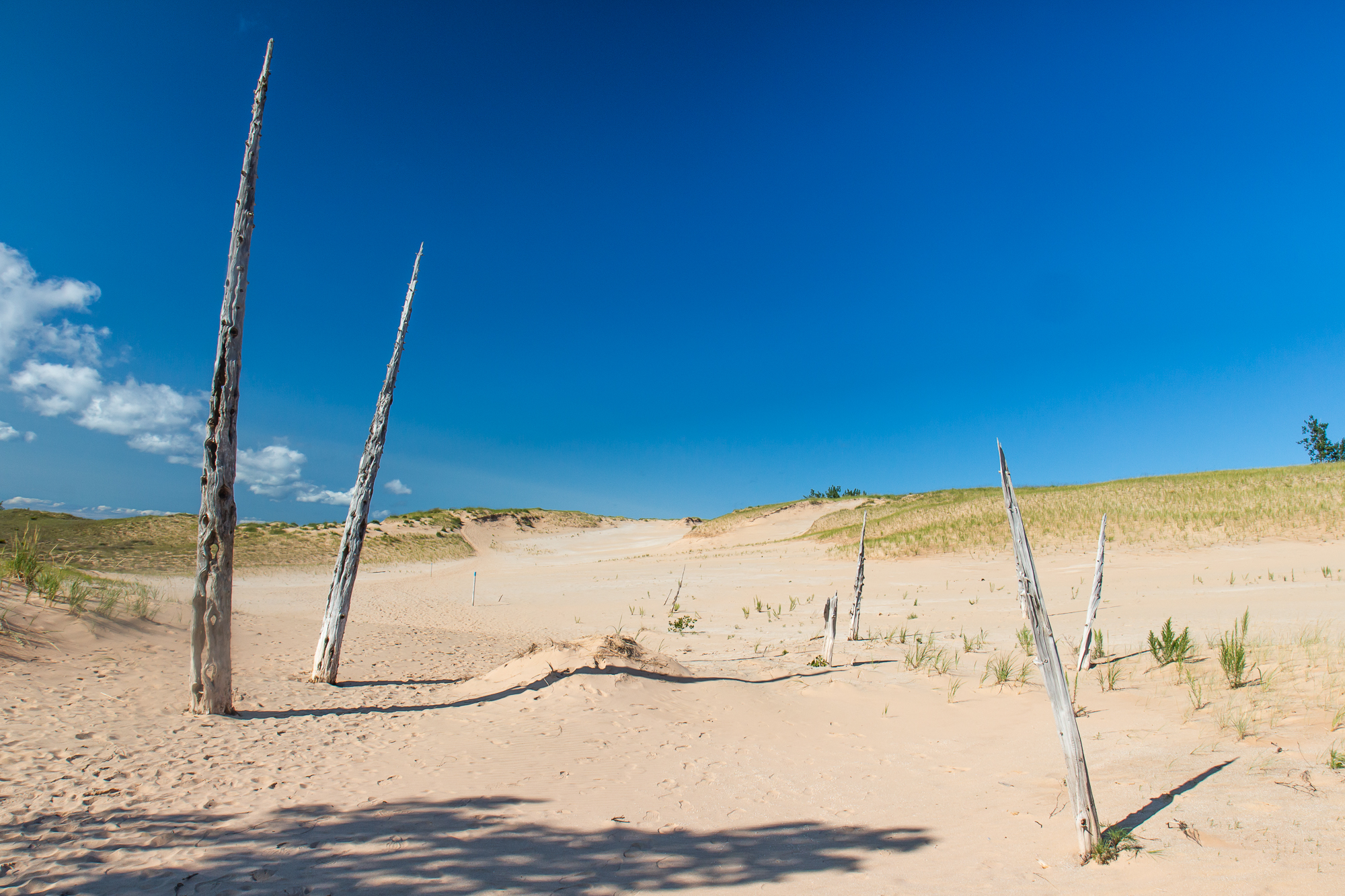
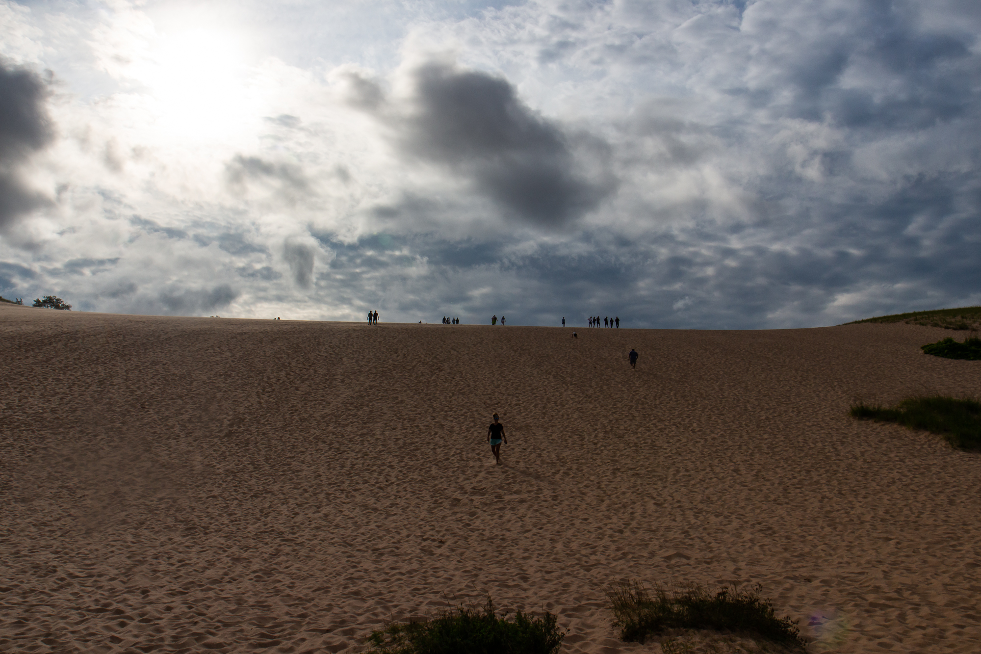
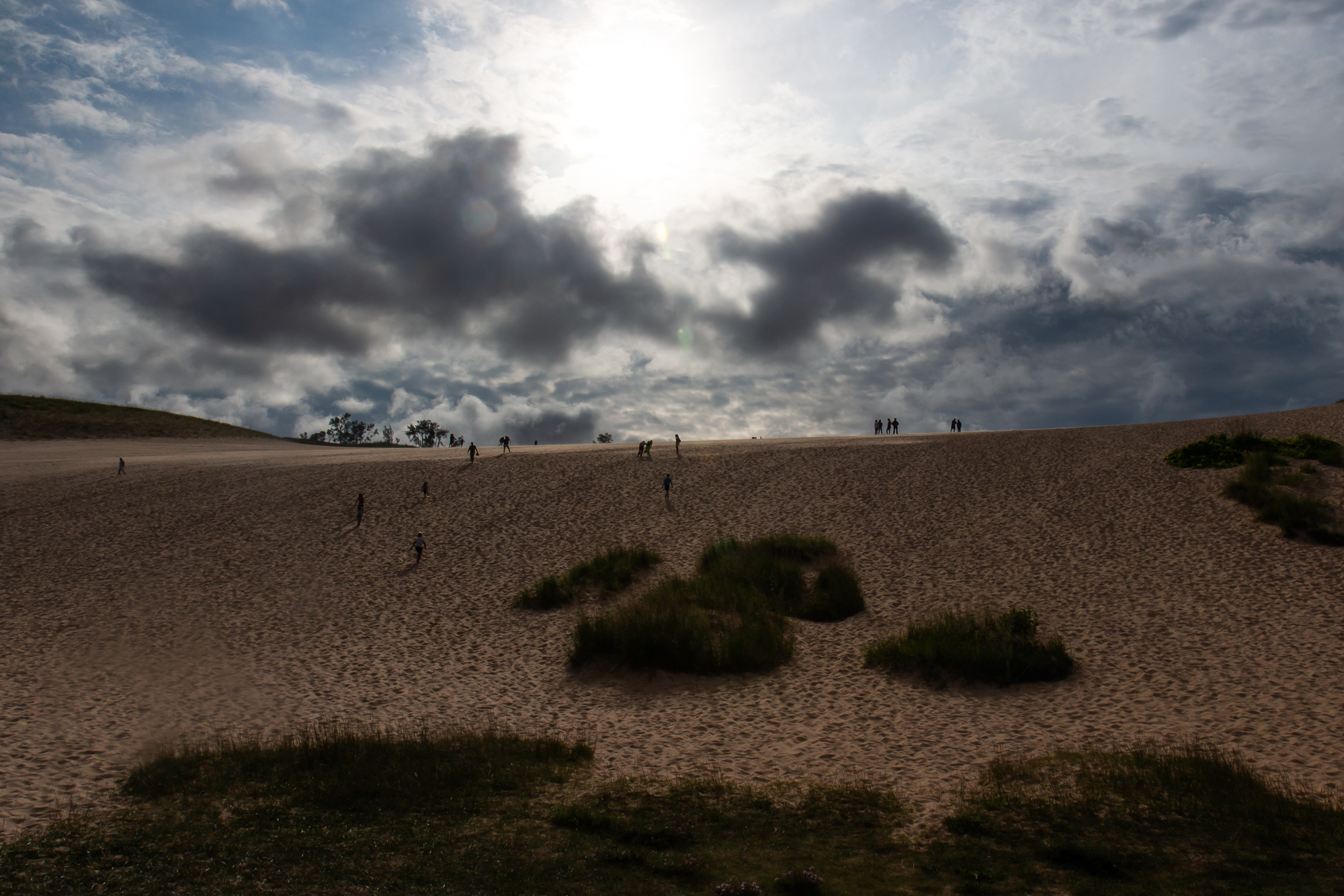
I hiked the dune trails as they went along the ridges and scrawling vegetation, occasionally passing dried out husks that were once trees. As the sun fell in the west I parked my car at the main lot and made the Dune Hike straight up and over the ridge system, climbing five or six steep hills before reaching the beach on the far end. I had done this trail before, but it still felt like forever as I cleared each hill only to see another one.


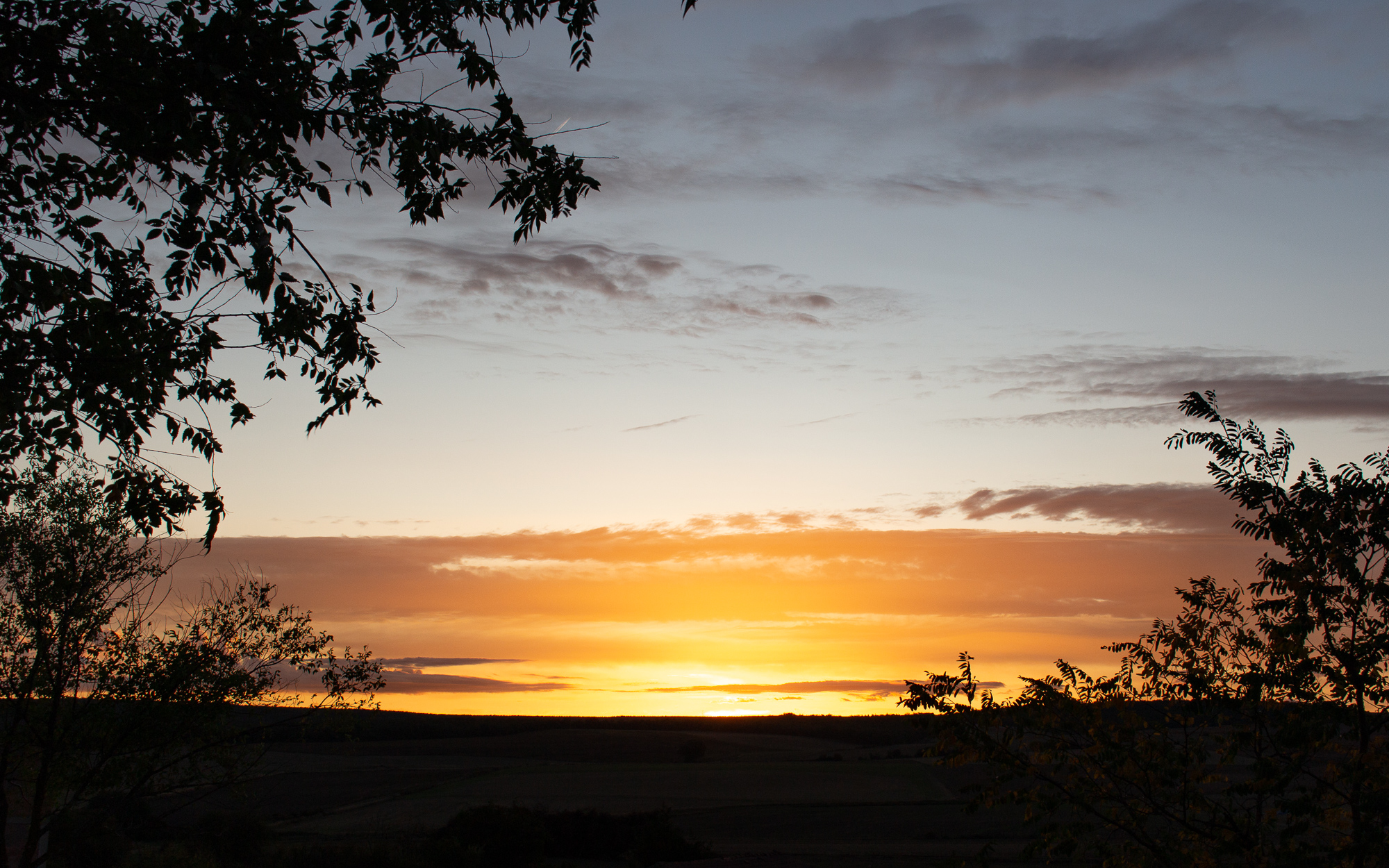
I sat by the water and waited for the late day sun to come out of the clouds that loomed just above the horizon, longing for another sundown of another where and when – one that won’t happen until I’m allowed to return to Europe. It has been a strange and unprecedented year where I had just about everything planned out of where I would go, and what I would do when I got there – only to have life get in the way and change all if it. This week long trip in Michigan might well be the only vacation of note that I take. I, like the rest of America – whether they want to accept it or not – have to wait until we’re not sick anymore. But I’m nothing if not thankful as I allow these times to pass, as surely they shall. There are other worlds than these.

All at once, the sun fell behind the water. I packed up my lensball and camera and made a good pace back in the fading daylight. It was fully dark by the time I reached my car.
This roadtrip continues in the Upper Peninsula.
The Route 66 Bike Tour
The Route 66 Bike Tour
Recently my Facebook feed brought up a photo album from ten years ago of a bike tour I did from Joliet to St. Louis on America’s historic Route 66. It was the first major trip I had taken since I moved to Chicago almost two years prior. Up to that point I was content exploring Chicago’s neighborhoods and finding things to do in the city. And as fun as it was, it did eventually feel like a normal part of my life. By the early summer of the second year, I was starting to look beyond the city limits for new things to explore. This bike tour in particular was the first multi-day outdoor trip I had ever done, and happened at a time when I was just beginning to find my place in a bigger world. Starting on a dark highway just southwest of the metropolis I had spent two years getting to know, I faced an uncertain future.
The Metra train left the city and made its final stop at the southwest suburb of Joliet in mid-evening on a Tuesday. I wheeled my bike into the platform elevator next to a young guy in a wheelchair. He asked me about my trip and I told him I would get to St. Louis if all goes well. He went on to say that he cycled a century not long ago on a handbike. Then he wished me luck and wheeled in the opposite direction as I turned south, already feeling inspired and challenged.
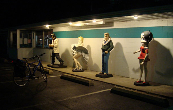
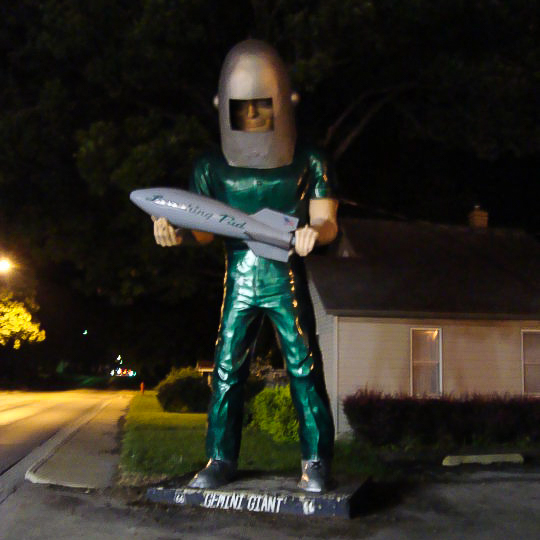
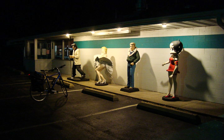
I rode southward out of Joliet on the main corridor, eventually leaving the last stoplight behind and continuing on into a dark, silent prairie, with no idea how far I would get or where I would stay. There was little to see between the towns other than farmhouses silhouetted on the dark horizon, and occasionally the headlights of a passing car. I soon reached Wilmington and was greeted by the Gemini Giant, the first of many classic landmarks on the route.
Four miles after that was Braidwood, another quiet town in the late summer night. Lights outside of a diner remained open, illuminating icons of an older era.
The interstate was just west of the town, where I turned off from the main road to find a shitty hotel for the night. I found one near the exit, checked in, wheeled my bike into the room, and turned on the TV. A huge rainstorm was closing in, according to the forecast. I went back outside to the far end of the parking lot and looked out at the west across the interstate towards the approaching storm. It was all for the best that I didn’t try to ride any further.
I continued south from Braidwood the next morning. For hours I rode on a straight, flat highway, passing an occasional gas station or diner with Rt. 66 memorabilia. A Polish friend of mine went on a roadtrip in this same place a year later, from Chicago all the way to Santa Monica, and posted all kinds of pictures of landmarks along the way. I told her that if she really wanted to experience my country, that a roadtrip on Route 66 is as American as it gets.
The midday sun was hot as I reached the outskirts of Bloomington, tired from the 70 miles I spent chasing vanishing points on a mostly featureless countryside. When I checked for evidence of chafing, I realized why distance cycling in khaki shorts was a bad idea. I wasn’t in any serious trouble yet, but a rash was starting to form from all of the sweat and friction. It got bad enough that I had to pedal the last 5 miles into the city standing up. I knew there was no way I could go another 200 miles with a ravaged taint, and found a bike shop in town to hopefully get help. The guys there had a good laugh, and sold me a pair of padded bike shorts and bottle of Chamois Butter (or what I like to call Ass Lube).
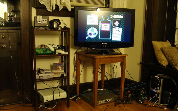
On a better note, my Couchsurfing host in Bloomington had the most kickass array of old Nintendo gear I’ve ever seen.
I left town the next morning, wondering if I would make any more rookie mistakes, like say, taking the wrong road out of the city. After what ended up being a ten mile detour, I found the main road again and continued southwest. It was more of the same, with long stretches of flat, open road, and a town with a stoplight or two every 30 minutes. I reached Springfield halfway through the day and took the main beltway around it. I continued south on a steady pace, losing track of the little towns and their names as I rode on for hours into the afternoon. I must have gone at least 80 miles so far, yet for some reason I had an endurance that I couldn’t explain. I wasn’t getting tired. I just kept going.

I made it to Carlinville around 6pm and found a good Sicilian pizzeria at the town centre. The hot sun was finally starting to disappear behind the buildings. Maybe it was the nice temperature that put me in such a good mood. Or the boost of protein that gave me such a strong second wind. Or maybe it was the realization that even with my mistakes, this multi-day adventure was coming together without any major problems. Whatever it was, I was going harder than ever on the country road amidst the darkening cornfields, even as the day was coming to an end.
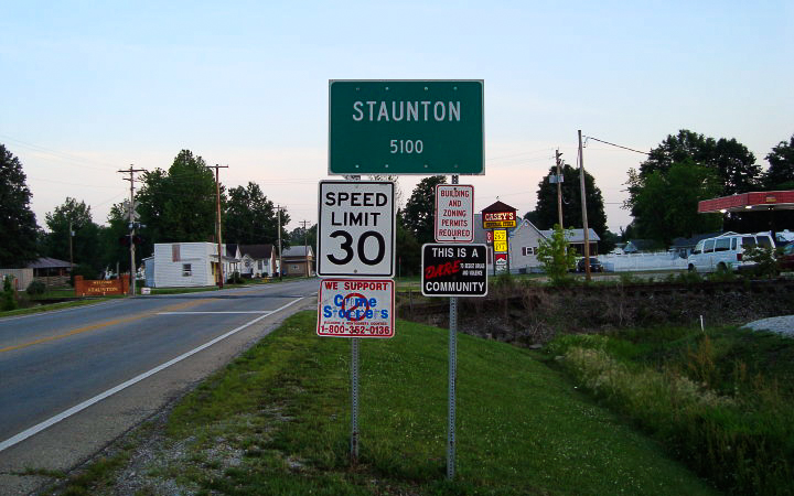
I could have kept going, but I decided to stop in the town of Staunton 20 miles later. St. Louis wasn’t much farther, but I didn’t want to get there at night. I found a hotel on the west edge of town and checked in. From Bloomington to Staunton, I rode 130 miles that day.
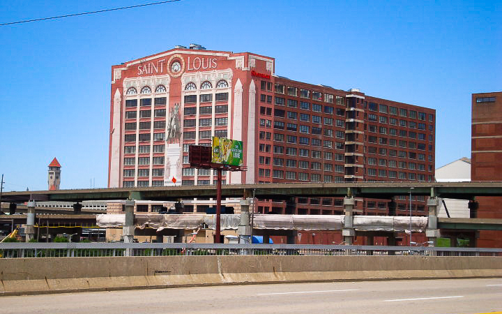
A bike path crosses the main road going south out of town. When I reached it the next morning, I decided I had seen enough of Americana and took it into downtown St. Louis.


Route 66 continued west through the city. I rode on for a final hour before reaching the west suburbs where I planned to stay with a Couchsurfing host for the weekend.
I started using Couchsurfing in 2008 when I moved to Chicago and needed a place to stay while I looked for a job. After settling into a routine, I started hosting people, and actively attended weekly bar meetups with the local Chicago group. Over the years, Couchsurfing became my primary way of meeting people when I traveled to new cities. It turned out that my host for the weekend, Tiffany, was also active in the community, and an organizer for the St. Louis Couchcrash that weekend.
A Couchcrash is like a marathon of events that each city does once a year, usually in the summer. From three days up to a week, local organizers schedule bar meetups, walking tours, picnics, house parties, and whatever else they can do to showcase their local scene to the visitors. Many Couchsurfers from out of town come together for the Couchcrashes and tour the cities in big groups, all people of whom share the same ethos of community and travel experiences. You can find events like this in New York, DC, Chicago, Minneapolis, and many other cities (or at least you could before the Covid-19 pandemic banished all of us to Zoom meetings).
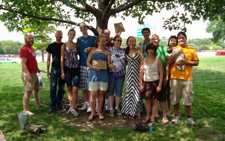
That night, Tiffany drove me to their Friday night event at the City Museum, a huge monstrosity of what I could only describe as a jungle gym for grownups. Inside the big downtown building is a network of tunnels, mega-slides, and caves that span over multiple floors. You can find a massive ball pit outside, if you can handle the pain of children throwing watermelon sized balls at your face. And there are even more slides, a ferris wheel, and bus hanging off of the roof. And to top it all off, they have a bar on the bottom floor. A group of us hung around drinking there before exploring the cavern passageways and eventually going to the rooftop to view the city.
We went to a picnic and city zoo the next day, and then met up for a big bar crawl in downtown that night. It was a fun weekend overall, and wouldn’t be the last time I would crash in St. Louis in such a fashion. Throughout this event and others, I became familiar with the network of Couchsurfers who built an online community of travelers in cities across America and elsewhere.
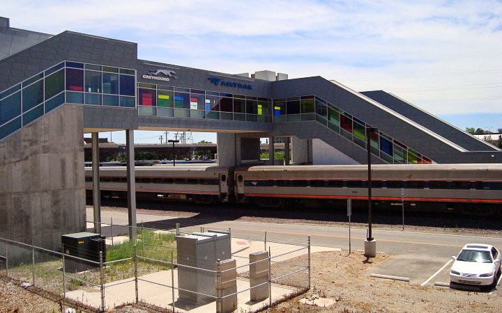
I left Tiffany’s house the next morning and rode to the train station in downtown. I wheeled my bike on the train car for a 5 hour ride back home. I didn’t realize until later that the tire pump in my cargo had the wrong valve… good thing I didn’t get any flats on that trip!
Since then, I continued to take other trips all across Illinois, like the weekend later that year up the Great River Trail on the Mississippi north of the Quad Cities. Or the overnight century in a state park south of Carbondale. Eventually I toured even bigger places out west with a newer bike and better gear. Over time, bicycle touring became just one column among five different things I liked to do. I started to feel like the open road was just one way to go on an adventure. But even more could be explored in the oceans, down the rivers, in the high mountains, and from the sky. Even now, the next adventure is in the forefront of my mind. It never stops.
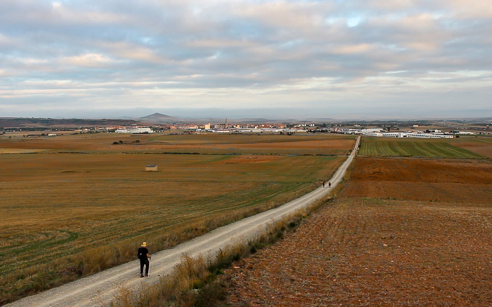
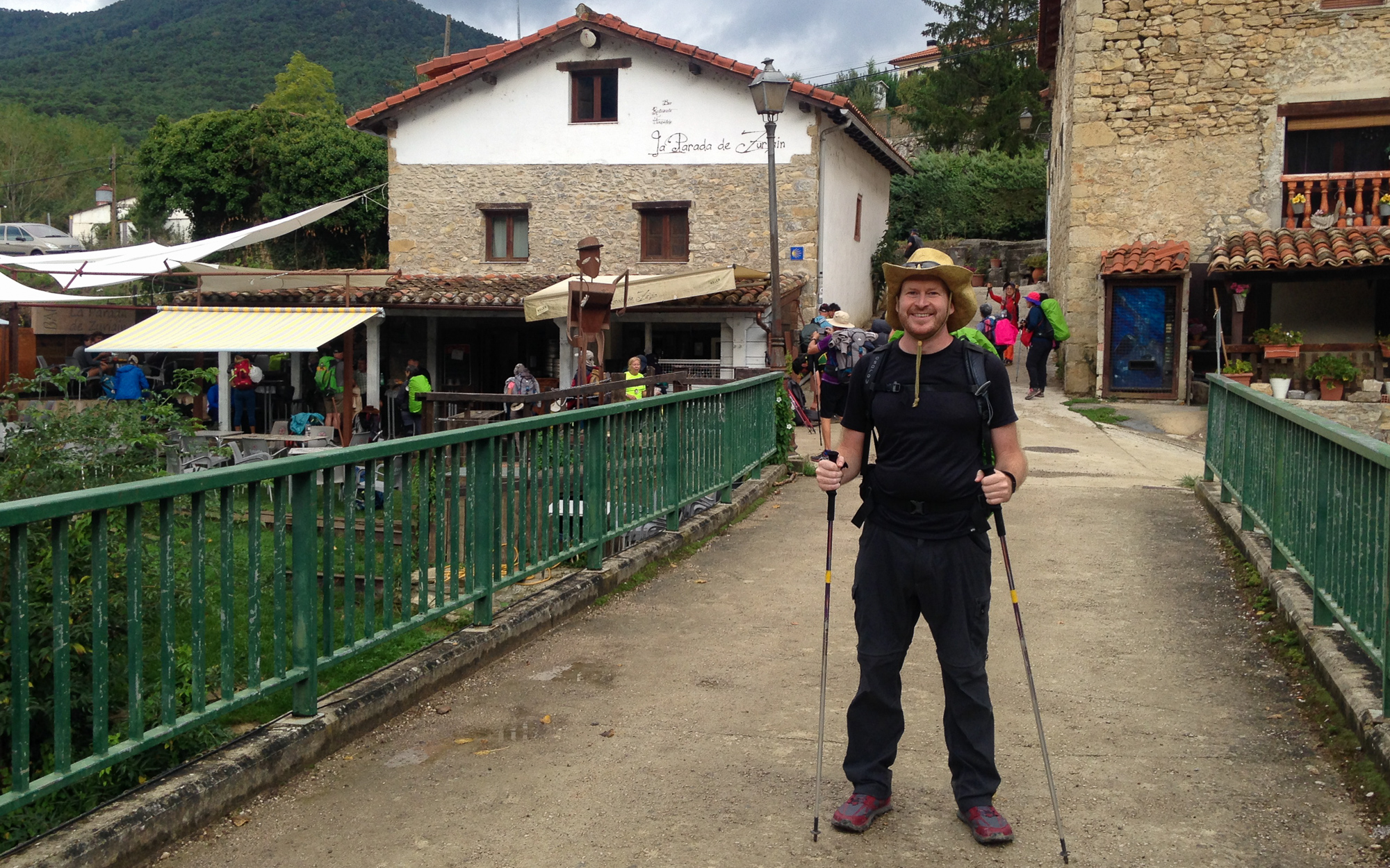
The Camino de Santiago Part 2: Pamplona to Burgos
The Camino de Santiago Part 2: Pamplona to Burgos
…continued from Part 1: The Pyrenees
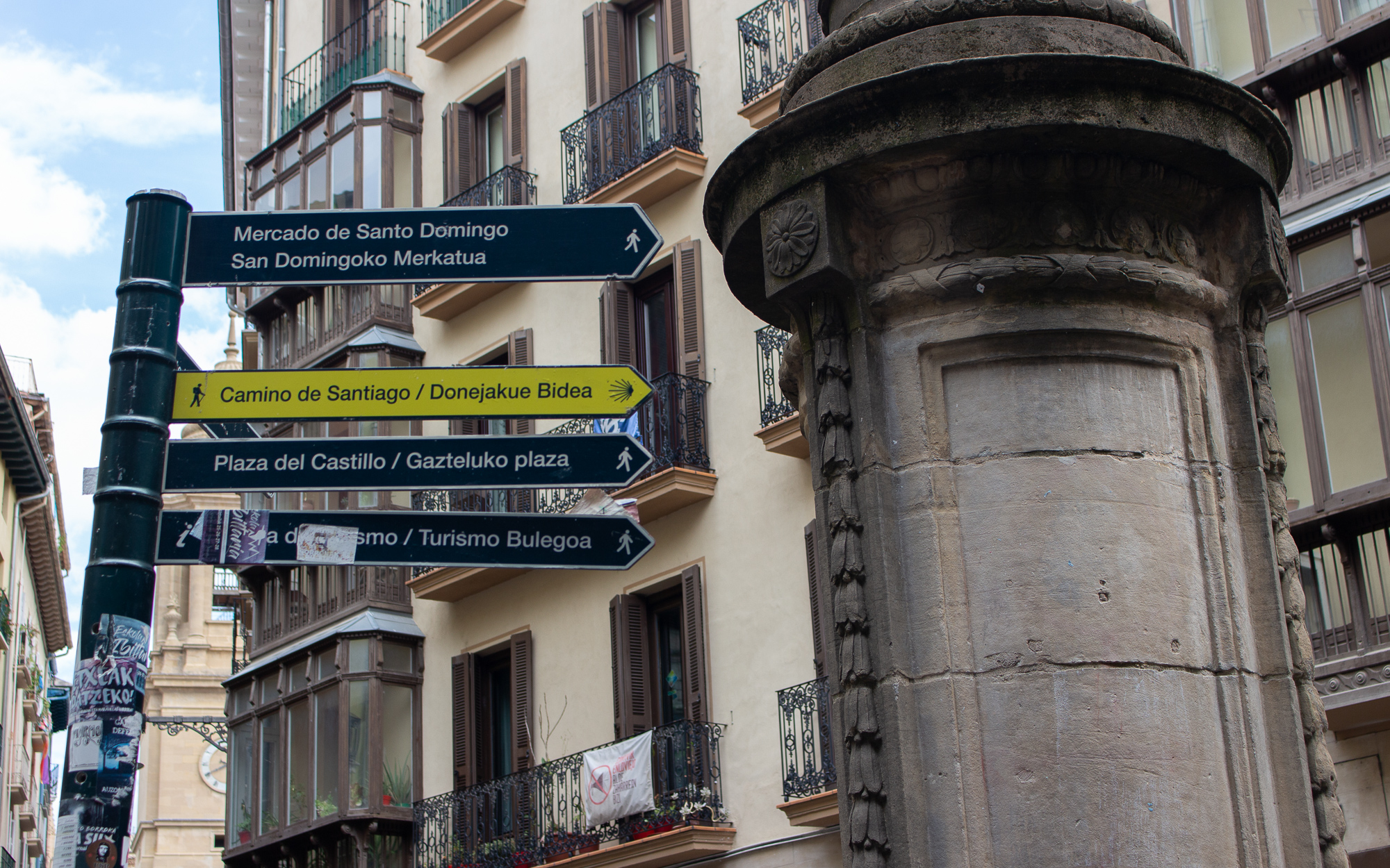
I start west in the morning after a passing rainstorm. The way out of Pamplona is well marked, either by yellow arrows or the famous Camino shell, which can be found on signs throughout the pilgrimage. The story is that pilgrims would reach Santiago de Compostela and receive a scallop shell to wear on their journey home as proof that they reached the end. Over time, it became the official symbol of the Camino, and can commonly be found on trail markers, in churches, at souvenir shops, or on the backpacks of pilgrims. I reach an intersection in western Pamplona expecting to see one. “La señal del Camino es allá,” a lady says, pointing at the seashell emblem engraved on a sidewalk tile, marking the way out of the city.
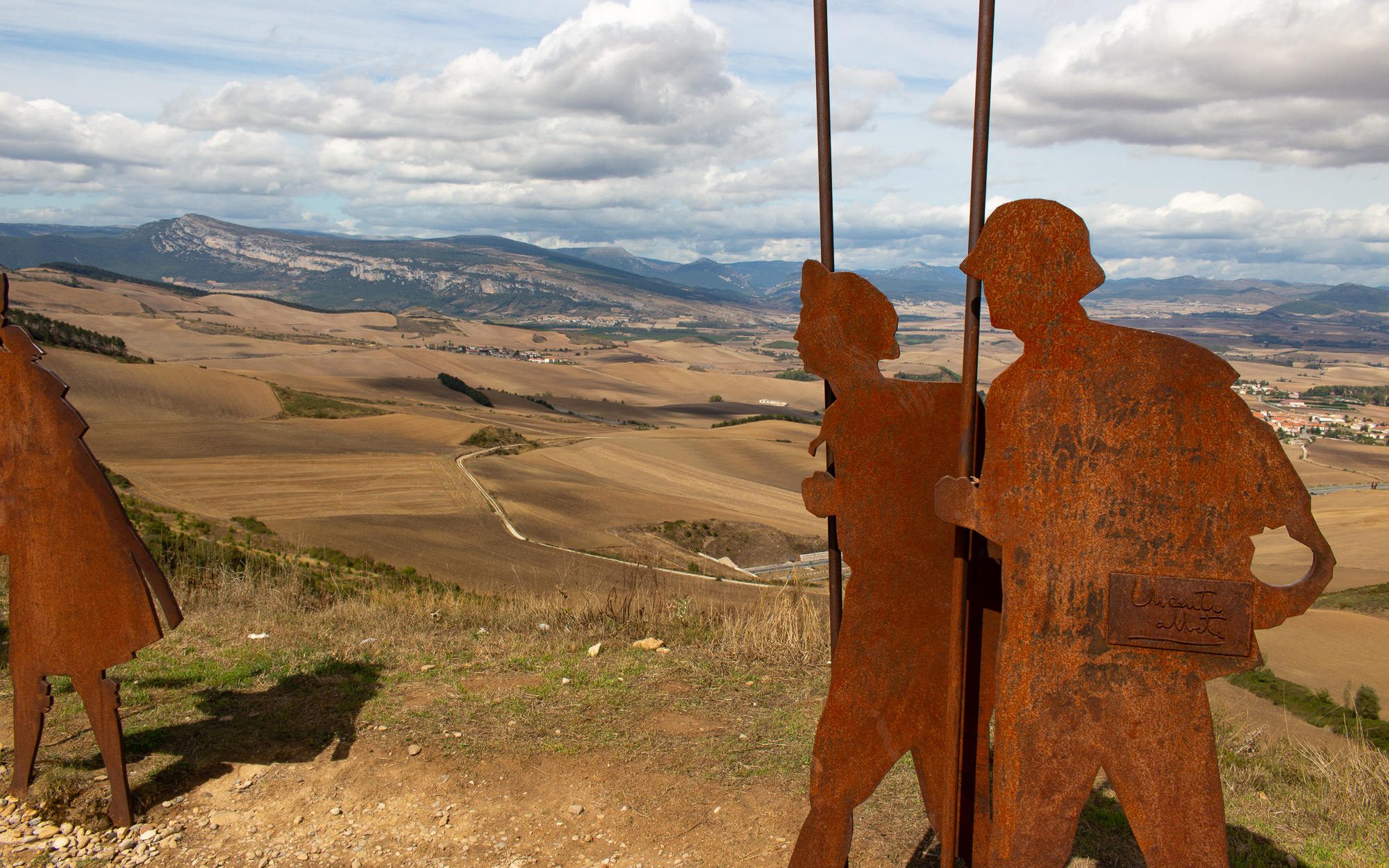
I spend two hours hiking past the outskirts of Pamplona before starting an ascent up a barren ridge lined with windmills. When I reach the summit of Alto de Perdon, I find an incredible panorama marked by famous sculptures of pilgrims. I look back and see the sprawling city in the east. To the north are the jagged mountains of the Basque Country. And in the west is the way of the pilgrim, crossing into a vast plain and beyond. I look out at the western horizon. Santiago and the ocean feel like a lifetime away. But I don’t need to think about it right now. I just need to get down the mountain.
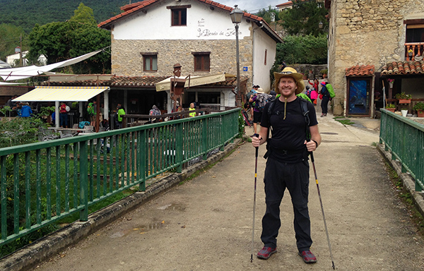
I pass three towns that afternoon, exhausted in the late day. It is at its hottest part of the day from mid to late afternoon, and I realize why most people start at daybreak and finish around 2:00. When I reach Puente la Reina, I hike a painful quarter mile through the town to my hostel. The blinding sun feels like it’s trying to push me backwards. A cute Spanish girl passes and says “Buen Camino!” which is a welcome and encouraging distraction from the hot, blistering afternoon. I finally check into my hostel and look for the first restaurant I can find.
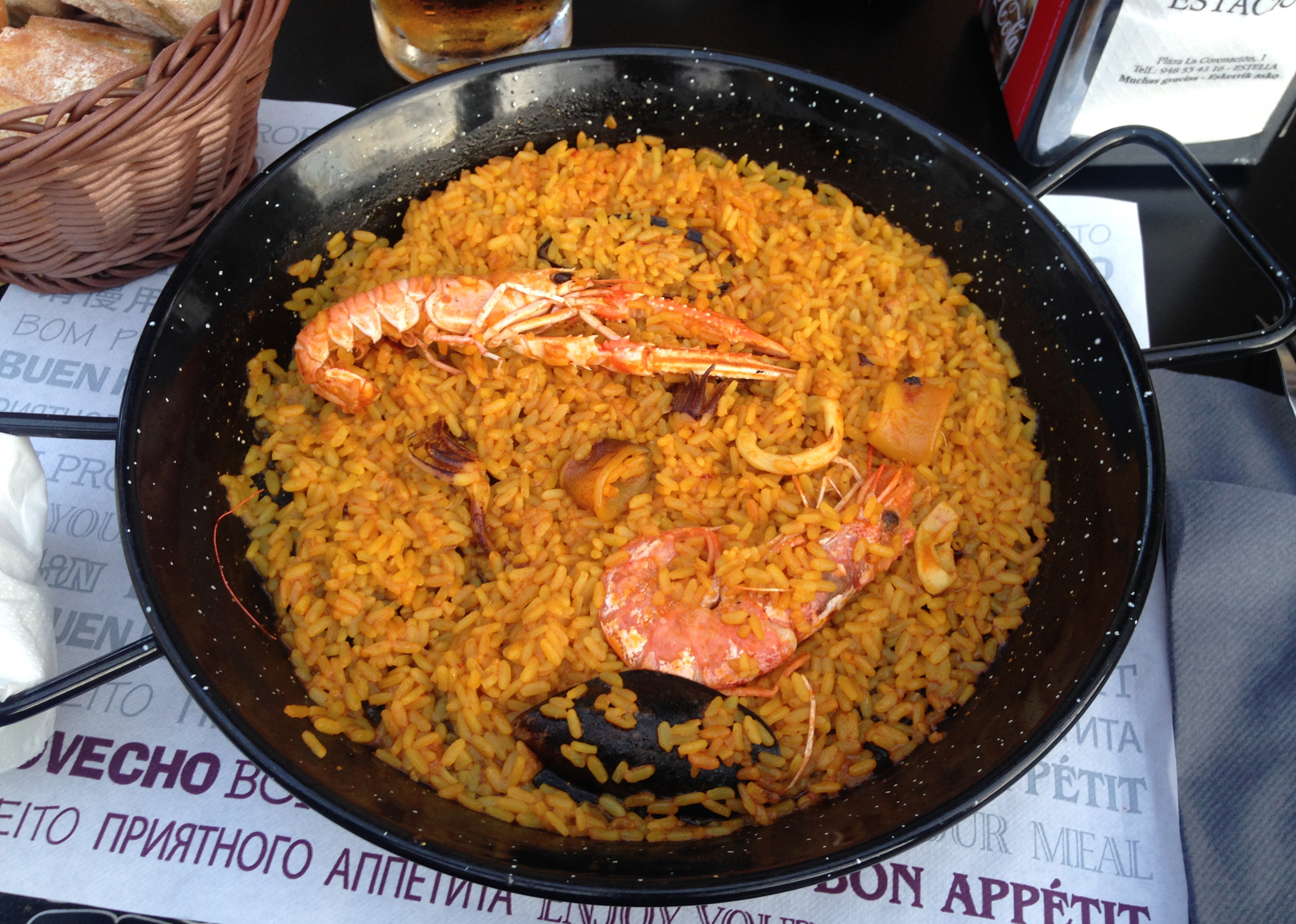
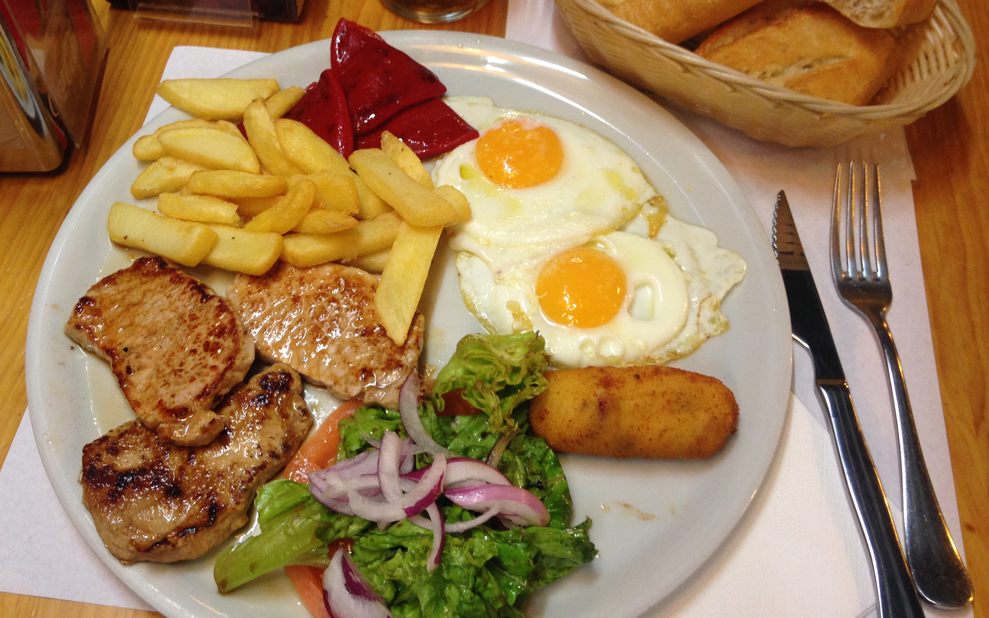
Learning my lesson, I set out the next morning at daybreak. I soon reach the town of Estella, which feels secluded by three different hillsides. After another foot assessment I realize I’ve been hiking out here for a week and have yet to develop a single blister. And if a seasoned backpacker knew this, they would tell me that my foot strategy is working. In other news, this is a picture of me getting unvirgined to paellas:
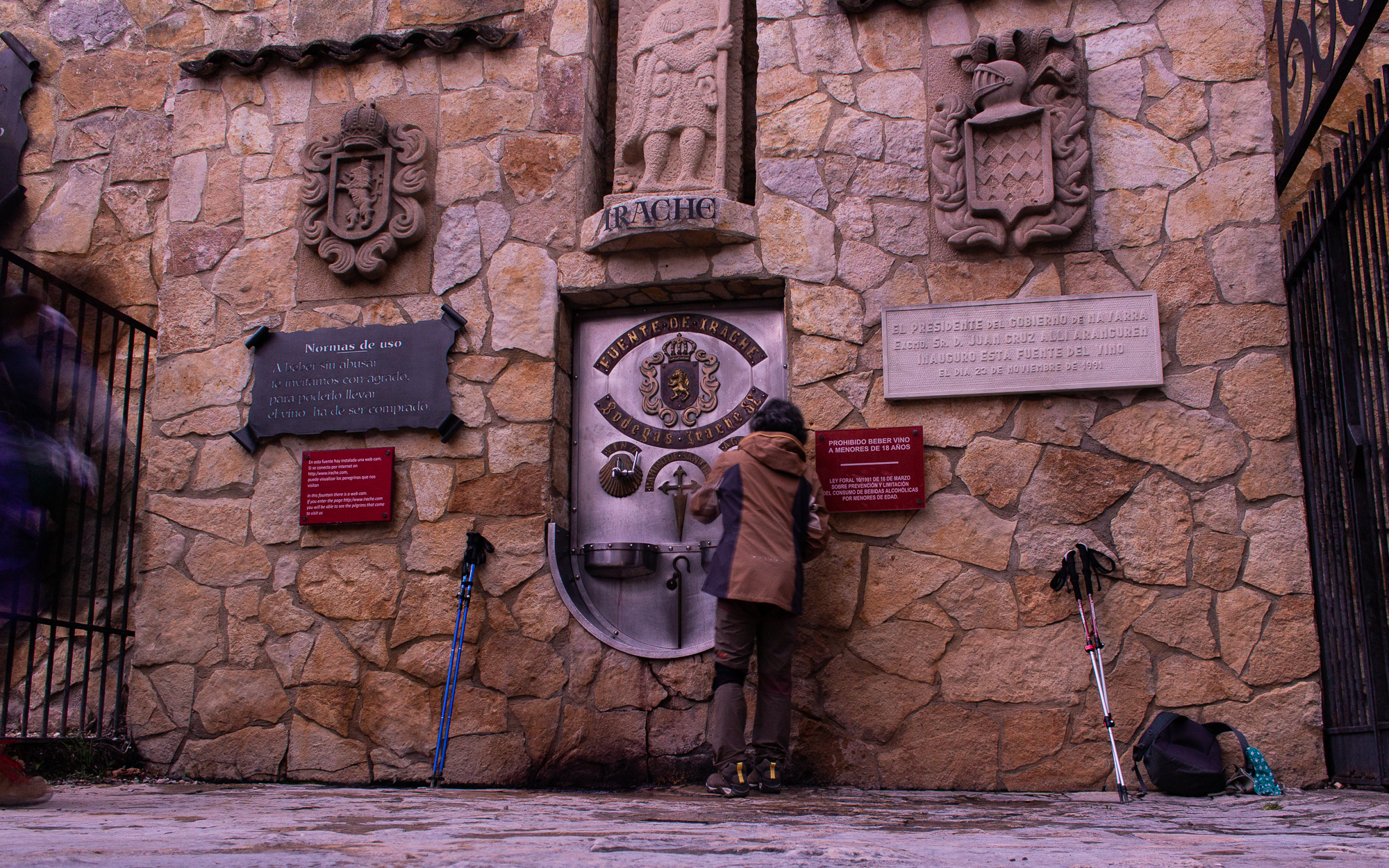
I leave early the next morning, joining a group of Koreans leaving the city. Out of nowhere we reach the Fuente de Vino. I completely forgot about this fucking place. Agua or vino? You decide!
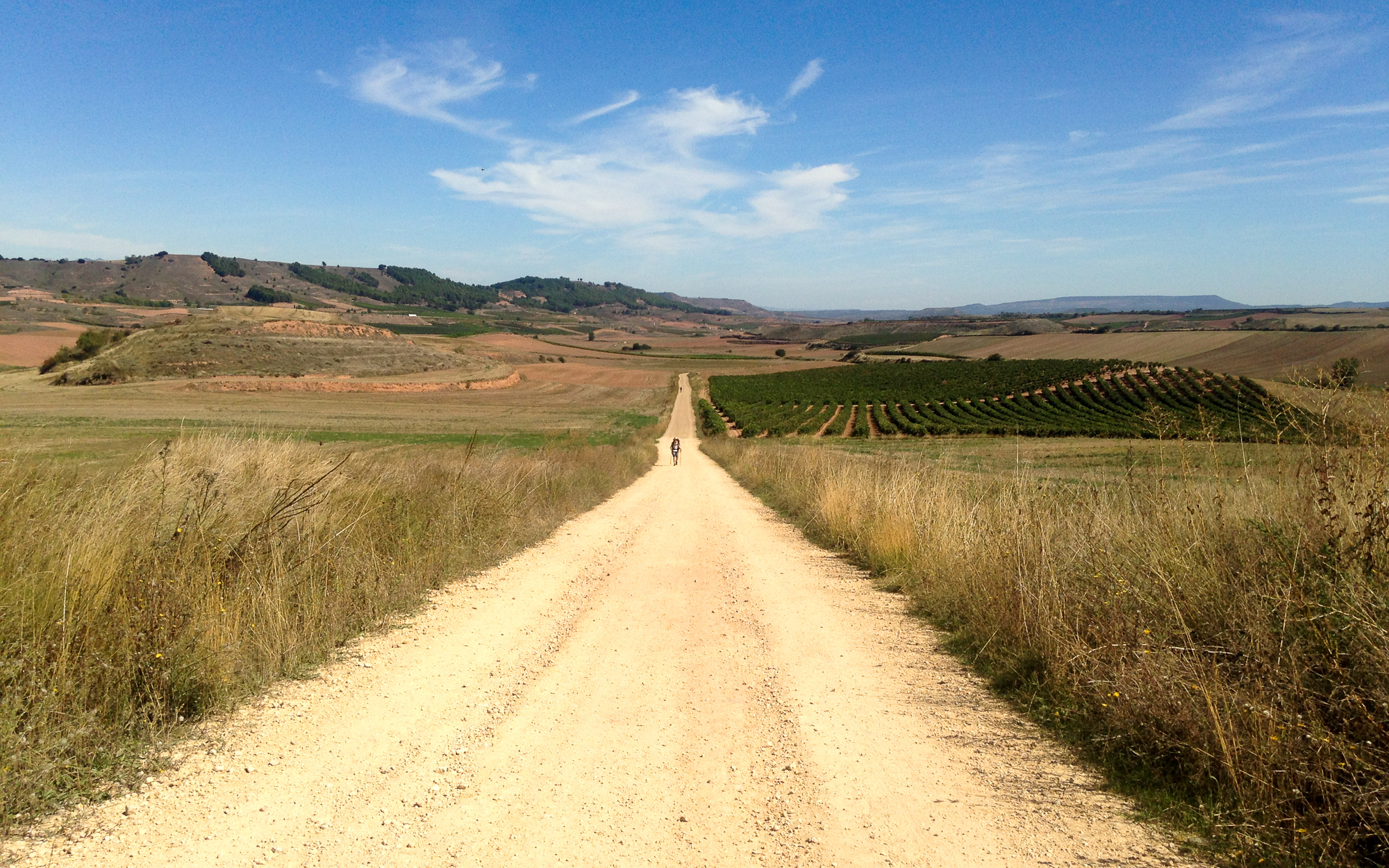
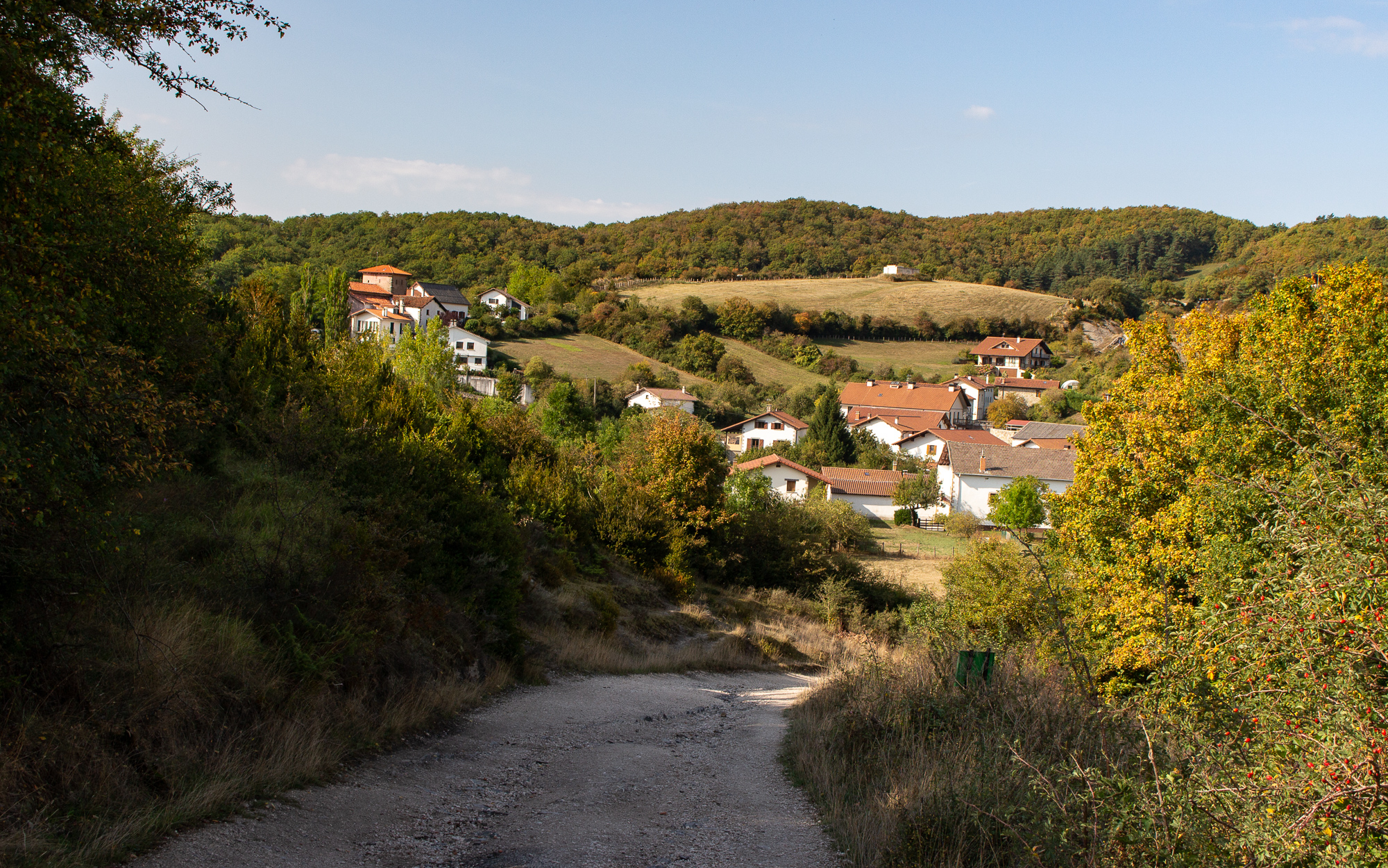
The land going out of the Navarre region is an old landscape, where to the westbound pilgrim the mountains will eventually change into rolling hills, some with hilltop castles in the distance. Much here has moved on, but many old, crumbling buildings remain to this day. Each day I walk through the country, cresting the hills and looking out at the surrounding towns. My Camino begins to feel like a dream – a timeless and stateless and perhaps even endless trek, always with one more seashell or yellow arrow to guide me onward. The kindness of the common folk and the pilgrims, and the transient nature of the Camino itself, are forcing me into the present state of mind without any regard to time or attachment. With each grinding step on the gravel, each hillside town, each dinner at a plaza restaurant with new friends, and each sunrise from a new day, this road becomes my own Camino – mine among other wanderers, each with their own story.
I meet Leah and Greg, a couple from Cleveland just outside of Logroño after an especially hard day. They invite me to watch a bull fight that evening. I tell them thanks, but the idea of slaughtering an animal in front of a cheering crowd doesn’t seem very appealing. Instead, I walk around the centre during a big city wide festival. I run into the Brazilian peregrinas, Maria and her mom, and we find a good pinchos restaurant a couple blocks from the main plaza. It’s basically a butcher shop where they grill all kinds of meats on demand. The thick bacon was especially good.

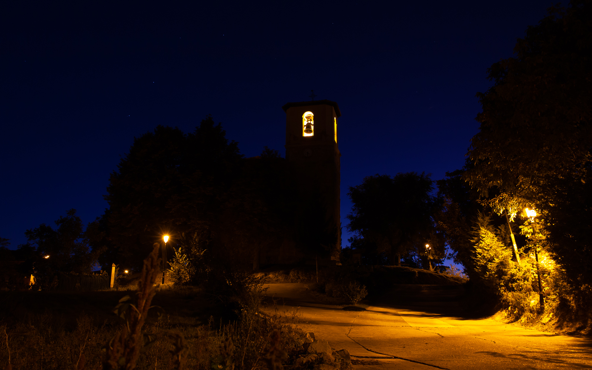
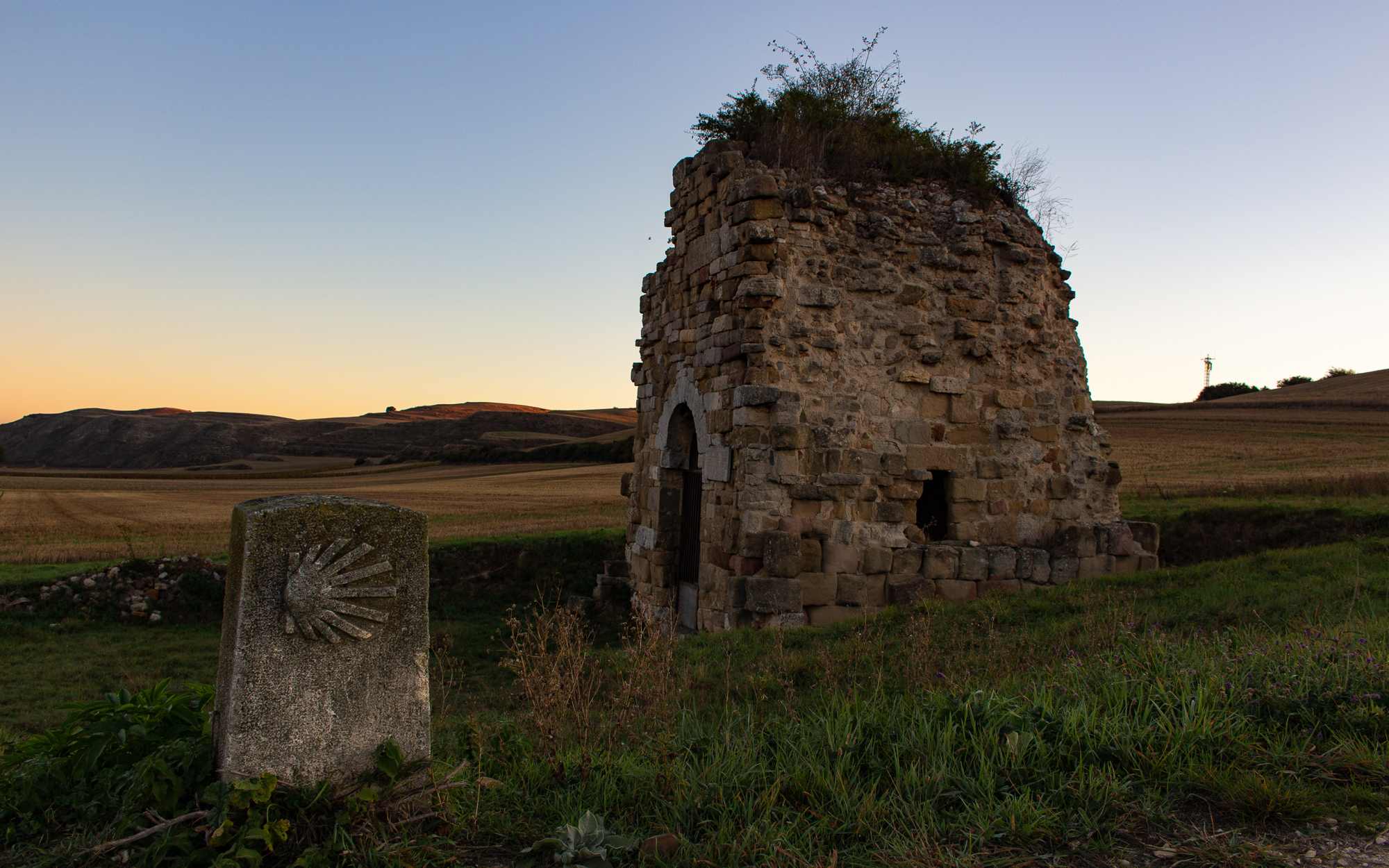
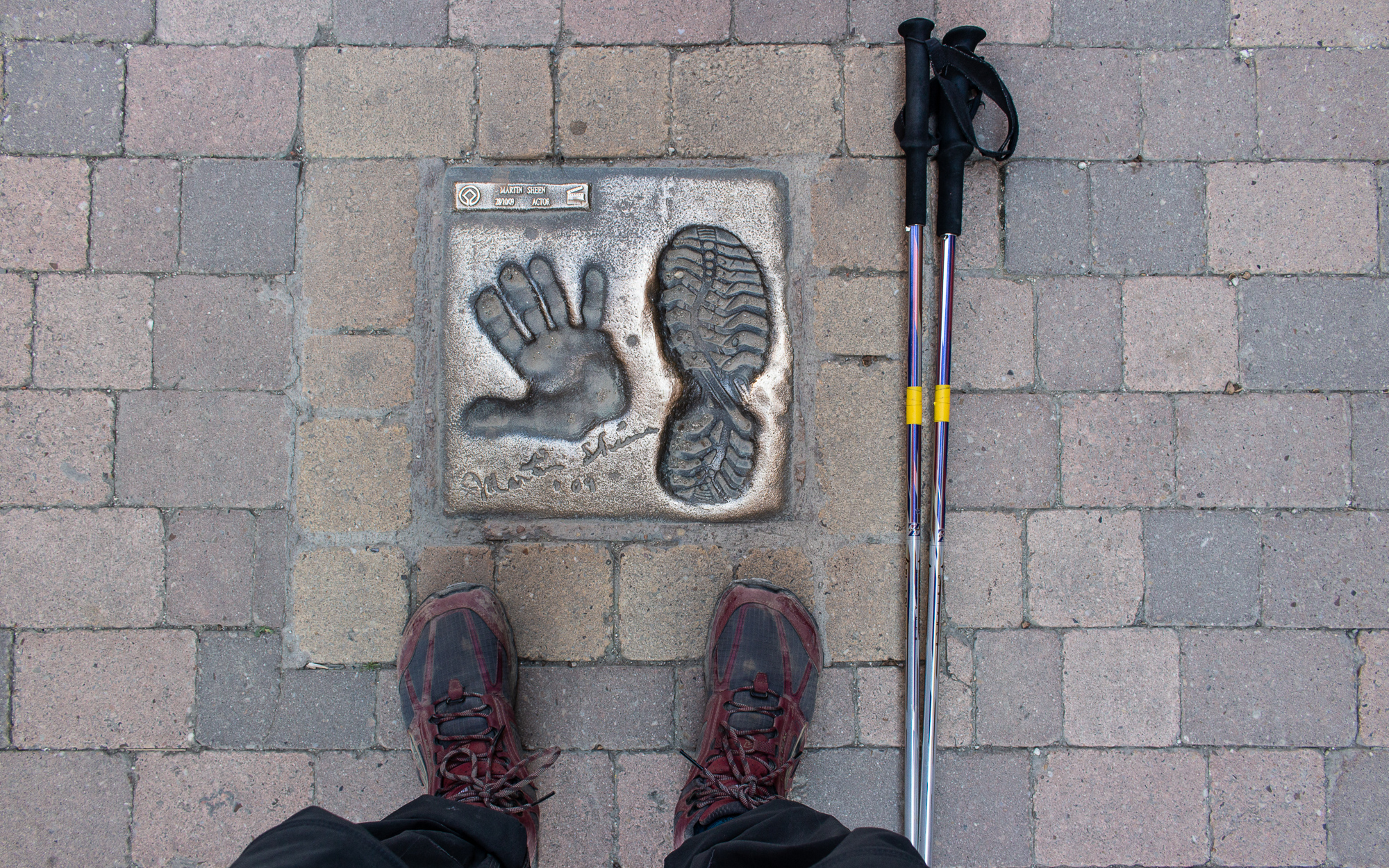
I leave Logroño the next morning on a well maintained bike trail out of the city. Villages come and go in a blur, many with their own unique story, like the lovely Torres del Rio, which translates to Towers of the River. In Belorado, I hike the main street until I reach this landmark left behind by Martin Sheen ten years ago when he filmed The Way.
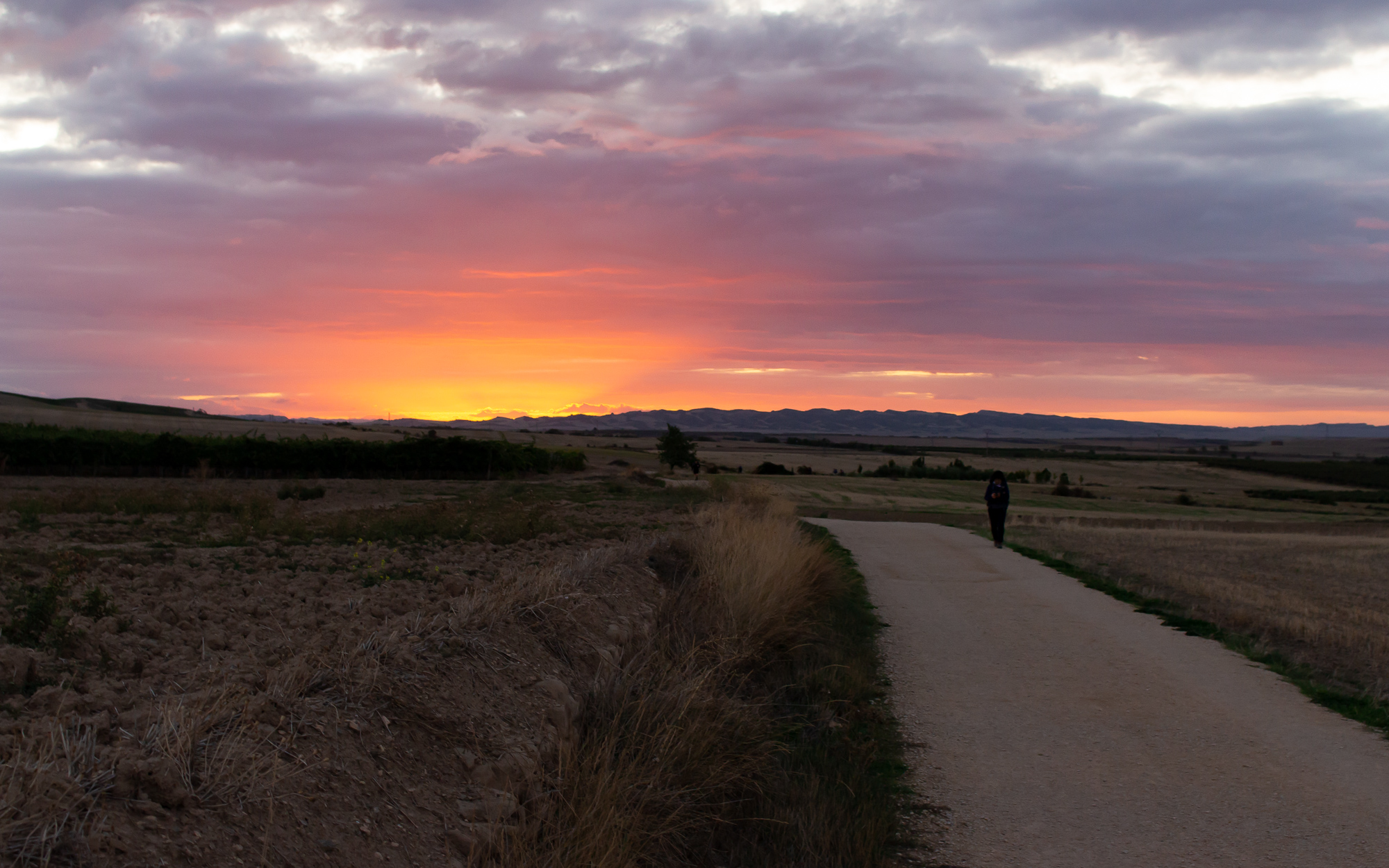
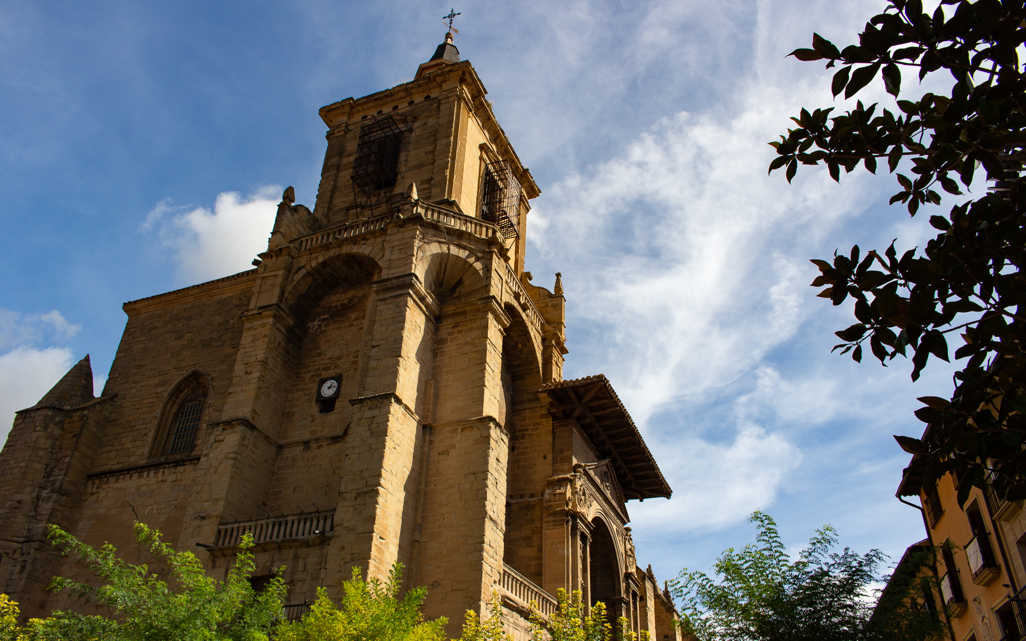
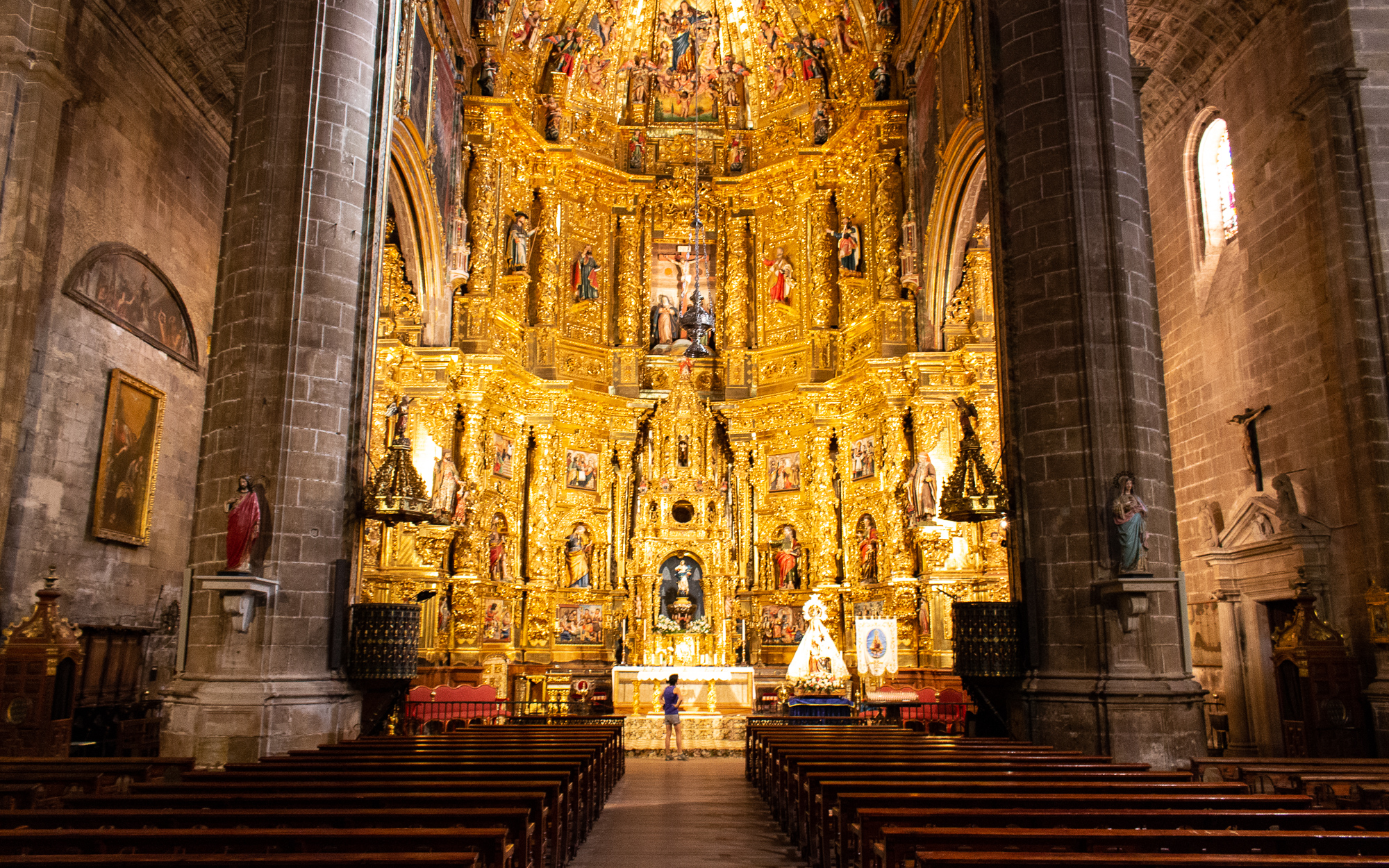
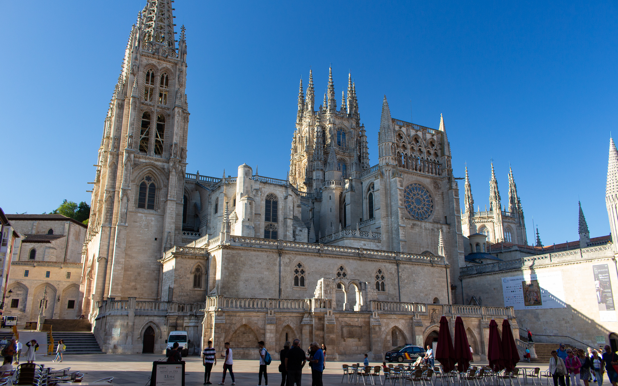
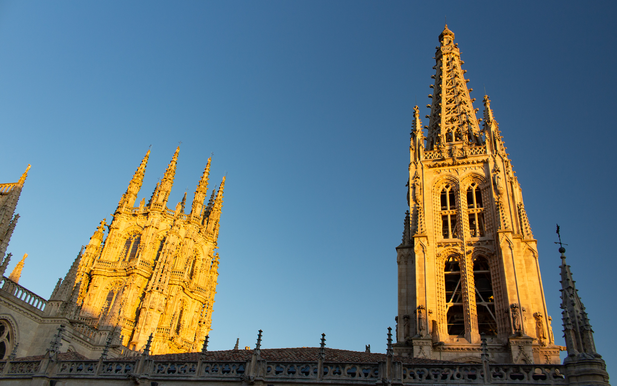
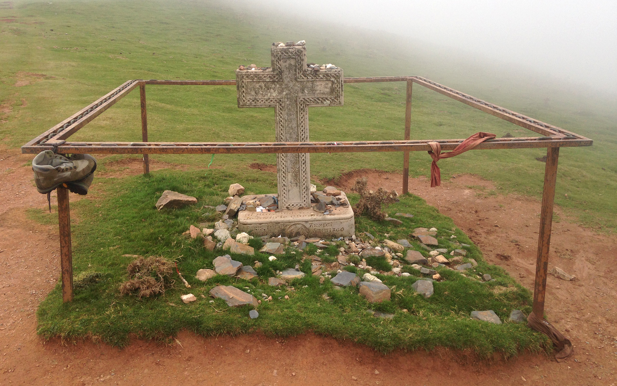
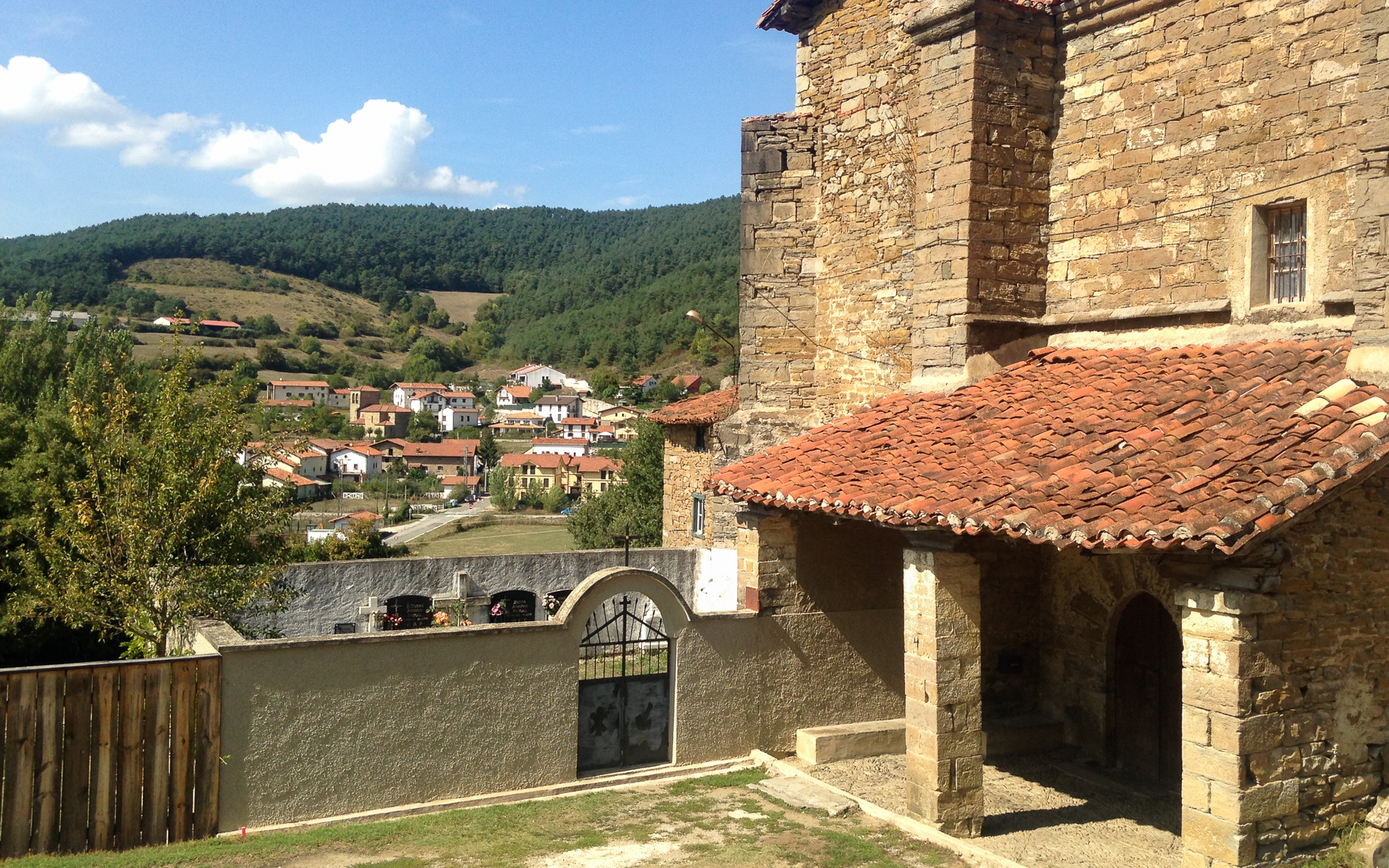
Then there was the cathedral on a hilltop above Santovenia, where I come out to see the sunrise for the simple reason that the sunset the night before was just as amazing. It is the thirteenth and last day of this stage. I clear one final ridge that day and see the city of Burgos sprawling across the valley ahead. After three more shitty hours hiking past the airport and along the main highway into the city, I finally reach the magnificent Burgos Cathedral, marking the end of my second stage of the Camino.
I was paranoid for the longest time that this trip would get derailed by blisters or something worse. But after checking my feet in Burgos, I note that I didn’t get a single blister the entire time. No problems with soreness or swelling either. My feet are at 100%.
It’s the shoes. I used the hiking shoe model of the Altra Lone Peaks, namely for the soft cushioned insoles and outer traction that work so well on hard, flat surfaces. For many backpackers, it comes down to a lot of trial and error before they find out for themselves what the best footwear strategy is for long-term hiking. When they figure it out, it is often just a short list of things that work uniquely for them. For me, it was Altra shoes, Injinji toe socks, a thin merino wool outer layer, minimal Vaseline on my toes, and a gel toe cap to cover a chronic callus on my fourth right toe. The bastard toe. The one I’ve had since I was a teenager and could never for the life of me get rid of. Usually it is the first thing on my feet to give me trouble when I go hiking. But even that turned out okay.
Unfortunately, I can’t hike any further at this time. I don’t have enough vacation hours left for the remaining four weeks of the trek, and I will have to save them up and continue in the future. But this stage was never really about completing the Camino, it was about answering the question that drove me crazy for years: Can I really do this? Now I realize that not only can I hike this trail, but I can kick ass at it.
I leave on a bus for Madrid the next day. I think about how the last two weeks went by in a flash, and I’m not yet sure how I feel about it. As the bus departs from the city, I think back to the evening I spent at a small aubergue in Viloria three nights ago.
The host family made a pilgrim dinner for me and two other hikers. There was Ivan, a loud, opinionated fellow who started his Camino from his home in Belgium. And Catherine, a recently retired woman from North Carolina who just started her Camino for the first time. And then there was me, the guy from Chicago with all of the drive in the world and no understanding of why.
The wife, an abuela originally from Italy, told us that she had lived in the town for twenty years, and watched the Camino change a lot as it became a popular trail all over the world. And while others like Ivan and I weren’t as interested in how commercialized it was getting, she didn’t seem to mind. Because to her, the Camino is for everyone. And each person can find their own path, no matter what was or wasn’t.
I was almost about to leave the next morning when she came over to wish me farewell. She told me that I must walk the path for myself, and I must find my own Camino. I don’t remember exactly how she said it, but I do remember the kindness of the person behind it. And to be completely honest, I still don’t know what I was doing out there, or why that trail matters to me so much. I went through a lot of fucking trouble to get there, but the reasons for it are not something I can put into words. And while I may not know yet what it means to “Find my Camino”, with each new day maybe I can.
The bus continues south through the Spanish countryside. I’m an hour outside of Madrid, where I look forward to a few days of rest and good food. I look out at the passing hills as we approach the city, thinking back to an old road that goes across Spain, where many unforgettable stories have only just begun. And whether I’m hiking across the formidable Pyrenees Mountains, sharing tapas and wine with pilgrims in the bustling city centres, crossing an endless Meseta among the kindred spirits on the trail, casting a lifetime of burdens at the foot of Cruz de Ferro, or watching a golden sunset on the shores of Cape Finisterre, there is no question to me that there is something wonderful and cathartic about the Camino de Santiago.
This isn’t over.
This story continues on the Meseta.
The Camino de Santiago Part 1: The Pyrenees
“If I take one more step, it will be the farthest away from home I’ve ever been.” -Samwise Gamgee
There is an old road in Spain where you can feel its ancient history with each step. Where you can pass countless vineyards, farmlands, villages, and kind hearted Spaniards. Where you can walk in the company of pilgrims for hundreds of miles – and on the footsteps of many more over a time spanning over a thousand years. Where the kindness of a pilgrim’s spirit is known among the people who walk it. Where your path can become an inward journey as much as an outward adventure. Where with each step, your own tale becomes another part of the trail’s rich history.
There is an old road in Spain called the Camino de Santiago. And I was trying to reach it.

I had first heard about it several years ago from adventure bloggers who had posted about their own journeys online. And to be honest, it didn’t get my attention at first. But as I learned about it, it became more and more apparent that this wasn’t any ordinary adventure. And though I didn’t understand why I felt drawn to the old Spanish roads (and I still don’t even to this day), I could not deny my own incredible feeling of curiosity about them – right up to the point that I first made the nervous decision to book a flight to Europe and hike the Camino in the spring of 2019.
The problem was, I had no idea how. I had been on plenty of smaller hikes, but never anything of this scale. This was a 540 mile trek across an entire country. And it is not forgiving to the underprepared – something that really set in when I read this from a Camino message board, posted by a first aid medic on the trail who encountered a Swedish hiker in trouble:
Her problem was that she had put a Compeed onto a heel blister. The blister had grown over the days of walking until it burst and forced an edge of the Compeed open. Dirt got in and it became infected – what did she do? Just kept walking. When we saw her she had blood poisoning, her ankle had already started to swell. Had we not found her she may have died of that blood poisoning somewhere, going to bed with “just a little fever” and waking up dead. The doctor cleaned it all up, gave her horse-pill sized antibiotics and told her that her Camino was over, she had to go home.
This hit me in the face like a bucket of cold water. I went on, reading thread after thread, about the foot problems that so many hikers were having. And how many different things they tried to prevent and minimize their suffering. My ex is an active backpacker of many years who told me that she always gets blisters no matter what she does. While she seemed to have the experience and willpower to push through it, I didn’t yet know how this would play out for me.
The first thing I did was look for a good pair of trail runners at REI. I immediately liked the Altra Lone Peak runners for their mega-soft cushion and good traction. Then I started to field test them with every suggested maintenance strategy I could find. Thin socks, double lined socks, vaseline, antiperspirant, runner tape, moleskin, and any variation on the local city trails in Chicago almost every weekend. All with a loaded pack at 20lbs. My feet were generally okay, even with hotspots that I learned to quickly cover with Rocktape.
I thought I was cruising. But something started to happen two weekends away from my trip. The backs of both shoes had broken in and started digging into my achilles. Which I knew for sure would cause a huge problem if I tried to hike with them for hours every day. I tried everything. I padded the shoes, put moleskin layers on my feet, doubled the socks. But nothing worked. And I knew I couldn’t rely on normal shoes for this either. Casual walking is one thing, but you figure out that hiking day after day with a pack is a completely different matter. Out of desperation I even cut the seams on the backs of them to relieve the pressure. That didn’t help either. It eventually got to be the night before my planned 540 mile trek. What the fuck am I going to use?
I came back to REI in one last desperate attempt to find something. I tried almost every runner and sandal they had, but nothing seemed to fit. The problem was that my left foot was starting to widen for some unknown reason, and made anything with arch support too uncomfortable. The simple fact is, if it’s not comfortable when you buy it, it definitely won’t be when you use it. I must have tried more than 15 different pairs. I left with nothing.
In a last ditch effort, I tried to glue moleskin padding on the backs of my already ravaged trail runners. But I made the mistake of using superglue. When it dried, the glue hardened through the padding, causing it to rub against my feet. It was shot. Unwearable, worthless, destroyed. I threw the fucking shoe across my apartment, and gave up the idea of figuring this problem out.
I flew to Paris the next day as planned, but had to reschedule the rest of my trip. I remember hiding in my hostel room for three days in Paris of all places, just to process all of the stress and figure out the next step. When I came back home three weeks later, I rescheduled my Camino for the end of the summer, giving me a few more months to reset and figure out a system.
I spent several weekends trying out minimal barefoot shoes, which seemed to work with my widening foot. Eventually, I realized that even with padding, they were too hard on my feet and I still needed something with more bottom protection. I finally found it when I revisited the Altra brand to see what else they had. The Lone Peak runners didn’t quite do it, but a different model perhaps? I knew it when I saw it: the Lone Peaks had a boot model. It was essentially the same shoe, but with higher ankle support – something that should mitigate the achilles problems I was having with the other ones. It’s what I’ve been looking for and bitching about for months. It’s what my feet wanted and I knew it.
So the shoe problem was solved. But now there was something else. My widening left foot was happening because of a lump that was growing on the upper inner arch for about a year. I didn’t know what it was, so I did what any normal person would do and probably shouldn’t: I looked for answers on Google. And while it was reassuring to read that most foot lesions are benign, the vast array of awful things that Google said it might be ended up freaking me out. I needed to get it diagnosed.
I went to an orthopedist a month out from my trip. After ruling out any bone related problems from an X-ray, he told me that I needed an MRI to properly diagnose the tissue mass. When I scheduled it, the earliest available MRI was on Monday, four days before my flight to Europe. I was cutting it close.
I spent three weeks waiting for the scan, paranoid, trying not to think about a worst case scenario (like a sarcoma, for example), trying to keep busy with work, and for fucks sake, trying to avoid Googling my symptoms. Then at the end of the Friday before the MRI, one week before my flight to Europe, I received an email that my scan was cancelled.
What??? Stunned and confused, I called the radiology center. The guy didn’t know why, but he told me that the next available date was on the 18th. Nine days after I was supposed to leave. I tried to stay as calm as possible with him, and bitterly rescheduled the scan to the 18th. Then I hung up the phone.
WHAT THE FUCK!!!! YOU FUCKING PIECE OF SHIT!!!! DO I HAVE CANCER OR NOT????
The reason it was cancelled was because MRIs are expensive, and the radiology center didn’t get coverage authorization from my insurance in time. So I had to delay the scan to allow more time for them to process the authorization. At one point I even tried unsuccessfully to reschedule the MRI sooner and pay it out of pocket. Welcome to America.
The scan was authorized and rescheduled, as was the doctor’s followup appointment to the following Monday. The same day that I had rebooked my flight to Europe to hike at least part of the Camino. I really was working this down to the wire.
On that day, my life would go one of two ways. The doctor would give me the scan results, I would either be well enough to leave on my plane to Europe, or I would have to stay in Chicago for more testing. And with that possibility, my life without a doubt would go in a completely different direction.
The only thing I had to go by as I waited was that malignant problems in the feet are extremely rare, as I already said. But I couldn’t get out of my mind the people in my life who have fought these battles. Some were taken seemingly out of nowhere, while others are living out normal lives in remission. And one fabulous woman I’m friends with is fighting and winning against her own stage 2. It really does come for all of us. But I was reminded as I waited how my life is becoming more and more precious with each passing day.
The first good report during the entire ordeal came in that Saturday. I received the findings summary of my MRI from the reviewing physician. Other than noting an insignificant cyst in my big toe joint and some mild bone degeneration, he noted that “no soft tissue lesion was identified” in the area in question. It was medical speak for what I assumed to mean that not only was it benign, but there was no evidence of a tumor in that area at all. While I still needed my ortho doctor to confirm it on Monday, it was already a huge relief.
That Monday, the doctor confirmed the same thing and told me it was a mass of overgrown muscle tissue, likely because of some kind of injury. As long as I wore flat shoes, I should be able to manage it. Then he and the resident assistants left. The appointment didn’t even last five minutes.
I went outside and called my parents to give them the news. And then I stood there on the street, unsure how to even take the next step. This situation had burdened me for months, to the point where I hardly thought anything about hiking trails and epic Spanish adventures. But no more. Now here I was, standing on the verge of the next chapter with literally nothing holding me back.
It was time to let the arrow fly.
The Camino de Santiago Part 1: The Pyrenees
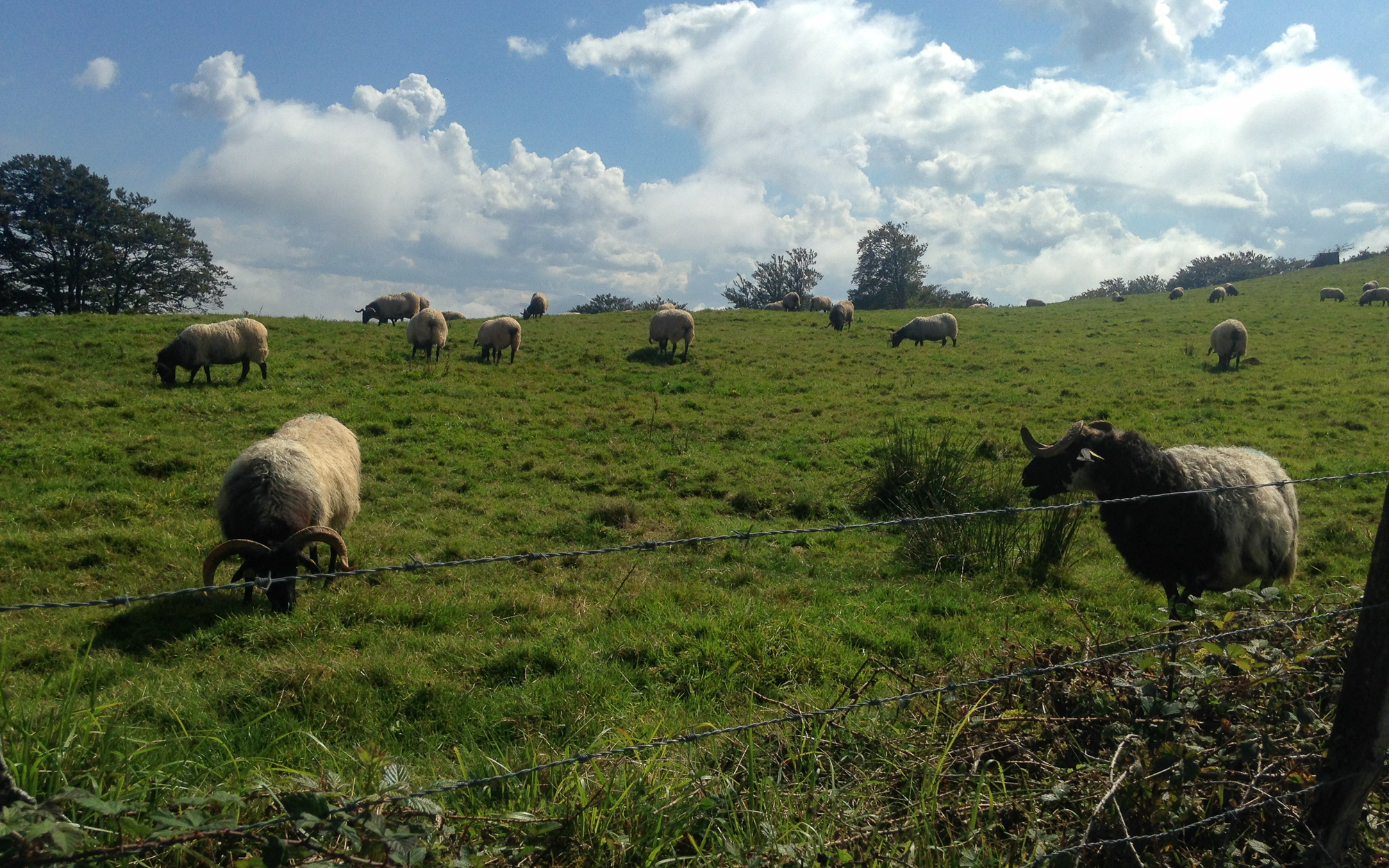
I hike up the steeply winding mountain road along the north foothills of the Pyrenees Mountains. St. Jean and two other towns are visible from the ridgeside among the haze and rolling hills. I’ve been hiking with Dianne, a lady from California, for an hour. We look back at the countryside behind us. She is also walking her Camino for the first time. Reaching the small refuge of Ithurburia we run into six other pilgrims having a picnic. I refill my water and take my shoes off. “You got blisters already?” I hear a man say. “Not if I can help it,” I say back, inspecting my toes for any signs of trouble and applying Vaseline. We hike on, reaching a series of switchbacks and steep uphill grade, which eventually will leave the tree line, only to change into alpine pastures and huge herds of roaming sheep.
I’m hiking the first and most difficult day of the Camino de Santiago from St. Jean-Pied-de-Port France, across a mountain pass of the Pyrenees to the Spanish town of Roncesvalles. It consists of a brutal twelve mile uphill climb and steep downhill for two miles to the valley floor on the other side. It is considered by pilgrims to be the hardest stage of the entire trek.
Clouds are shrouded on the ridgetops, but open up enough at times for the hot sun to burn on my arms. I’m out of breath and sweating as I follow a seemingly endless ascent to the spine of the range. I take a break at an overlook and air out my feet again. “I keep seeing you tending to your feet,” I hear Dianne say when she catches up. I do think I’m becoming the Foot Guy out here. I’m not yet sure just what my feet will be like on this trip. But I know that if there are any problems with my foot strategy, now is the time to handle it.
We hike on together in a group for another hour in the company of cows and grazing sheep. Soon we reach the refuge of Orrisson, an albergue halfway up the climb where many pilgrims choose to rest for the day. I consider it, but feel well enough to keep going. The truth is that I have no idea yet what I’m doing out here, how far I can get, how long I can go each day, and if my feet can handle the abuse of continuously walking across an entire country. What I do know is that I’m not going to finish the entire 540 miles of the Camino this time. I have given myself two weeks to get as far as I can, and as slowly as I have to. Then I will take whatever I learned from this trip and make it to the end next year.
Clouds have completely covered the high trail in mist. I continue on, feeling the weight of my jetlag as I push myself forward, exhausted. Chiming bells echo through the hollows. Farmers put them on one in every fifty of their sheep, and each bell has its own sound. When they wonder together, it makes a song. And when I hear that song, I want more than anything to lay down in the soft grass and sleep among the sheep and mountain fog. But I know that I need to find a hostel sooner than later. That, and I don’t want to wake up on a stone table with bound hands and feet, surrounded by 200 cave goblins. So I keep going.
I clear the summit at last and hike one final ridgeline to the downhill trail. The clouds break up and I see sunlight on the forested ridge on the far side of the valley. But no sign of the valley floor or the town. I have to hike steeply downhill for two more hours to get there. I have already overworked my legs by now, and with each step, my quad muscles are having spasms as I descend miserably on the rocky trail.
I finally reach the town at 5pm. It is the busy season on the Camino and all of the albergues in Roncesvalles are full. And in the town after it. So the monastery shuttles us to a campground hostel 3 miles ahead in the town of Urrobi. I check in, amazed that I made it this far in good health, and best of all, with no blisters.
Twenty of us sit together for a pilgrim dinner, drinking wine and celebrating the end of the first and most difficult day of our journey. “Buen Camino!” we all say together as we cheer our wine glasses.
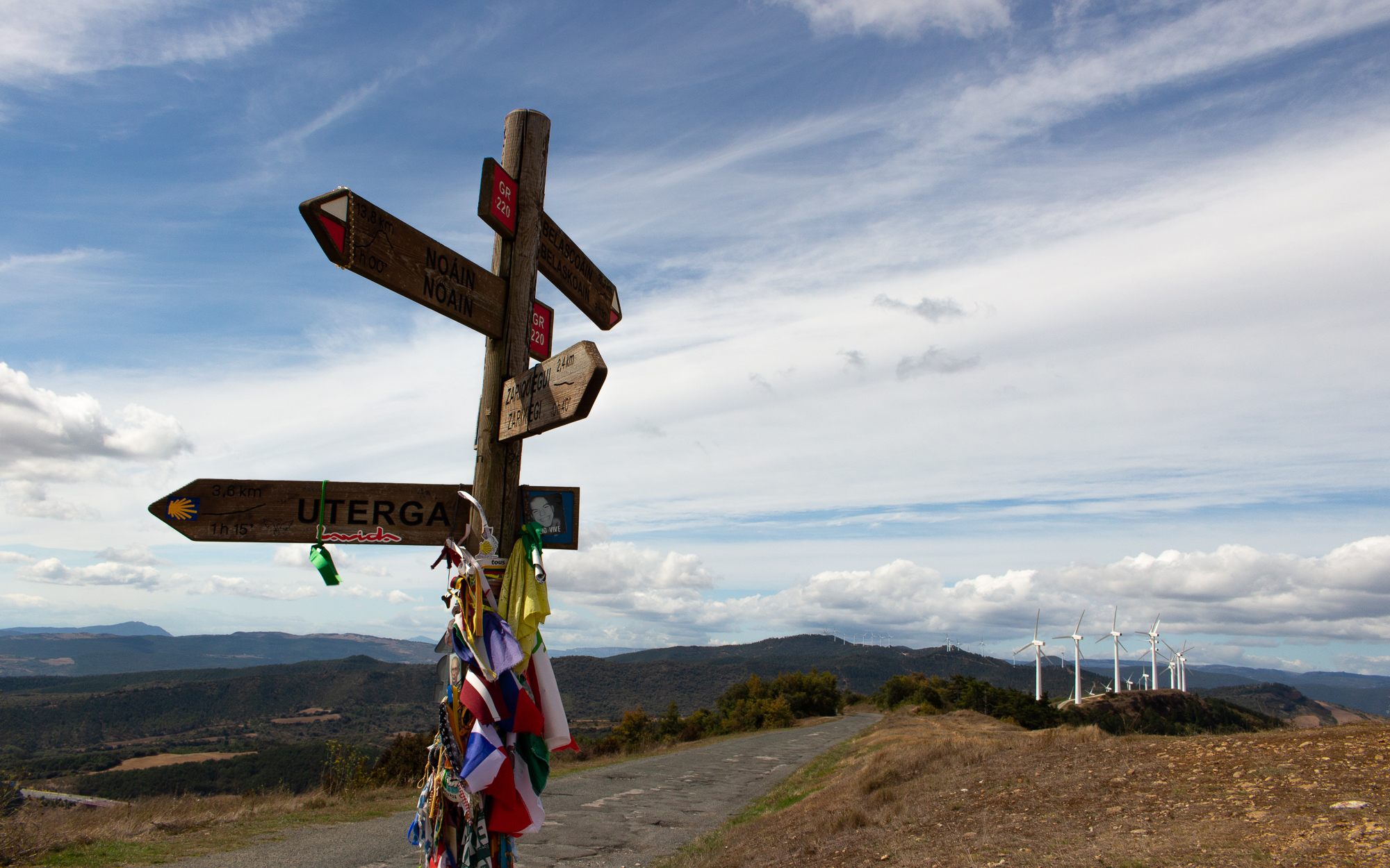
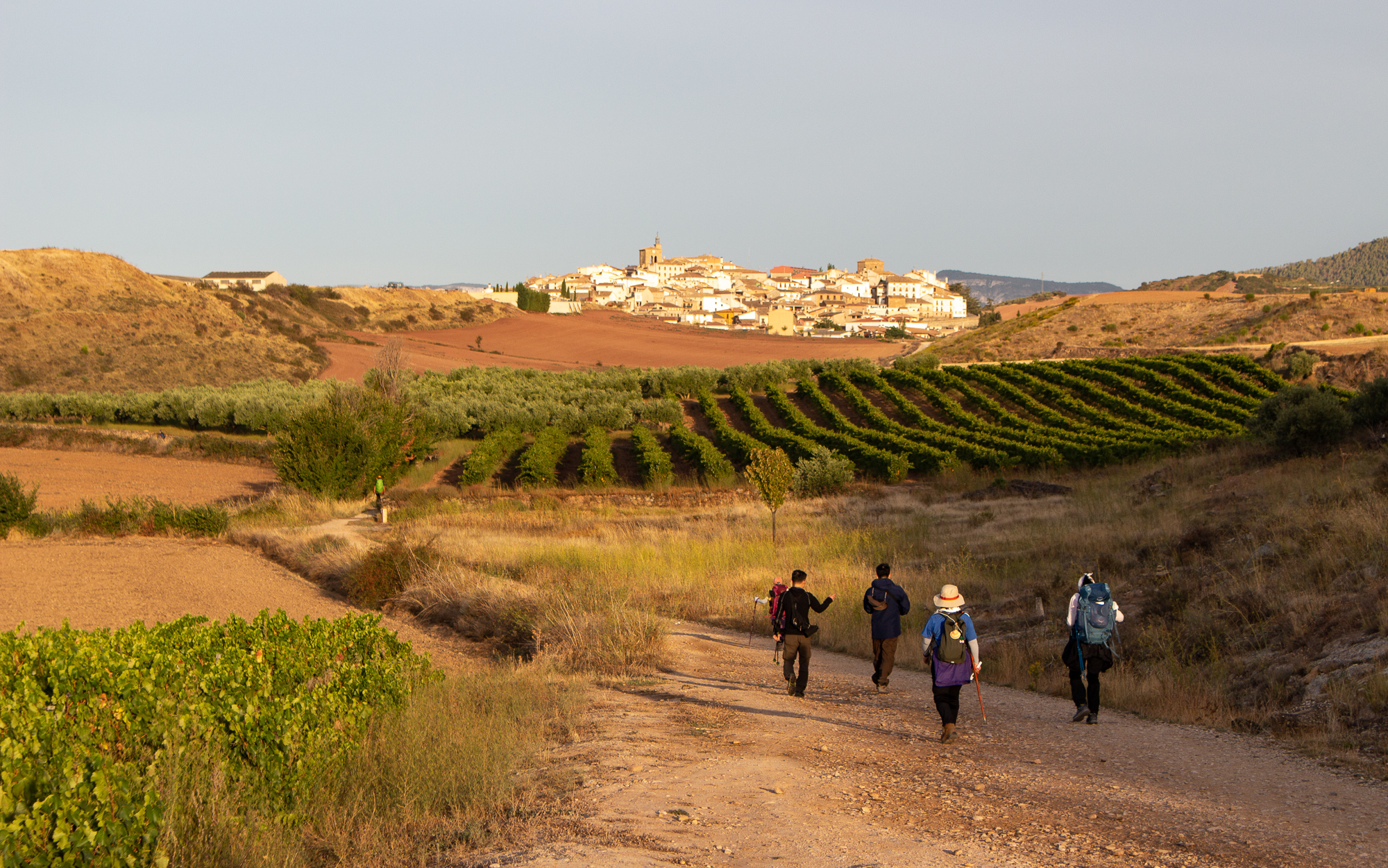
I start west the next day after breakfast with the goal to clear two ridges today before stopping at a town in the Arga Valley. I catch up with a steady line of pilgrims after Espinal as we begin the first of two forested uphill walks today. I’m in good spirits and the morning is pleasant.
Around midday I’m at the top of the second climb and reconnect with Aulily and Lily, who I met in Urrobi yesterday. They are a French mother and daughter who started their pilgrimage on one of the French caminos a month ago. People start from far across Europe, heading south and west on ancient roads until they reach the Spanish Caminos. There are more Caminos throughout Spain and Portugal, though the one I am taking, Camino Frances, is the most famous. I join with the French peregrinas and we descend the ridge together, stopping for a midday break in the cold, rushing Arga River. I rest in the next town for the night and they continue on. But we find each other again at a café along the trail the next morning.
It becomes a common thing in the mornings for people to start early, hike a few miles, and stop for breakfast at an outdoor café. When twenty other people do this, you find other people who you recognize and reconnect, reinforcing the sense of a shared spirit among the pilgrims. As I start to work out my routine, these spontaneous community breakfasts become one of my favorite things about the trail.
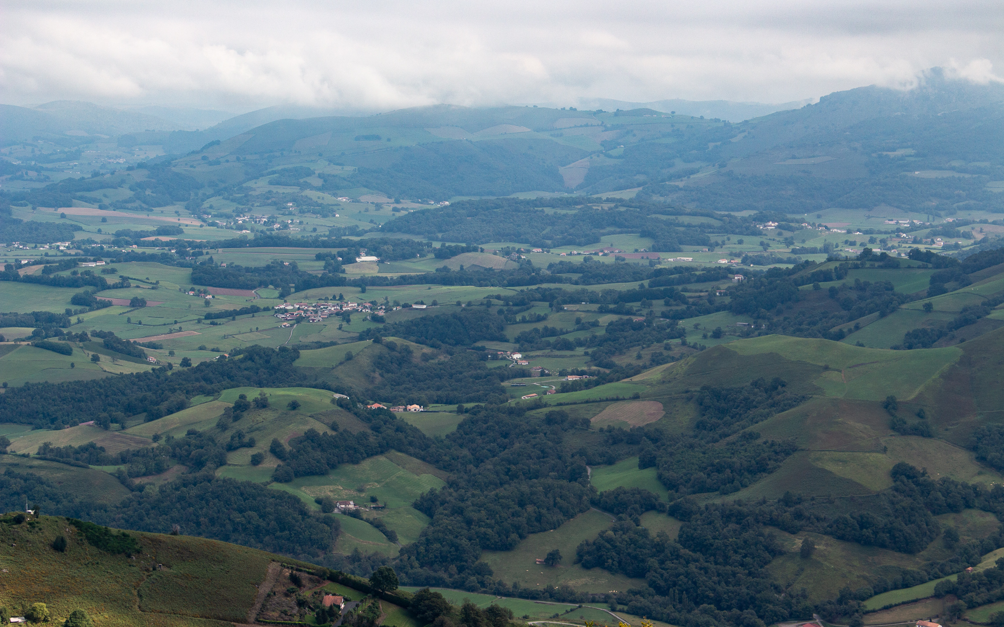
I hike out of the valley, passing one town after another, walled in by the ridgelines of the Spanish side of the Pyrenees. There are many more hills which will gradually level out, creating a straighter, easier path to Burgos and the Meseta farther on. From what I understand, the worst climb is behind me. I won’t face anything close to it again until I reach the Galician hills in the west.
I pass by a weekend festival in Larrasoaña, and the trail goes by an abandoned building south of town. A dog starts barking and runs out. He’s a half grown German Shephard. Without a chain and no sign of the owner. And he’s growling at me. Between me and where I’m trying to go.
“Hey perro,” I say, inching along slowly. “No soy peligroso, solo un hombre caminando!” He isn’t buying it – the little fucker nips me in the leg. I have to stay calm or this could get bad. He’s not a big dog, but definitely big enough to give me stitches and ruin my morning. Especially if I have a loaded pack and can’t defend myself.
“Somos amigos, perro, esta bien!” I say as nicely as I can, carefully inching away from what he thinks is his territory. Perhaps he senses it. He starts to relax and wag his tail. I slowly put out my hand and pet him. There we go, I knew there was a good little guy under all that bravado. But I wonder as I continue on how many more people today will have to deal with him.
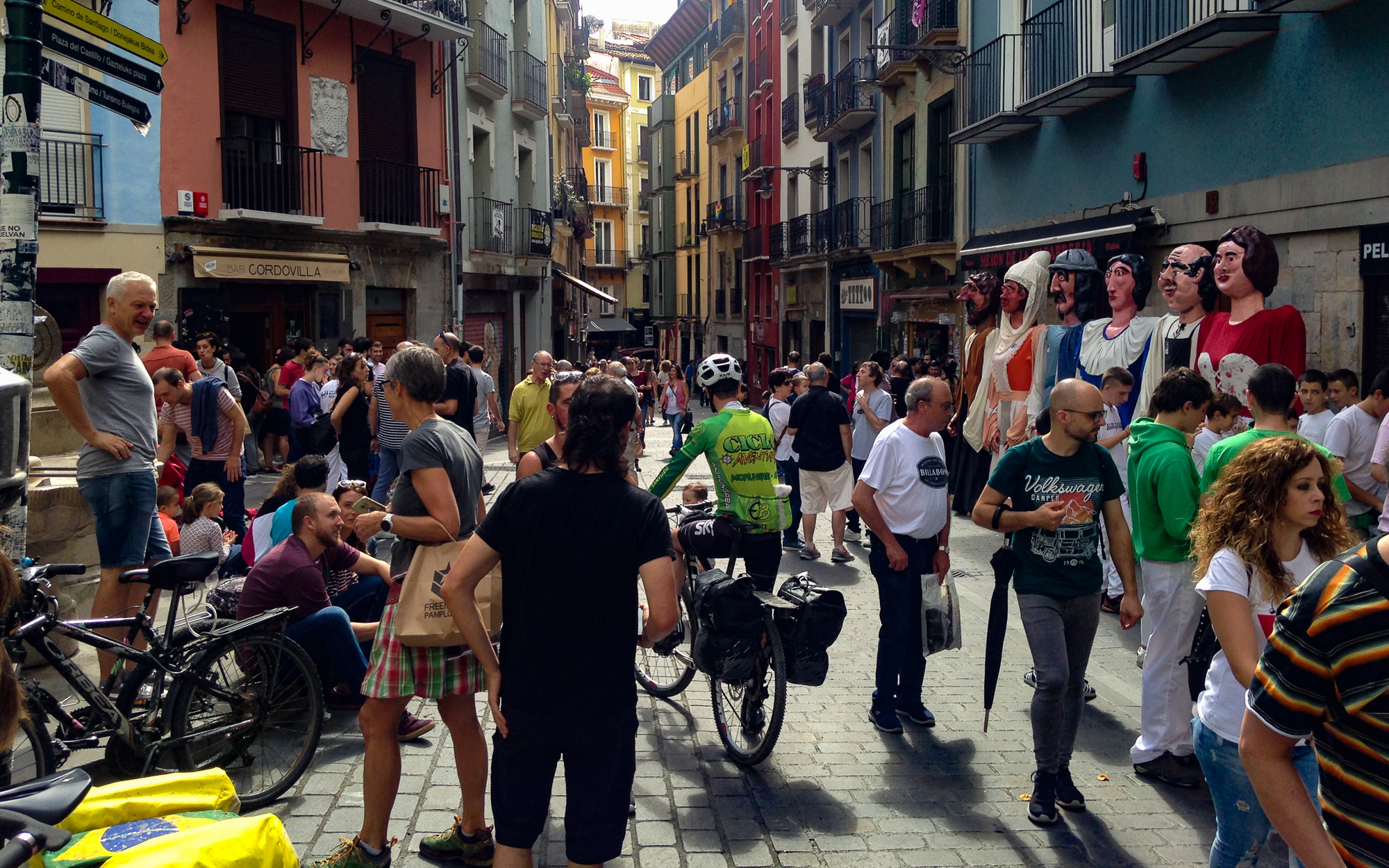
I spend the rest of the morning hiking out of the mountains and am suddenly surrounded by a huge crowd of people in the busy city centre of Pamplona. Today, I earned an easy half day hike and hotel room.

The first stage of my Camino is over. Tomorrow I head into more hills and farmlands.
This story continues on the Way to Burgos.
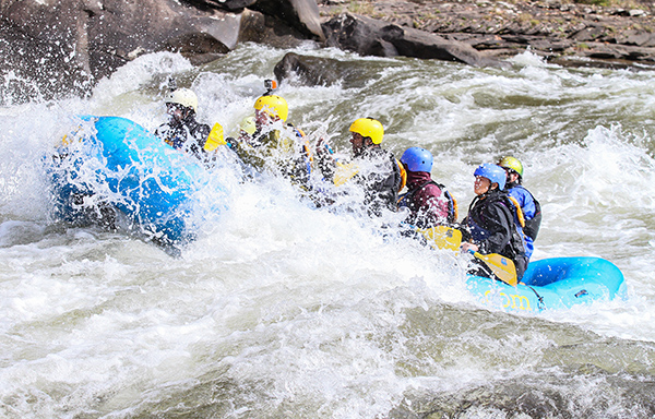
Rafting the Lower Gauley
Rafting the Lower Gauley
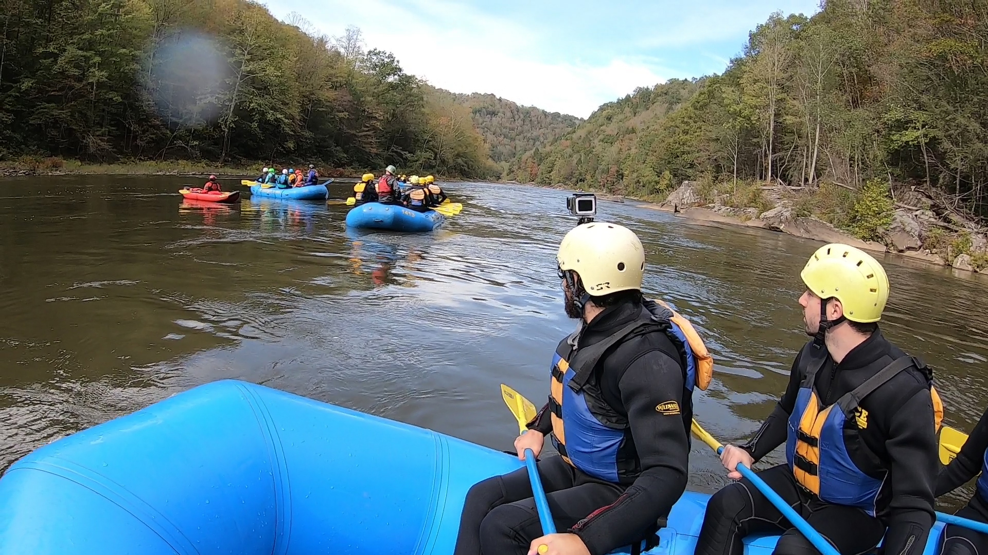
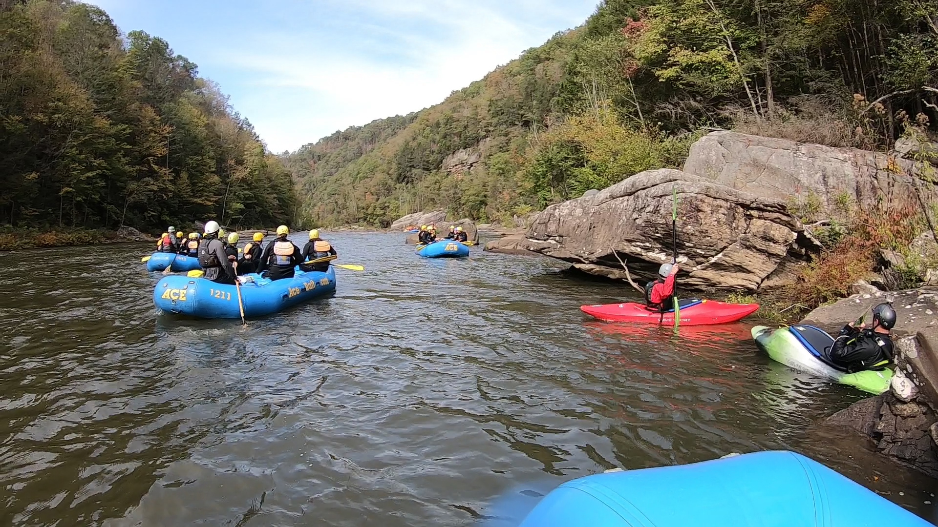
I traveled through West Virginia recently on a train and made the most of the fact that Ace Raft is a three mile hike from the Thurmond Amtrak. Timing had it that I could stop by for the last weekend of Gauley Season and all of the river carnage that it brings. It was October in Appalachia with morning temperatures just low enough to bite. Leaves turn into fire and gold, and the river charges its way down the canyon, thanks to the dam release up in Summersville.
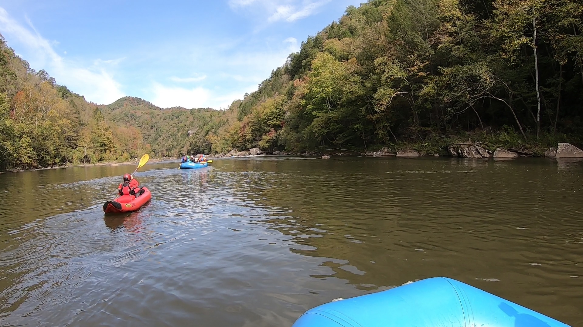
We arrived on a bus at the boat launch just above the Fuzzy Box of Kittens rapid and Woods Ferry, which separate the Upper and Lower sections of the Gauley. It’s a wild Class III-V river throughout, although my paddle down the Lower Gauley today would hopefully be more forgiving. The Upper section is famous for its huge powerhouse rapids that go back to back for 13 miles. And while the Lower Gauley has its share of that too, it is altogether calmer, more scenic, and spaced out. The trip would mostly amount to floating down easy flatwater and enjoying the fall colors and brisk mountain air.
Mostly.
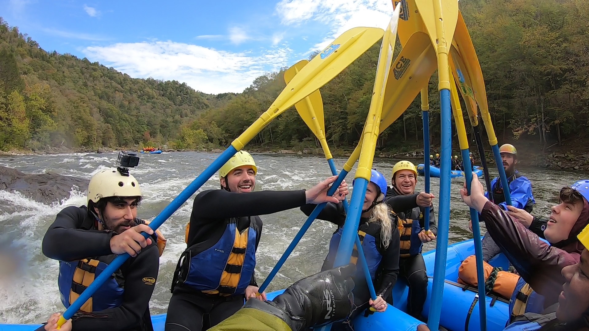
We were just getting started on the second rapid, Woods Ferry, when we ran into a bit of a scuffle. Halfway through, the raft got stuck on a ledge and one guy almost fell out. By a miracle, he landed on a rock and it kept him up just long enough for his buddies to pull him back. The guide, Bobby, yelled at us to paddle, trying to steer clear of the Juicer, a huge slanted boulder at the bottom that nearly always flips a raft. We bumped right into it, and amazingly the boat stayed up and went back into the current.
Our problem was that we weren’t paddling together as a group. You have to go together at full momentum to get the power you need to bust through this kind of water. Bobby had us practice our paddling moves in flat water, but I was still nervous and unsure if we could get through this. It was game time again soon enough. Bobby sent us charging through a huge wave train in Back Ender, then an even bigger series of hits in Koontz Flume, the first Class V of the day. We minded a house sized undercut boulder on the right and slammed through four big wave holes.
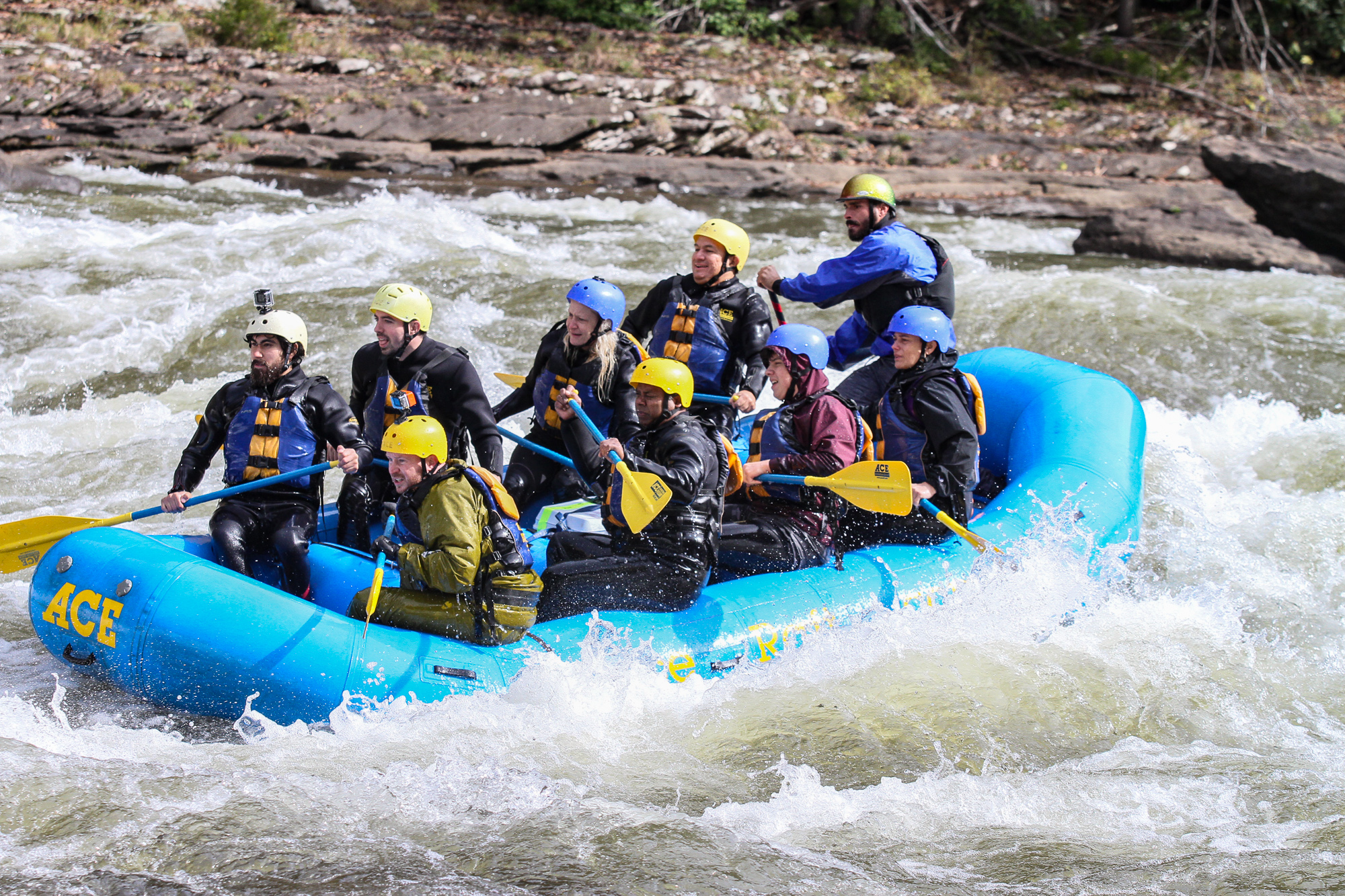

My camera died right before Canyon Doors, a calmer, scenic cliffside section of the river. We stopped to eat, I replaced the camera battery, turned the camera on, and we kept going. The river picked up its pace again as we had to navigate the clusterfuck of boulders in Upper Mash. The payoff was that it positioned us to run the main channel on Lower Mash with enough force to slam through the huge wave-hole at the bottom. For what it’s worth, I think we were finally paddling together as a team. As long as we listened to the guide, he could get us through all of it. My confidence in myself and the group was at an all time high.

The only big rapid left was Pure Screaming Hell, a Class V monstrosity known for its disastrously big Hell Hole. Here, you paddle for your life and do everything the guide tells you. Unfortunately, my camera died before we got there, but this video does a good job describing it:
From what I can remember, Bobby steered us on the tongue just left of it for an easier line. I only had a second going by to stare into the face of oblivion. We got through it in good standing, but it did give some boaters after us a thrashing – luckily nowhere near the undercut boulders.
This is a scary river. If you look up documentation about it, pretty much every section with a high rating is loaded with bad rocks. Some areas like Tumblehome are completely sieved out. None of it can be done without a guide or proper whitewater training. But despite the threats, I just can’t pass up the chance to see the beautiful bigwater Beast of the East, the Gauley on dam season. Even if it means I have to spend one boring final hour floating down flatwater to the takeout. It was late afternoon by then, and all I could think about was beer and pizza.
I went back to the lodge restaurant for both, slept in a cabin tent, and hiked back to the Thurmond station the next day.
VR Skydiving with iFly Chicago
VR Skydiving with iFly Chicago
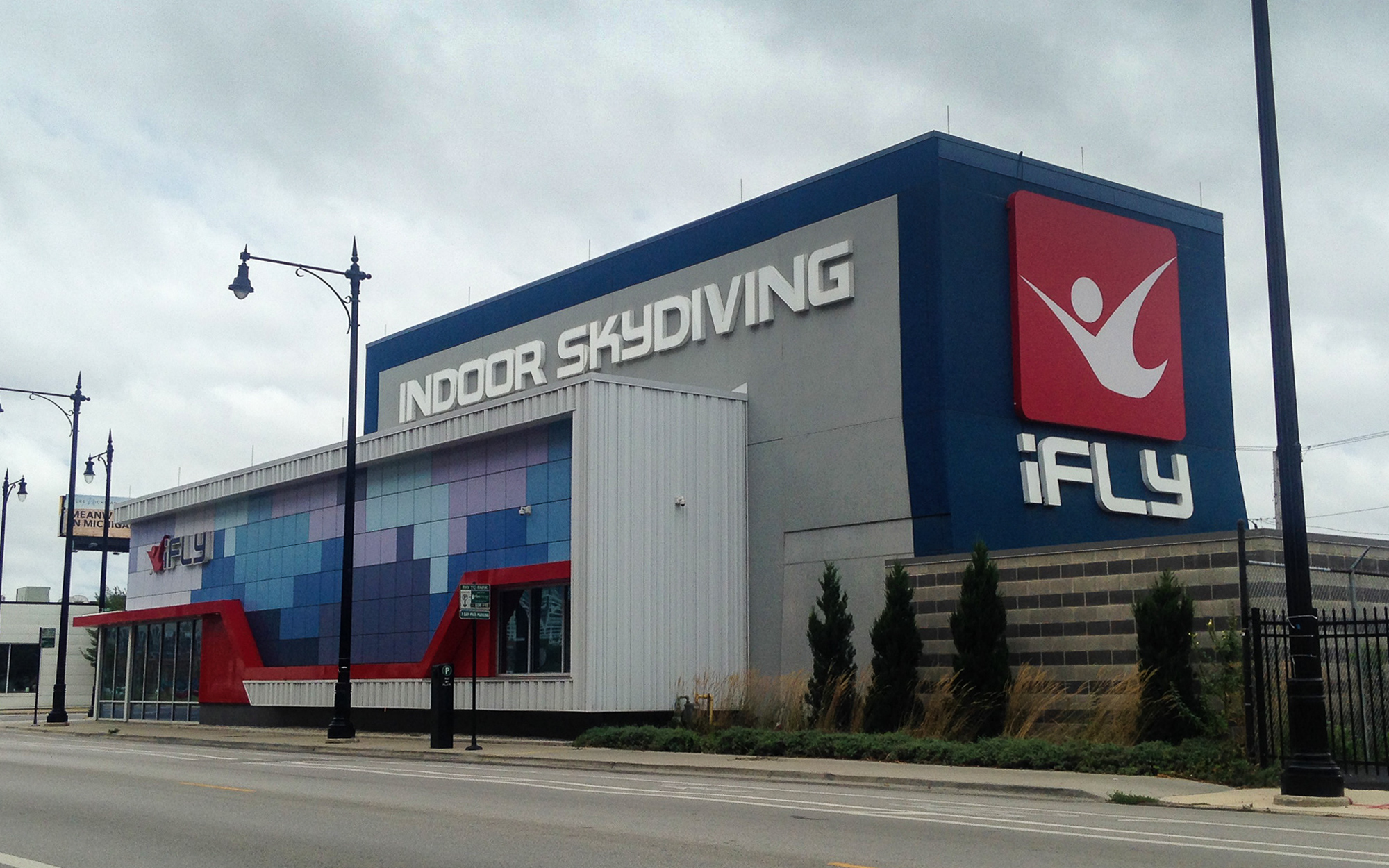
The travel enthusiast in me is always Google searching the digital landscape for new ideas. Whenever I’m not out doing something, I’m thinking about it. And I’ve been getting curious about the idea of Travel VR, where the wild places of the world are brought to you in an immersive digital format. iFly Indoor Skydiving has flight simulation centers all across the country. Using a powerful wind tunnel, they harness the feeling of a freefall with VR gear, simulating skydives over Hawaii, Dubai, California, and the Swiss Alps. It can be the next practical option if, like me, you won’t be making it to Dubai anytime soon.
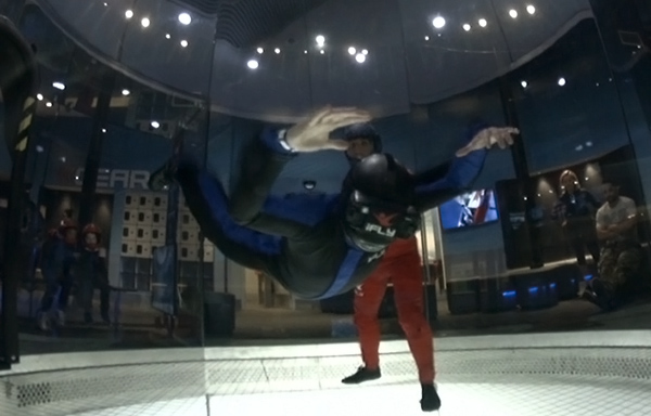
I went to the Lincoln Park, Chicago location recently after work. After a short orientation video, I suited up for my first “jump”. The first two flights were without VR – the intent being to get first time jumpers comfortable floating on an upward blast of wind. The instructor stood in the middle to help stabilize and keep me from flailing and spinning around in the tunnel. The main thing they told me to do is relax – something I never do the first time with anything. I gradually got more stable with each flight, but my first visit overall was tense and challenging. For the last flight, the instructor gave me a VR headset and loaded up the Hawaii jump. I floated in the middle of the tunnel, watching a 60 second video of divers over the Hawaiian coast. It was cool, but I was still too in my head to be totally in the moment.

I came back a week later and felt better overall. I could finally relax in a fixed position. When the instructor noticed, he started showing me maneuvers, like how to turn simply by moving my hands. It’s always a fun challenge to test my physical and mental limits against natural forces – whether they be water, gravity, or in this case, wind. For the VR simulation, I tried the wingsuit jump in the Swiss Alps. It was altogether better and more immersive than before, as I pretended to glide between the high alpine ridges, nearly skirting the treetops like a daredevil.
This was all fun and will have to do until I get the chance to dive for real over blue water. If it works out, it might happen later this year.
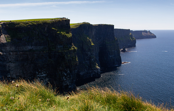
Cliffs of Moher
Cliffs of Moher
Concerning Ireland, I think I was meant to have fun and to suffer in equal doses. I liked Dublin for its local food, cheap ass pints of Guinness, and pub music. But I caught an awful headcold halfway through my stay there, for the second vacation in a row no less. It was the kind that lasts for a week, with three particularly brutal days at the start. I couldn’t fight it off with Afrin or tissues alone, and needed to consult with the healing powers of Irish Coffee and Guinness Stew, of which I learned counts as a cold remedy. I also learned that in Ireland, chicken curry fries are a thing. And it’s fucking awesome. Eat, drink, and feel like shit, for tomorrow we drink again.
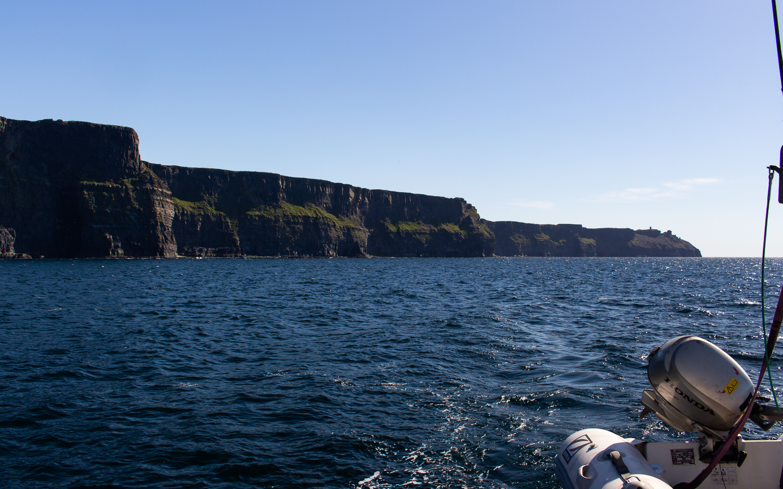
But I was well enough on Friday to go to a Couchsurfing meetup to drink with locals and international backpackers. I stayed out drinking until 2, and then sat on a 3 hour shuttle the next morning with a pounding headache. I needed water, but I couldn’t hydrate because I was stuck on a bus without a bathroom. Kind of a catch-22. We made it to the coast in the afternoon to see the dramatic Cliffs of Moher. Like everything else out here so far, it was well worth the suffering.
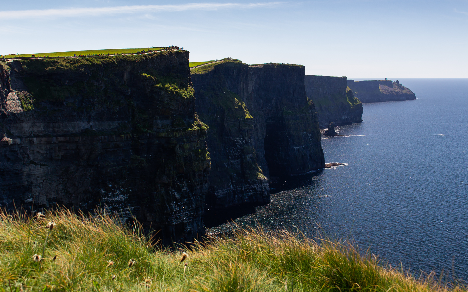

I walked along the cliffside trail for an hour, watching shuttle boats go by on the water as seabirds turned gracefully in circles along the rocky walls. We went back to the bus and the guide drove us to a boat dock to the north. For the next hour the boat went along the cliffs on a perfect bluebird day. We didn’t stay out for long, but I’m sure it must have been one hell of a sunset.
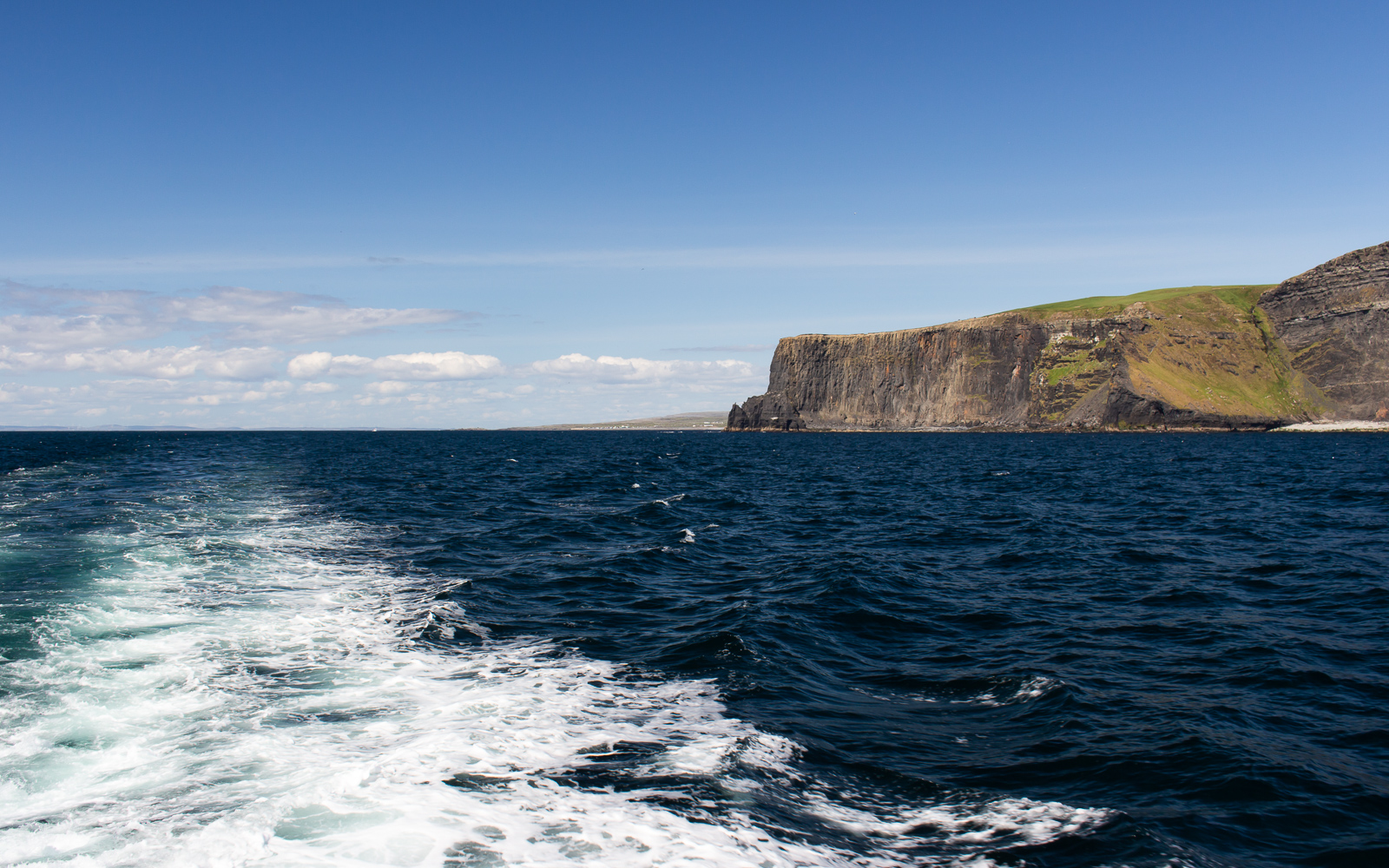
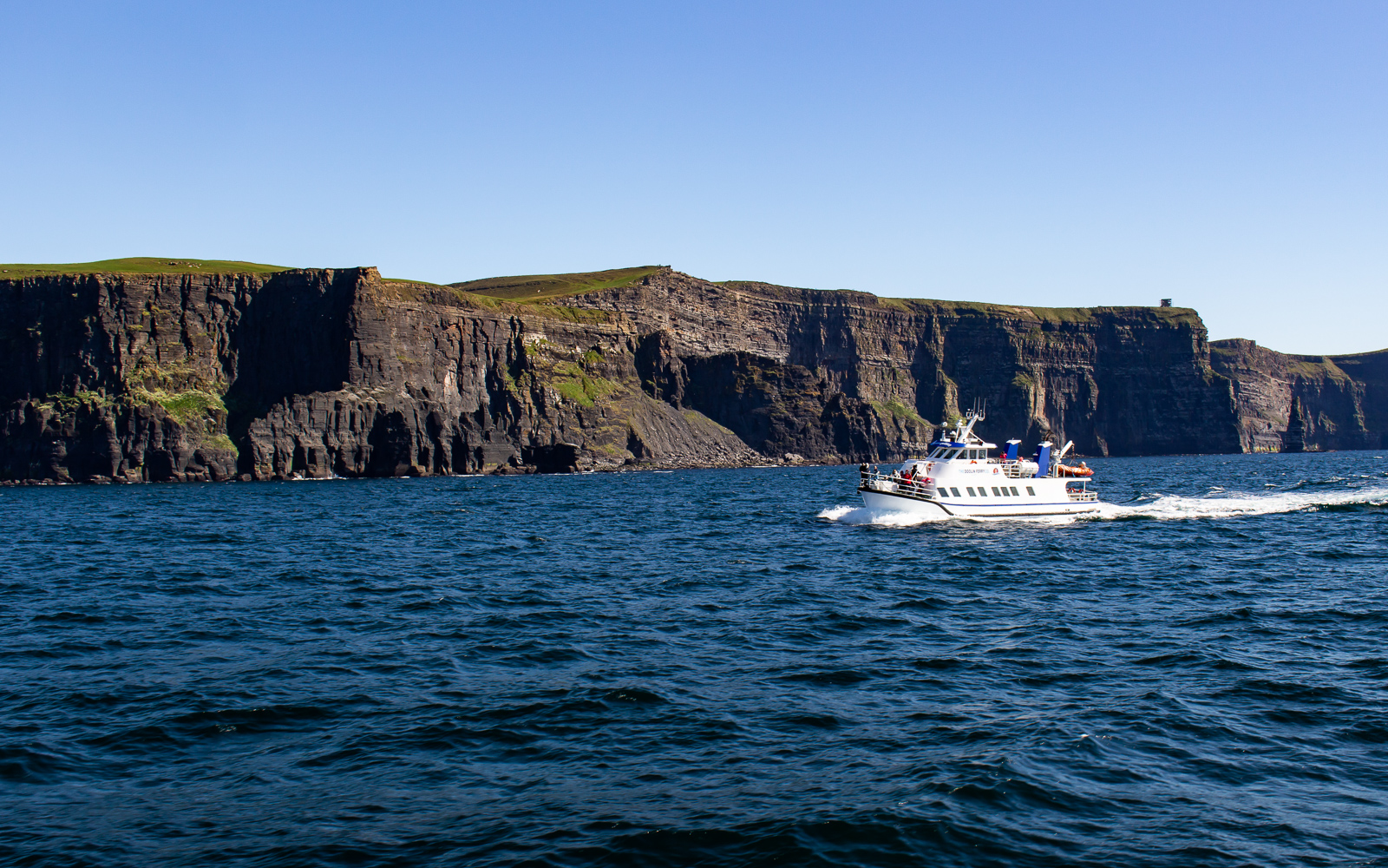
On the way back, I managed to slowly drink a PowerAde from a rest stop, and then sober up back in Dublin of all places. I’m getting another headache just talking about it. Recovery mode or not, the Cliffs of Moher is well worth the day tour. And the Temple Bar is a great place to get shithoused, even if your congestion makes you feel like you’re beat to shit.

The Scottish Highlands
The Scottish Highlands
The highlands of western Scotland highlight a region of Britain that is full of picturesque landscapes, historic landmarks, and down to earth folks with an accent thicker than molasses. I got the chance to visit a month ago on a three week trip around Europe, including a three day shuttle out of Edinburgh with Highland Explorer Tours. I joined a shuttle full of people in the Old Town district on a rainy morning, was greeted by our guide, a kilted Scotsman by the name Steven, and we started west out of the city.
Day 1: Out of Edinburgh
Steven narrated Scotland’s history and lore as the shuttle went along the Scottish countryside, crossing the River Teith just upstream from Doune Castle. Soon, we made it to the mountains and the forested edge of Loch Lomond and The Trossachs. After going for a while there, the rain stopped and we passed the Loch Tulla Overlook. I got out and looked down at the loch from the ridgeside, appreciating the clearing weather and brisk springtime air.
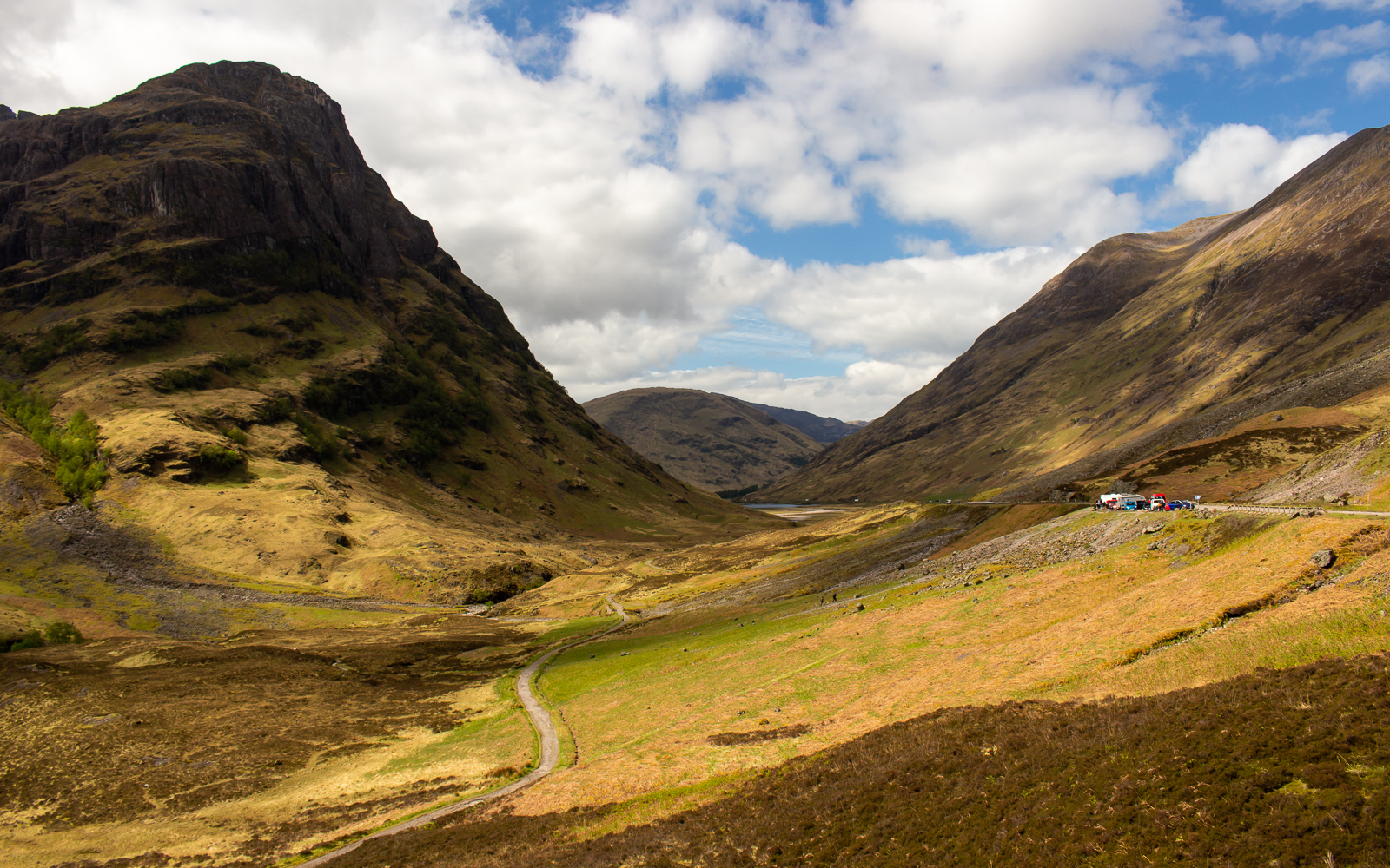
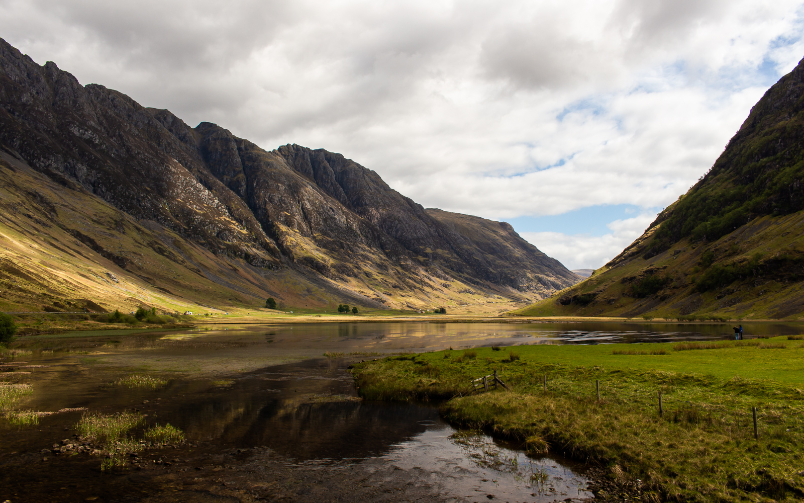
When we reached the high plateau, Steven explained how the peated topsoil in this region and the west isles was used in their whiskey production. It was a smoky flavor that I spent years enjoying – mostly from the Laphroaig Distillery in the south. We reached the far end for a mountainous descent to the shoreline town of Glencoe, stopping first at Loch Atriochtan and the Three Sisters of Bidean nam Bian.
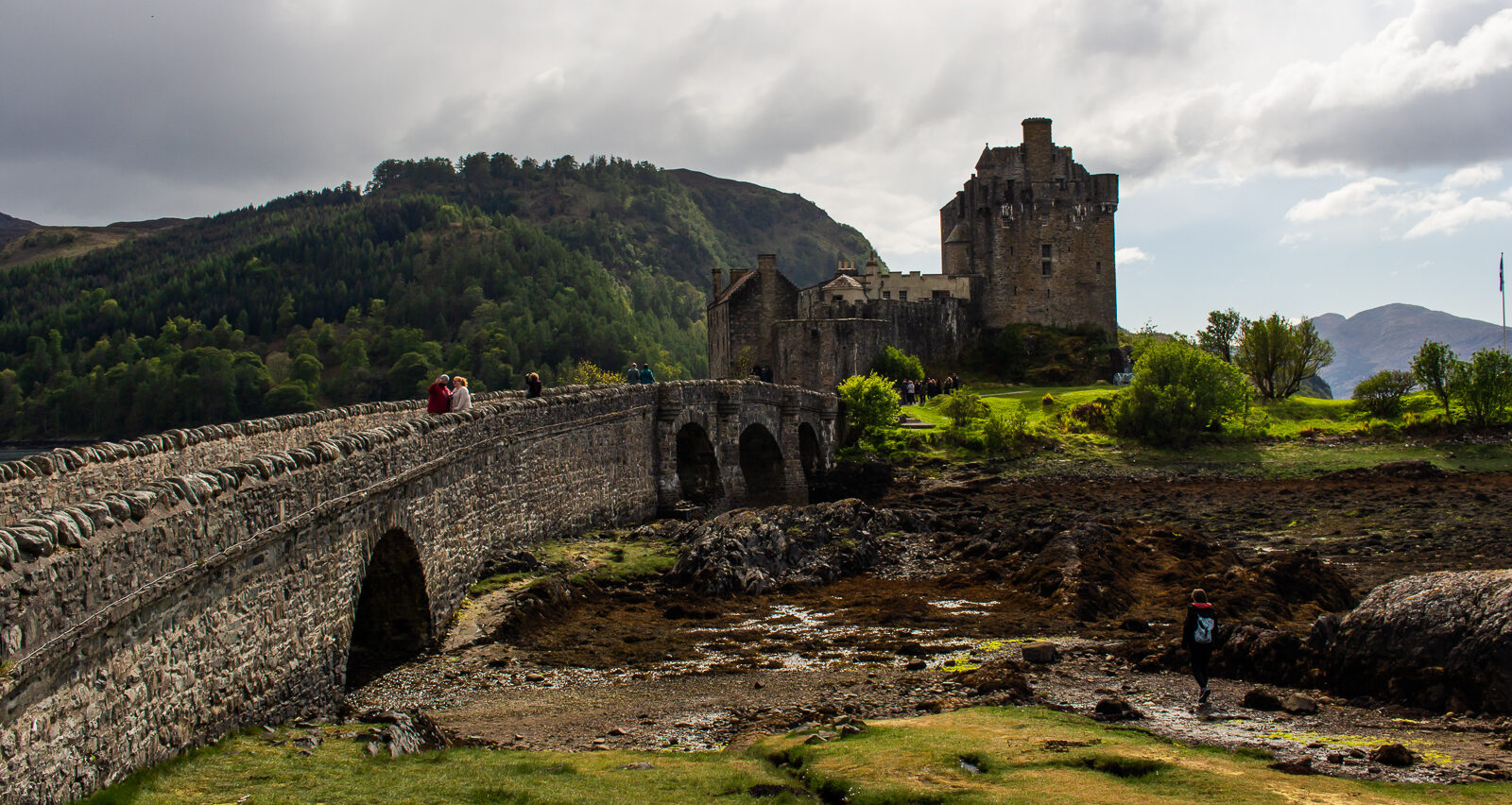
After getting lunch at the busy tourist town of Fort William, we continued north for 90 minutes along more lochs and winding mountain roads. The famous Eilean Donan Castle stood at the water’s edge, backlit by afternoon sunlight. This classic Scottish landmark has had four different versions and restorations dating as far back as the 13th century, the most recent one finished in 1932. It is one of the most photographed landmarks in the country. If you look up pictures of it, you might find more than a few of a Scotsman and bride on the bridge.
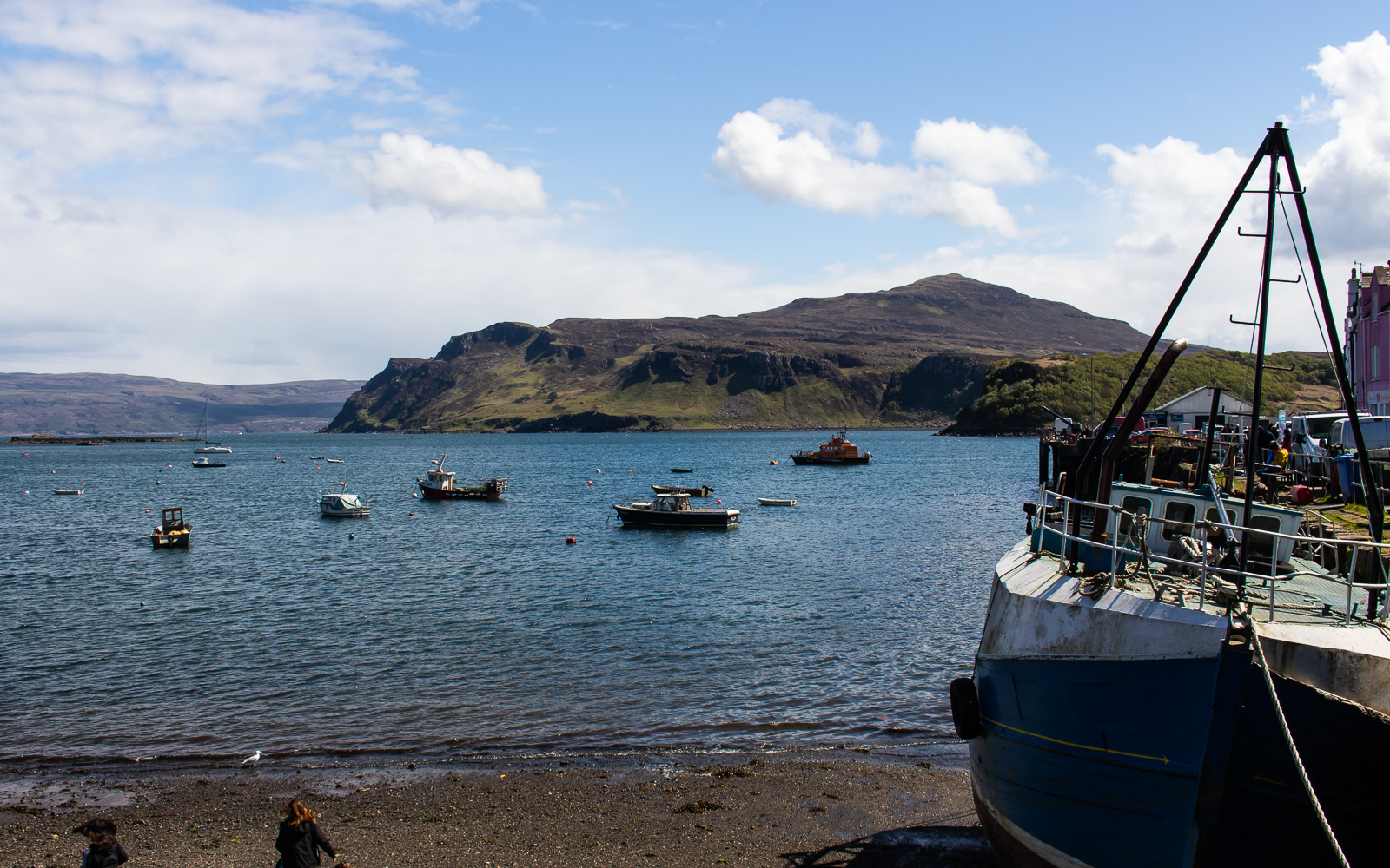
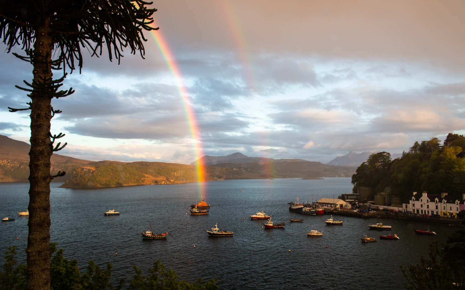
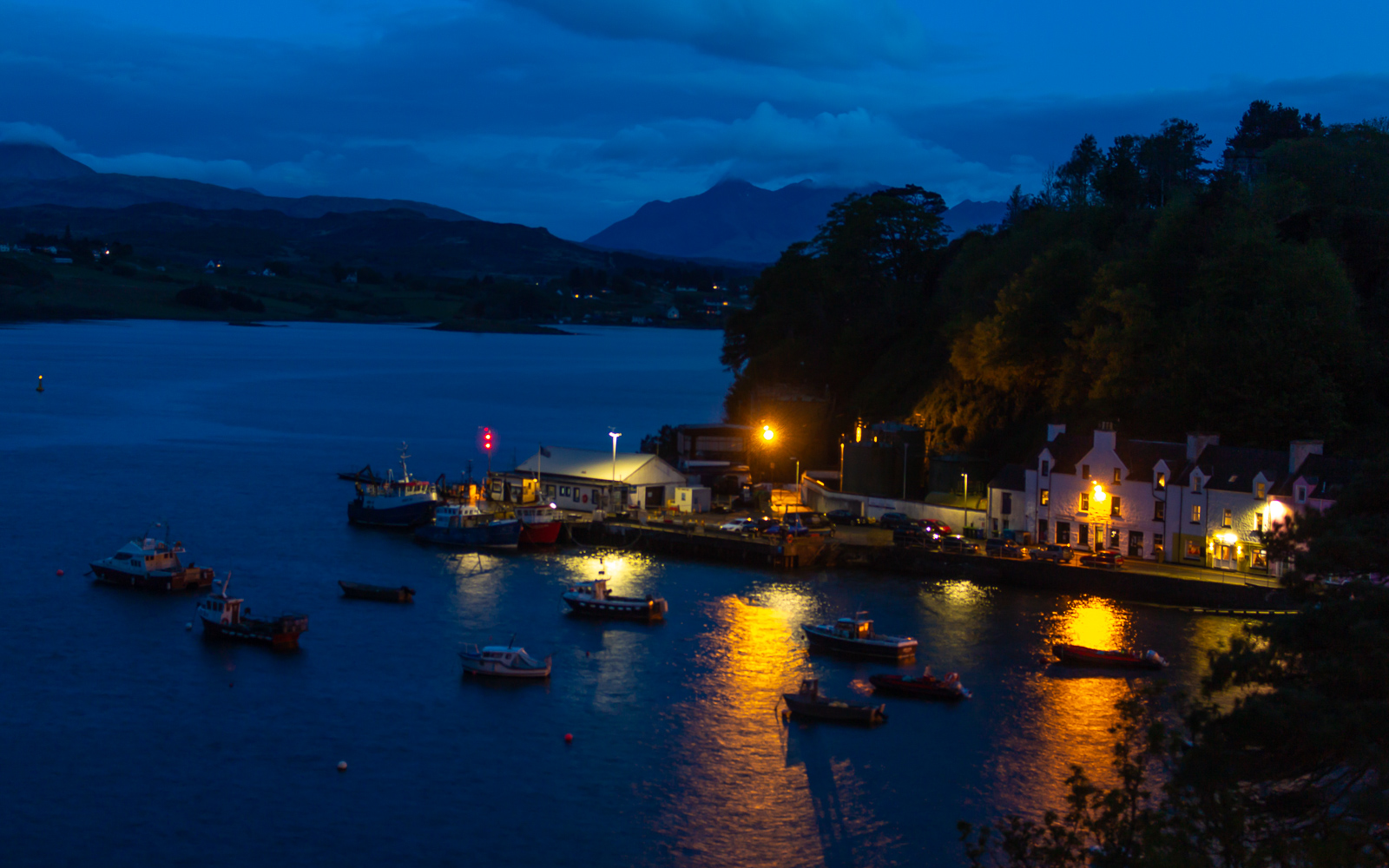
We crossed into the Isle of Skye in the late afternoon, stopping for the night in the seaside town of Portree. The tour company had arranged for us to stay at different BnBs in the town, and I checked into a modest stay on the north end. “Holy shit, a room with a view!” I thought as I looked out from my room over the harbour. Little boats floated about in front of a colorful row of houses on the far side. The Isle of Raasay and bigger mountains stood farther off, silhouetted along the edge of the inlet. The day ended in nightfall and clear skies over quiet water.
Day 2: Isle of Skye
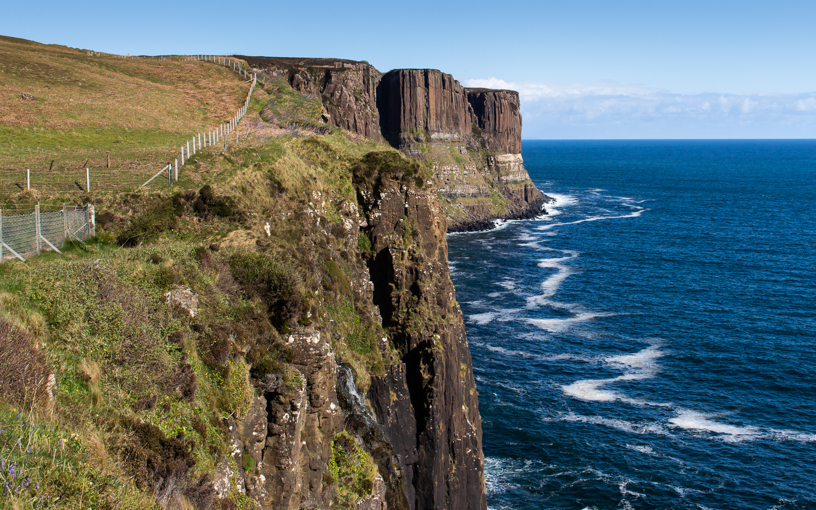
We met in the town centre and drove north. Steven immediately parked in a lot next to the road to view the Storr, a rocky formation of spires near the coast. The needle shaped Old Man of Storr looked like it could impale the foot of a giant. My only complaint about this tour so far was that they didn’t drop me off at the trailhead for a closer look. But fair play on that if it meant we would stop at Kilt Rock twenty miles up the road.

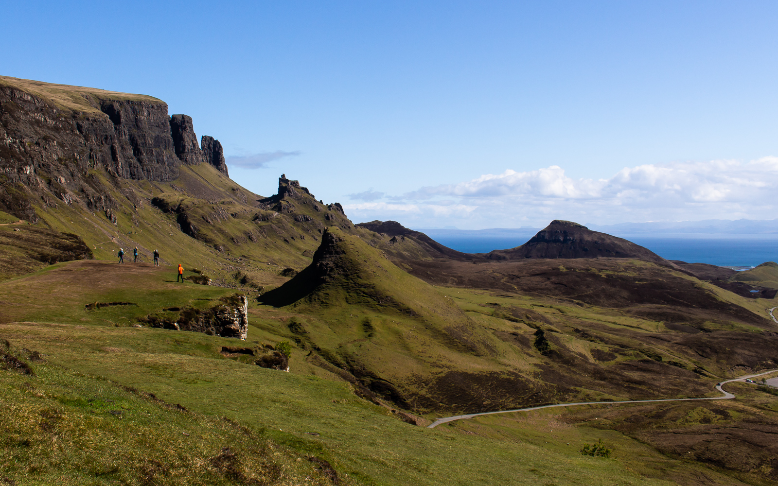
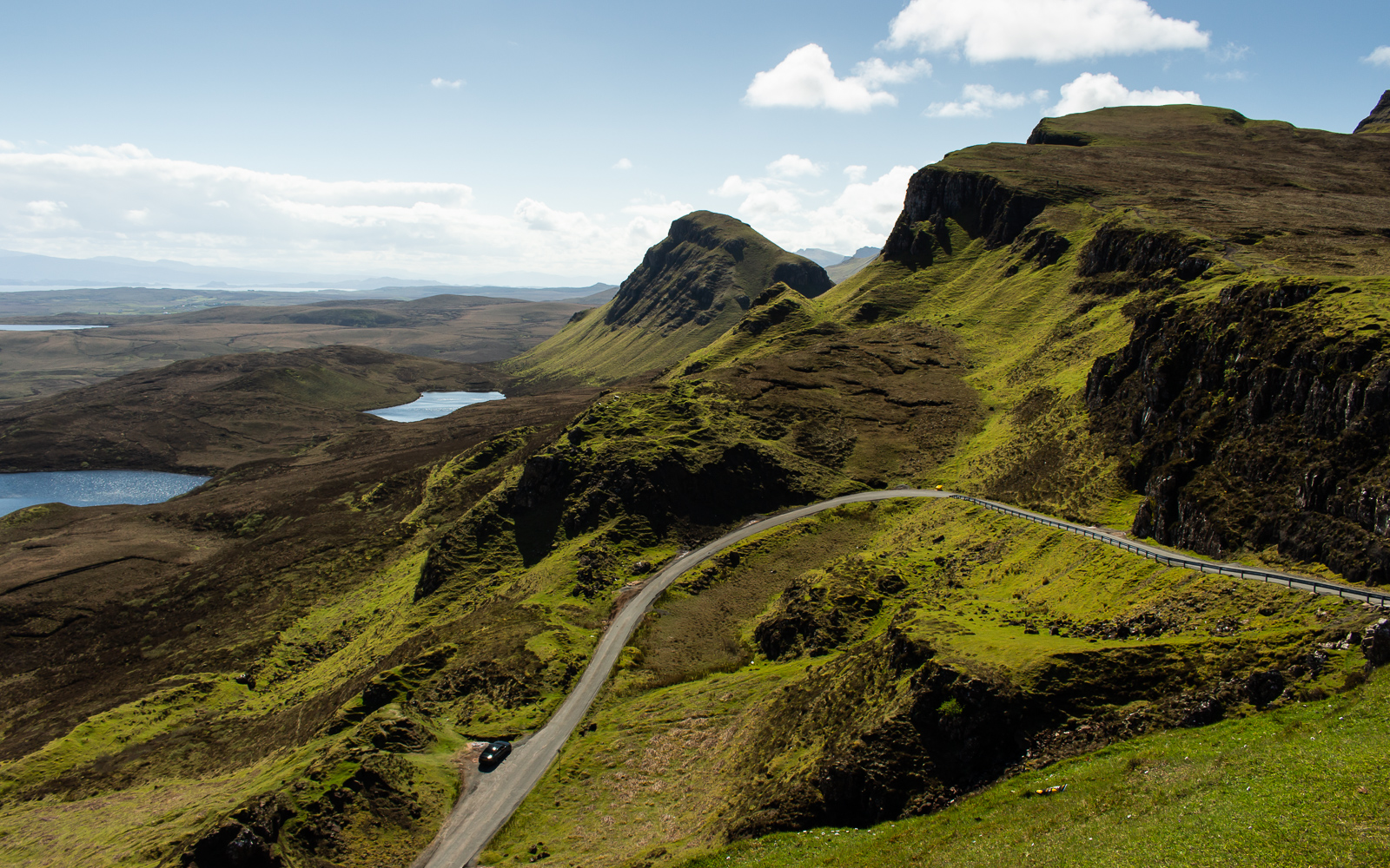
We went around the north side of the isle and down the western shore, passing tiny Scottish villages and farmlands. At Idrigil, the shuttle turned east on a back road, crossing back over the island. Soon we reached the Quiraing, a landslip formation along the broken ridge system of the Trotternish.
When we got back to Portree at midday, I went to a seafood restaurant and ordered the same thing I wanted ever since I got here – fish and chips. The menu said that standard whiskey was 4£ and that the high-end whiskey was 5. I asked the waitress to bring me a glass. Whatever it was, it was good enough for its own place at mid-shelf. I told her I wanted another. She brought me a glass of Laphroaig. Yeah, 4 pounds. The whiskey here was cheaper than the beer.
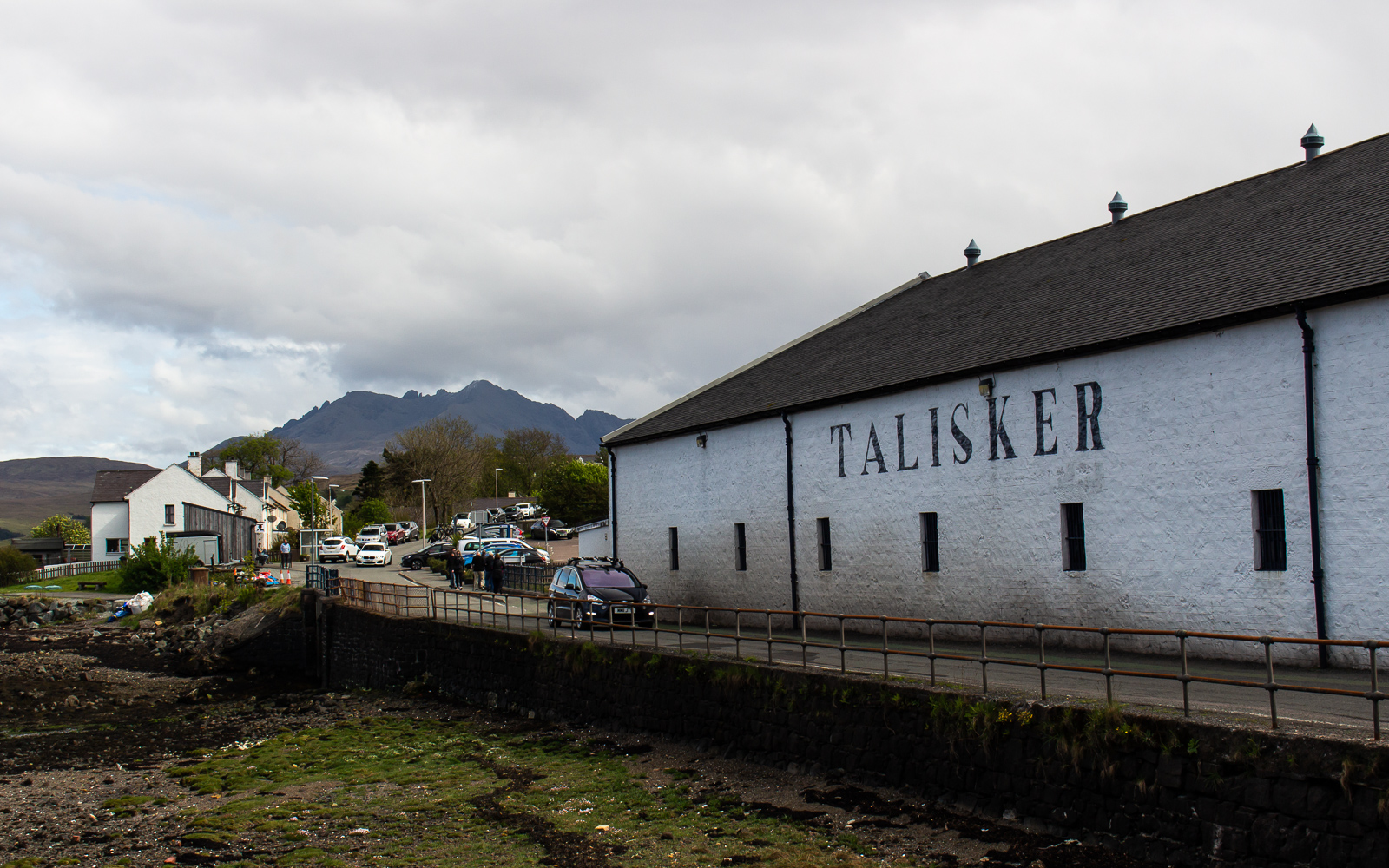
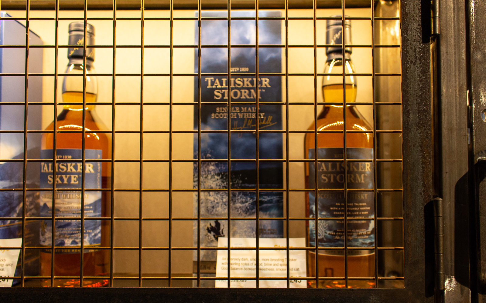
Speaking of whiskey, Steven asked us if we wanted to stop at Talisker for a tasting. We didn’t have to think about that for long. We passed more landmarks in the south, including the Sigachan River, which legend says if you put your face in the water for ten seconds that the faeries will grant you eternal beauty. I have not followed up with the others to confirm the accuracy of this tale.

Portree is a cute town, but in the evenings its restaurants are packed with tourists. I didn’t want to wait in line for an hour, so I got deli bread and a can of beer from the town grocery instead. I was just winding down in my room when a rain shower passed over the harbour. When I looked outside, this happened. You couldn’t make this shit up:
It made me think about how Scotland’s country has a warmth to it. It’s rugged and earthy, but not in any grand or epic sort of way that I’ve seen in bigger places. It feels close and almost homelike. A broken archipelago of steep hills and lush, grassy highland ranges that reminded me a lot of Iceland – yet with a closeness that Iceland doesn’t really share. Scotland is like the warmer brother to Iceland. And Iceland is like the darker sister island.
Day 3: Loch Ness
We left Skye and went east back into the mountains. Clouds gathered around mid-morning, bringing the kind of weather that is typical in the UK. We stopped at Urquhart Castle and the shore of Loch Ness. Sheets of rain blew off the loch as I waited in line at the boat dock, one layer too light. Soon the boat arrived and I managed to dry off and warm up with a Scottish Hot Chocolate. As the ferry went north, I watched the water closely, but my admittedly untrained eye was not able to spot Ol’ Nessie (probably for the best).

Rain continued as we went past Inverness, turning southeast on the highway to Edinburgh. Most of the ride back was uneventful, but it was interesting to pass the Cairngorns National Park, where snow-dusted high mountains appeared between the rainclouds. Soon, I would reach the city and this chapter of my story would quickly end. Another in Dublin was about to begin.
I will leave you with this song from Tide Lines, who I never would have discovered if Steven wasn’t playing them on the tour. They’re like Scotland’s answer to our bluegrass and alt-country.